Edgar Earl Poulton
| Birth | : | 26 May 1914 Rinard Mills, Monroe County, Ohio, USA |
| Death | : | 26 Jan 1981 Fairfax County, Virginia, USA |
| Burial | : | Forest Lawn Memorial Park, Cathedral City, Riverside County, USA |
| Coordinate | : | 33.8154000, -116.4413000 |
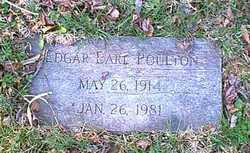
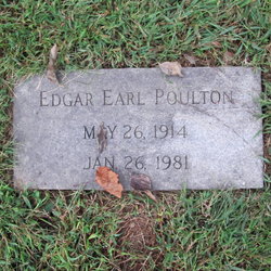
| Inscription | : | EDGAR EARL POULTON / MAY 26, 1914 / JAN. 26, 1981 |
| Description | : | Obituary contributed by Susan Barrow Spaulding (#47100792): The Washington Star Wednesday, 28 January 1981 Edgar E. Poulton, 66, who retired last March as an economist and writer for the Federal Deposit Insurance Corp., died Monday in Fairfax Hospital after a heart attack. A McLean resident for 21 years, he lived on Elizabeth Road in McLean. Mr. Poulton was active in the Lewinsville Presbyterian Church in McLean, where he organized and prepared study guides and courses for the church's lenten programs for many years. He was an ordained elder and represented the church as its commissioner to the National Capital Union Presbytery. He also... Read More |
frequently asked questions (FAQ):
-
Where is Edgar Earl Poulton's memorial?
Edgar Earl Poulton's memorial is located at: Forest Lawn Memorial Park, Cathedral City, Riverside County, USA.
-
When did Edgar Earl Poulton death?
Edgar Earl Poulton death on 26 Jan 1981 in Fairfax County, Virginia, USA
-
Where are the coordinates of the Edgar Earl Poulton's memorial?
Latitude: 33.8154000
Longitude: -116.4413000
Family Members:
Nearby Cemetories:
1. Forest Lawn Memorial Park
Cathedral City, Riverside County, USA
Coordinate: 33.8154000, -116.4413000
2. Desert Memorial Park
Cathedral City, Riverside County, USA
Coordinate: 33.8198400, -116.4422900
3. Sunnyland Annenberg Estate Grounds
Rancho Mirage, Riverside County, USA
Coordinate: 33.7805170, -116.4063020
4. Jane Augustine Patencio Cemetery
Palm Springs, Riverside County, USA
Coordinate: 33.8224000, -116.5340000
5. Welwood Murray Cemetery
Palm Springs, Riverside County, USA
Coordinate: 33.8310000, -116.5527000
6. Hope Lutheran Church Columbarium
Palm Desert, Riverside County, USA
Coordinate: 33.7154590, -116.3726440
7. Palm Desert Community Presb. Church Columbarium
Palm Desert, Riverside County, USA
Coordinate: 33.7048200, -116.3972600
8. Saint Margarets Episcopal Church Columbarium
Palm Desert, Riverside County, USA
Coordinate: 33.7032000, -116.3977000
9. St. Hugh's Episcopal Church Memorial Garden
Idyllwild, Riverside County, USA
Coordinate: 33.7518934, -116.7055594
10. Idyllwild Community Church Columbarium
Idyllwild, Riverside County, USA
Coordinate: 33.7467926, -116.7116256
11. Coachella Valley Public Cemetery
Coachella, Riverside County, USA
Coordinate: 33.6697006, -116.2164001
12. Joshua Springs Calvary Chapel Prayer Garden
Yucca Valley, San Bernardino County, USA
Coordinate: 34.0975780, -116.4126590
13. Ryan Ranch Cemetery
Riverside County, USA
Coordinate: 33.9853900, -116.1439860
14. Keys Family Cemetery
Joshua Tree, San Bernardino County, USA
Coordinate: 34.0445500, -116.1685800
15. Joshua Tree Memorial Park
Joshua Tree, San Bernardino County, USA
Coordinate: 34.1347500, -116.3509900
16. Morongo Tribal Cemetery
Banning, Riverside County, USA
Coordinate: 33.9543340, -116.8193220
17. Moravian Cemetery
Banning, Riverside County, USA
Coordinate: 33.9542670, -116.8193780
18. Saint Mary's Catholic Cemetery
Banning, Riverside County, USA
Coordinate: 33.9604830, -116.8257330
19. Torres Martinez Reservation Cemetery
Riverside County, USA
Coordinate: 33.5602989, -116.1517029
20. Ross Gravesite
Fawnskin, San Bernardino County, USA
Coordinate: 34.1757020, -116.5253010
21. Cahuilla Indian Reservation Cemetery
Anza, Riverside County, USA
Coordinate: 33.5393400, -116.7453800
22. San Gorgonio Memorial Park
Banning, Riverside County, USA
Coordinate: 33.9483900, -116.8812400
23. Saint Boniface Indian School Cemetery
Banning, Riverside County, USA
Coordinate: 33.9383488, -116.8886330
24. Soboba Indian Reservation Cemetery
San Jacinto, Riverside County, USA
Coordinate: 33.7796000, -116.9136000


