
| Memorials | : | 26 |
| Location | : | Idyllwild, Riverside County, USA |
| Phone | : | 951-659-4471 |
| Website | : | www.sthughsidyllwild.org |
| Coordinate | : | 33.7518934, -116.7055594 |
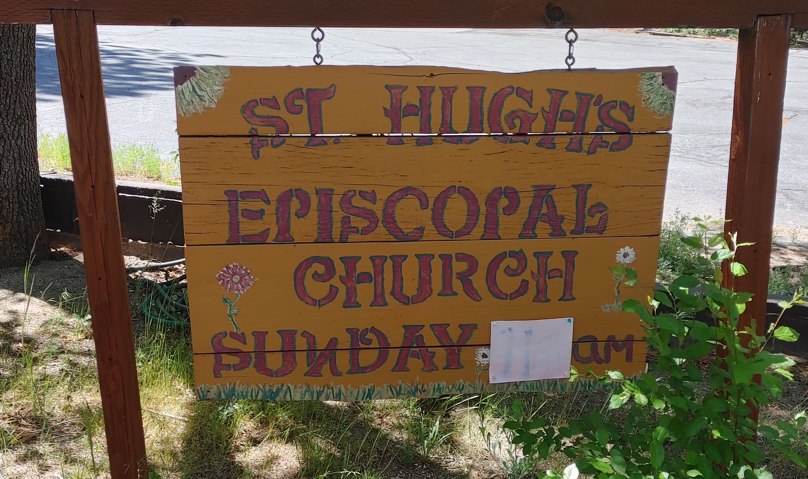
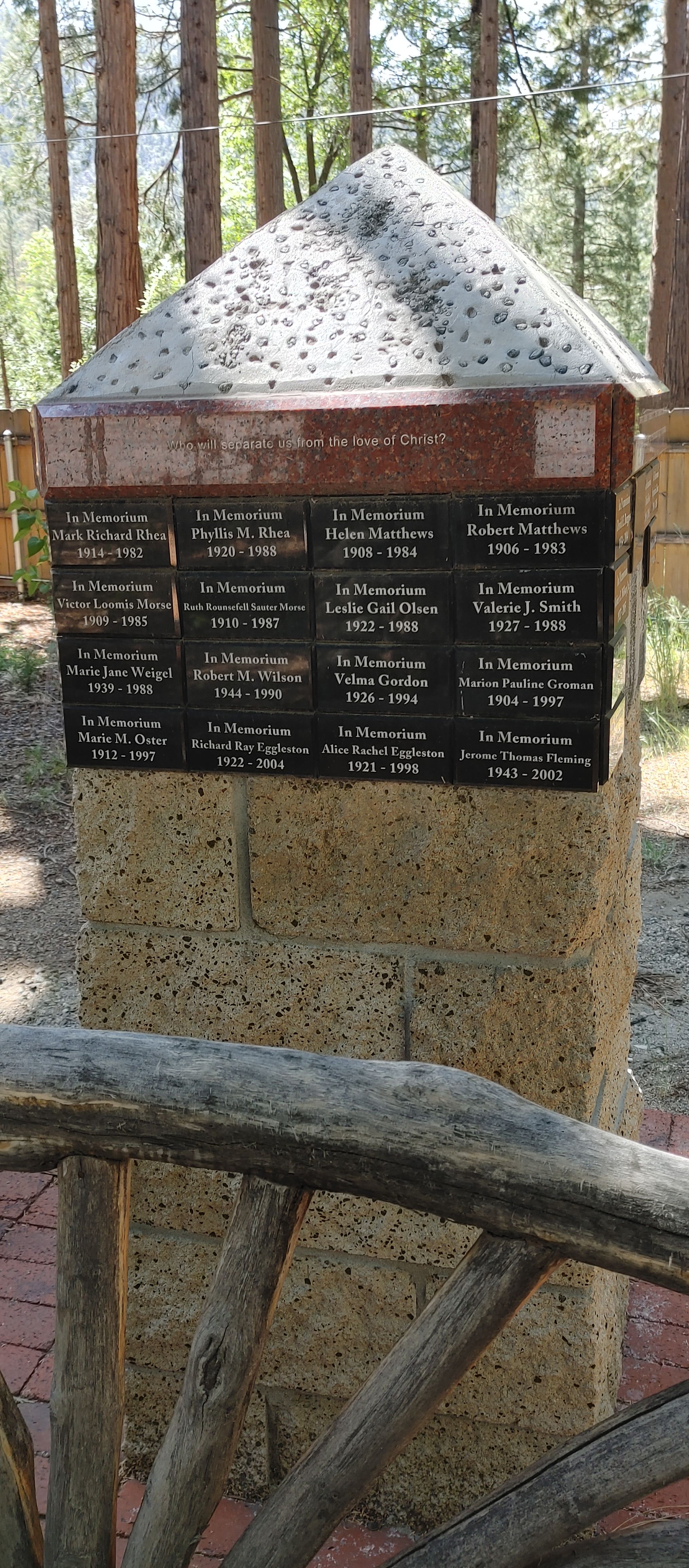
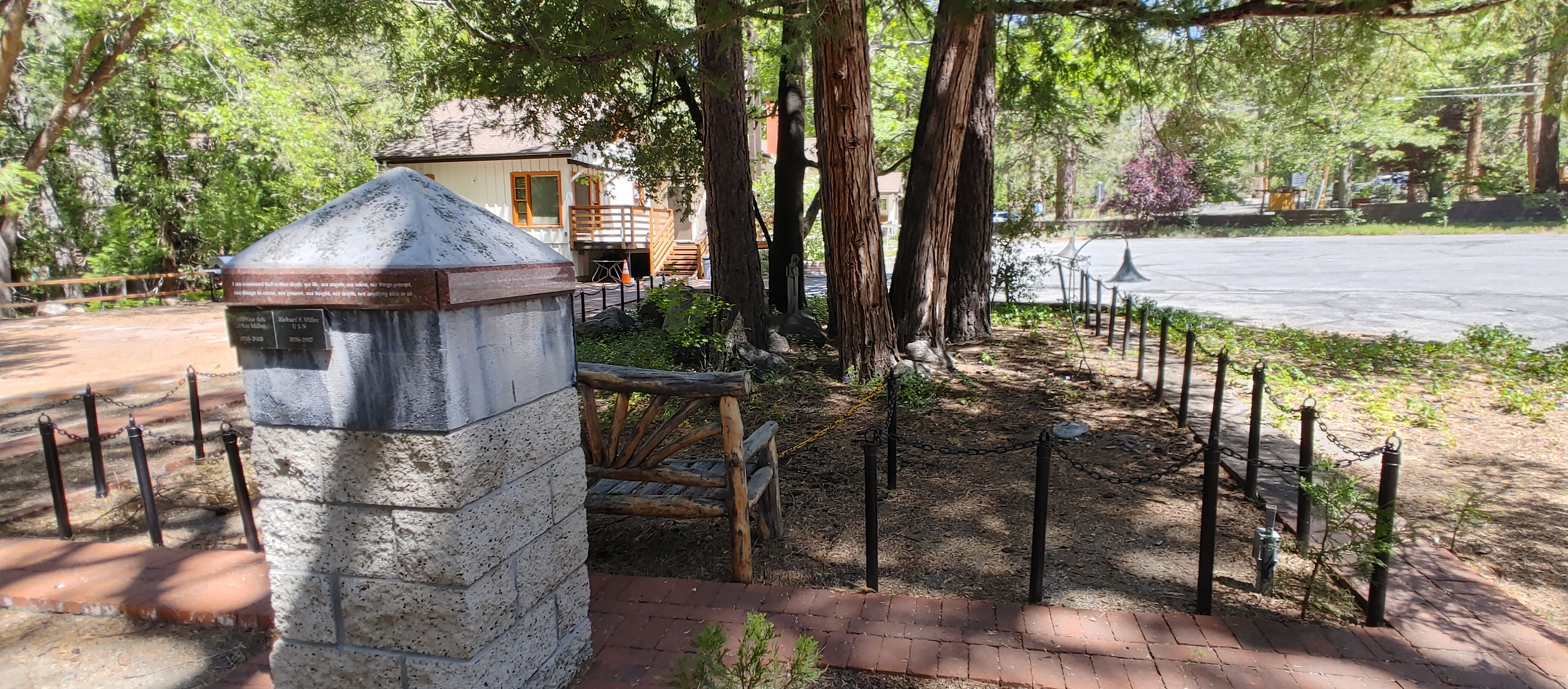
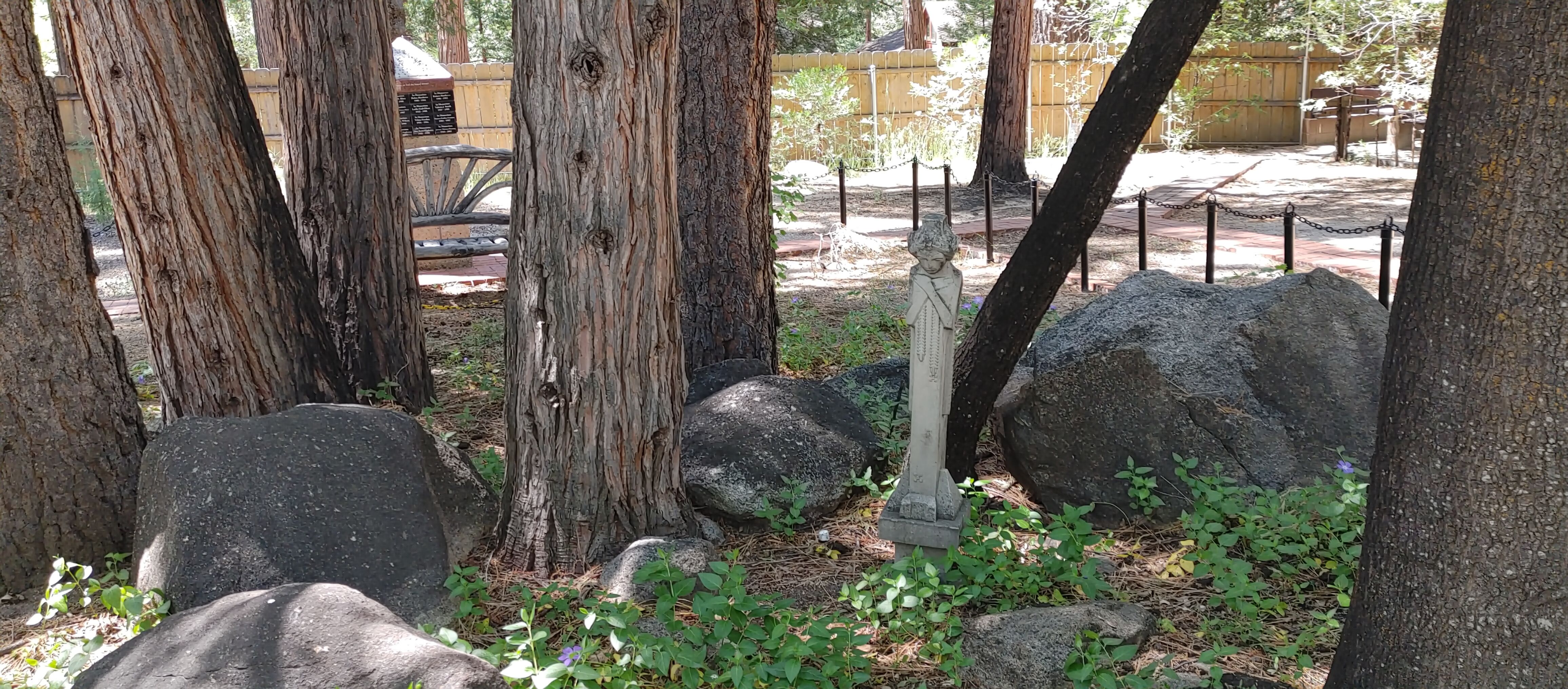
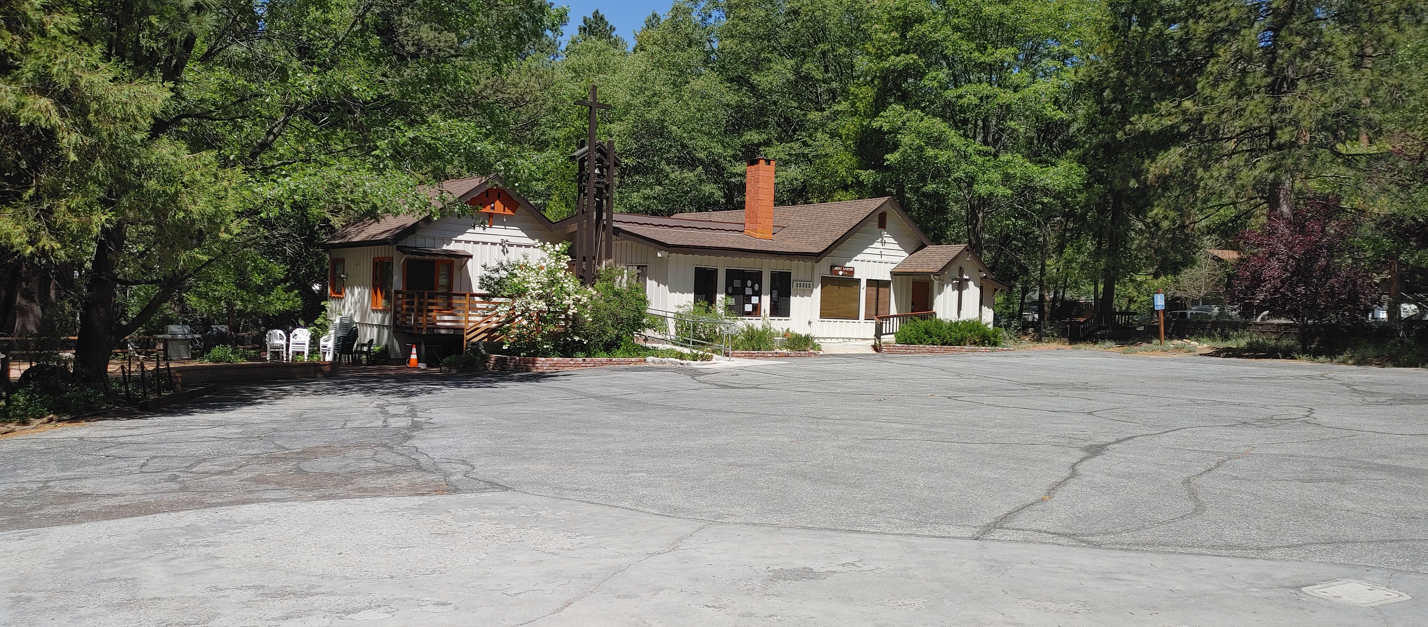
| Description | : | The Memorial Garden is located to the side of the church building. It is near the Outdoor Chapel and the brick Labyrinth. There is a concrete block column with memorial name/date plaques near the top. Ashes of the deceased are spread in the chained-off area under the trees with the saint statue. The official name of this church is St. Hugh of Lincoln Episcopal Church, but it is commonly called St. Hugh's Episcopal Church. |
frequently asked questions (FAQ):
-
Where is St. Hugh's Episcopal Church Memorial Garden?
St. Hugh's Episcopal Church Memorial Garden is located at 25525 Tahquitz Drive Idyllwild, Riverside County ,California , 92549USA.
-
St. Hugh's Episcopal Church Memorial Garden cemetery's updated grave count on graveviews.com?
26 memorials
-
Where are the coordinates of the St. Hugh's Episcopal Church Memorial Garden?
Latitude: 33.7518934
Longitude: -116.7055594
Nearby Cemetories:
1. Idyllwild Community Church Columbarium
Idyllwild, Riverside County, USA
Coordinate: 33.7467926, -116.7116256
2. Welwood Murray Cemetery
Palm Springs, Riverside County, USA
Coordinate: 33.8310000, -116.5527000
3. Jane Augustine Patencio Cemetery
Palm Springs, Riverside County, USA
Coordinate: 33.8224000, -116.5340000
4. Soboba Indian Reservation Cemetery
San Jacinto, Riverside County, USA
Coordinate: 33.7796000, -116.9136000
5. San Jacinto Valley Cemetery
San Jacinto, Riverside County, USA
Coordinate: 33.7599983, -116.9599991
6. Cahuilla Indian Reservation Cemetery
Anza, Riverside County, USA
Coordinate: 33.5393400, -116.7453800
7. Episcopal Church of the Good Shepherd Columbarium
Hemet, Riverside County, USA
Coordinate: 33.7440620, -116.9691790
8. Holy Ghost Fathers Cemetery
Hemet, Riverside County, USA
Coordinate: 33.7362940, -116.9698520
9. Moravian Cemetery
Banning, Riverside County, USA
Coordinate: 33.9542670, -116.8193780
10. Morongo Tribal Cemetery
Banning, Riverside County, USA
Coordinate: 33.9543340, -116.8193220
11. Forest Lawn Memorial Park
Cathedral City, Riverside County, USA
Coordinate: 33.8154000, -116.4413000
12. Desert Memorial Park
Cathedral City, Riverside County, USA
Coordinate: 33.8198400, -116.4422900
13. Saint Mary's Catholic Cemetery
Banning, Riverside County, USA
Coordinate: 33.9604830, -116.8257330
14. Saint Boniface Indian School Cemetery
Banning, Riverside County, USA
Coordinate: 33.9383488, -116.8886330
15. San Gorgonio Memorial Park
Banning, Riverside County, USA
Coordinate: 33.9483900, -116.8812400
16. Park Family Cemetery
Aguanga, Riverside County, USA
Coordinate: 33.5158430, -116.7879560
17. Sunnyland Annenberg Estate Grounds
Rancho Mirage, Riverside County, USA
Coordinate: 33.7805170, -116.4063020
18. Saint Margarets Episcopal Church Columbarium
Palm Desert, Riverside County, USA
Coordinate: 33.7032000, -116.3977000
19. Palm Desert Community Presb. Church Columbarium
Palm Desert, Riverside County, USA
Coordinate: 33.7048200, -116.3972600
20. Stewart Sunnyslope Cemetery
Beaumont, Riverside County, USA
Coordinate: 33.9196570, -116.9651700
21. Hope Lutheran Church Columbarium
Palm Desert, Riverside County, USA
Coordinate: 33.7154590, -116.3726440
22. Saint Stephens Episcopal Church Memorial Garden
Beaumont, Riverside County, USA
Coordinate: 33.9322860, -116.9795610
23. Mountain View Cemetery
Beaumont, Riverside County, USA
Coordinate: 33.9435997, -116.9800034
24. Desert Lawn Memorial Park
Calimesa, Riverside County, USA
Coordinate: 33.9566994, -117.0203018