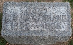
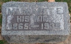
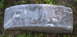
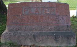
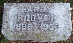
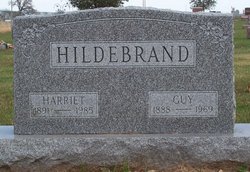
Edgar Henry Hildebrand
| Birth | : | 27 Feb 1865 West Liberty, Muscatine County, Iowa, USA |
| Death | : | 11 Dec 1926 West Liberty, Muscatine County, Iowa, USA |
| Burial | : | Bunker Hill Burying Ground, Charlestown, Suffolk County, USA |
| Coordinate | : | 42.3789300, -71.0621200 |
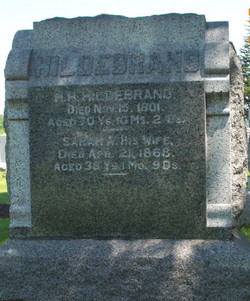
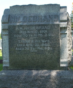
| Description | : | Source: History of Muscatine County Iowa, Volume II, Biographical, 1911, page 251 E. H. HILDEBRAND. E. H. Hildebrand, who has been successfully engaging in farming throughout his entire business career, is now the owner of one hundred and sixty acres of rich and productive land on section 30, Wapsinonoc township. His birth occurred in Muscatine county, Iowa on the 27th of February, 1865, his parents being H. H. and Sarah E. (Aument ) Hildebrand, both of whom were natives of Lancaster county, Pennsylvania. They came to this county in 1856, purchasing and locating on a farm in Wapsinonoc township, where they... Read More |
frequently asked questions (FAQ):
-
Where is Edgar Henry Hildebrand's memorial?
Edgar Henry Hildebrand's memorial is located at: Bunker Hill Burying Ground, Charlestown, Suffolk County, USA.
-
When did Edgar Henry Hildebrand death?
Edgar Henry Hildebrand death on 11 Dec 1926 in West Liberty, Muscatine County, Iowa, USA
-
Where are the coordinates of the Edgar Henry Hildebrand's memorial?
Latitude: 42.3789300
Longitude: -71.0621200
Family Members:
Parent
Spouse
Siblings
Children
Flowers:
Nearby Cemetories:
1. Bunker Hill Burying Ground
Charlestown, Suffolk County, USA
Coordinate: 42.3789300, -71.0621200
2. Bunker Hill Monument
Charlestown, Suffolk County, USA
Coordinate: 42.3762360, -71.0607300
3. Saint Francis de Sales Cemetery
Charlestown, Suffolk County, USA
Coordinate: 42.3815420, -71.0658620
4. Phipps Street Burying Ground
Charlestown, Suffolk County, USA
Coordinate: 42.3766300, -71.0673000
5. Charlestown Revolutionary War Memorial
Charlestown, Suffolk County, USA
Coordinate: 42.3745800, -71.0601800
6. Copp's Hill Burying Ground
Boston, Suffolk County, USA
Coordinate: 42.3670100, -71.0560800
7. Christ Church Cemetery
Boston, Suffolk County, USA
Coordinate: 42.3664900, -71.0545200
8. Kings Chapel Burying Ground
Boston, Suffolk County, USA
Coordinate: 42.3583340, -71.0600370
9. Granary Burying Ground
Boston, Suffolk County, USA
Coordinate: 42.3572400, -71.0613500
10. Trinity Church Tombs (Defunct)
Boston, Suffolk County, USA
Coordinate: 42.3549300, -71.0597500
11. Garden Cemetery
Chelsea, Suffolk County, USA
Coordinate: 42.3905983, -71.0330963
12. Central Burying Ground
Boston, Suffolk County, USA
Coordinate: 42.3526300, -71.0659500
13. Cocoanut Grove Fire Memorial
Boston, Suffolk County, USA
Coordinate: 42.3499600, -71.0681900
14. Milk Row Cemetery
Somerville, Middlesex County, USA
Coordinate: 42.3816300, -71.1020100
15. Bennington Street Cemetery
East Boston, Suffolk County, USA
Coordinate: 42.3814300, -71.0213000
16. Old South Church
Boston, Suffolk County, USA
Coordinate: 42.3500500, -71.0779000
17. Temple Ohabei Shalom Cemetery
East Boston, Suffolk County, USA
Coordinate: 42.3827900, -71.0145700
18. Cathedral of the Holy Cross Crypt
Boston, Suffolk County, USA
Coordinate: 42.3408200, -71.0697400
19. Bell Rock Cemetery
Malden, Middlesex County, USA
Coordinate: 42.4179800, -71.0718400
20. South Burying Ground
Boston, Suffolk County, USA
Coordinate: 42.3382600, -71.0741000
21. Saint Matthews Cemetery (Defunct)
South Boston, Suffolk County, USA
Coordinate: 42.3379940, -71.0497180
22. Old Burying Ground
Cambridge, Middlesex County, USA
Coordinate: 42.3752930, -71.1196840
23. University Lutheran Memorial Garden
Cambridge, Middlesex County, USA
Coordinate: 42.3719200, -71.1200700
24. Elm Street British Soldier Burial Site
Somerville, Middlesex County, USA
Coordinate: 42.3910900, -71.1185300

