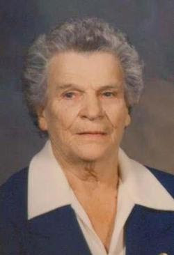
Edith Irene “Mic” Charbonneau Walker
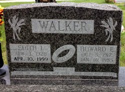
| Birth | : | 3 Apr 1928 Concordia, Cloud County, Kansas, USA |
| Death | : | 10 Apr 1999 Concordia, Cloud County, Kansas, USA |
| Burial | : | Glendale Cemetery, Saline County, USA |
| Coordinate | : | 38.9001000, -97.8681100 |
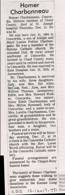
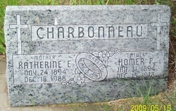
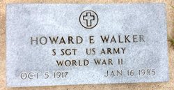
| Description | : | CONCORDIA -- Edith "Mic" Walker, 71, Concordia, died Saturday, April 10, 1999, at a Concordia hospital. She was born April 3, 1928, in Concordia, to Homer P. and Katherine E. Donahoe Charbonneau. She was a medication aide at Beverly Health and Rehabilitation Center in Concordia. She was a member of Our Lady of Perpetual Help Catholic Church in Concordia. She and Howard Everett Walker were married Sept. 9, 1946, in Concordia. He died Jan. 16, 1985. Survivors include sons, John Walker, Beloit, Jim Walker, Jamestown, Scott Walker, Talmage, and Donald Walker, Dick Walker, David Walker and Danny Walker, all of Concordia; daughters,... Read More |
frequently asked questions (FAQ):
-
Where is Edith Irene “Mic” Charbonneau Walker's memorial?
Edith Irene “Mic” Charbonneau Walker's memorial is located at: Glendale Cemetery, Saline County, USA.
-
When did Edith Irene “Mic” Charbonneau Walker death?
Edith Irene “Mic” Charbonneau Walker death on 10 Apr 1999 in Concordia, Cloud County, Kansas, USA
-
Where are the coordinates of the Edith Irene “Mic” Charbonneau Walker's memorial?
Latitude: 38.9001000
Longitude: -97.8681100
Family Members:
Parent
Spouse
Siblings
Flowers:
Nearby Cemetories:
1. Glendale Cemetery
Saline County, USA
Coordinate: 38.9001000, -97.8681100
2. Mitchell Family Cemetery
Bavaria, Saline County, USA
Coordinate: 38.8509480, -97.8175370
3. Prairie Mound Cemetery
Mulberry Township, Ellsworth County, USA
Coordinate: 38.8703800, -97.9505300
4. Franklin Cemetery
Tescott, Ottawa County, USA
Coordinate: 38.9841995, -97.8739014
5. Little Girl Gravesite
Brookville, Saline County, USA
Coordinate: 38.8128500, -97.8546350
6. Culver Union Cemetery
Morton Township, Ottawa County, USA
Coordinate: 39.0014000, -97.8225021
7. Brookville Cemetery
Brookville, Saline County, USA
Coordinate: 38.7825012, -97.8557968
8. Fairview Cemetery
Hedville, Saline County, USA
Coordinate: 38.8547300, -97.7240800
9. Monroe Cemetery
Beverly, Lincoln County, USA
Coordinate: 38.9813995, -97.9847031
10. Washam Cemetery
Lincoln County, USA
Coordinate: 38.9300003, -98.0211029
11. Walnut Grove Cemetery
Salina, Saline County, USA
Coordinate: 38.9356003, -97.7142029
12. Calvary Cemetery
Brookville, Saline County, USA
Coordinate: 38.7738991, -97.8542023
13. Price Cemetery
Tescott, Ottawa County, USA
Coordinate: 39.0311012, -97.9143982
14. Bavaria Cemetery
Bavaria, Saline County, USA
Coordinate: 38.7910000, -97.7572300
15. Shiloh Cemetery
Saline County, USA
Coordinate: 38.8857994, -97.6866989
16. Beverly Cemetery
Beverly, Lincoln County, USA
Coordinate: 39.0236015, -97.9749985
17. Saline County Cemetery
Saline County, USA
Coordinate: 38.8109550, -97.7068253
18. Crown Point Cemetery
Culver, Ottawa County, USA
Coordinate: 38.9613991, -97.6856003
19. Terra Cotta Cemetery
Carneiro, Ellsworth County, USA
Coordinate: 38.7475000, -97.9631700
20. Saint Pauls Lutheran Cemetery
Lincoln, Lincoln County, USA
Coordinate: 38.9463272, -98.0782166
21. Shady Bend Cemetery
Lincoln County, USA
Coordinate: 39.0112900, -98.0402420
22. Hammer Cemetery
Lincoln, Lincoln County, USA
Coordinate: 38.9575005, -98.0868988
23. Lambotte Gravesite
Brookville, Saline County, USA
Coordinate: 38.7097560, -97.8707220
24. Twin Hills Cemetery
Ottawa County, USA
Coordinate: 39.0891991, -97.9019012

