
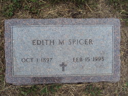
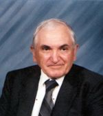
Edith May Gamble Spicer
| Birth | : | 1 Oct 1897 Parker, Turner County, South Dakota, USA |
| Death | : | 15 Feb 1995 Vancouver, Clark County, Washington, USA |
| Burial | : | Wessington Cemetery, Hand County, USA |
| Coordinate | : | 44.4569016, -98.7102966 |
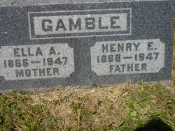
| Description | : | Rites held of Edith Spicer Edith Spicer, 97, formerly of the Wessington and Huron area, died Wednesday, February 15, 1995, at Emrald Terrace Nursing Home in Vancouver, WA. The funeral was held at 2 p.m. Monday at the Wesleyan Church in Huron with the Revs. Adrian Timmons, Donald Spicer and Lyle Spicer officiating. Burial was in the Wessington Cemetery. Edith May Gamble was born October 1, 1897 at Parker to Henry and Ella (Harper) Gamble. She graduated from Parker High School, then moved with her parents to Huron, where she attended Huron College. She... Read More |
frequently asked questions (FAQ):
-
Where is Edith May Gamble Spicer's memorial?
Edith May Gamble Spicer's memorial is located at: Wessington Cemetery, Hand County, USA.
-
When did Edith May Gamble Spicer death?
Edith May Gamble Spicer death on 15 Feb 1995 in Vancouver, Clark County, Washington, USA
-
Where are the coordinates of the Edith May Gamble Spicer's memorial?
Latitude: 44.4569016
Longitude: -98.7102966
Family Members:
Parent

Spouse
Siblings

Children
Flowers:


Nearby Cemetories:
1. Wessington Cemetery
Hand County, USA
Coordinate: 44.4569016, -98.7102966
2. Saint Josephs Catholic Cemetery
Hand County, USA
Coordinate: 44.4574400, -98.7100400
3. McCord Cemetery
Wessington, Beadle County, USA
Coordinate: 44.3998500, -98.6673100
4. Sand Creek Cemetery
Beadle County, USA
Coordinate: 44.3055800, -98.6791200
5. Beulah Cemetery
Vayland, Hand County, USA
Coordinate: 44.6060982, -98.8060989
6. Saint Johns Lutheran Cemetery
Wolsey, Beadle County, USA
Coordinate: 44.3927994, -98.4985962
7. Rosehill Cemetery
Hand County, USA
Coordinate: 44.2980995, -98.7731018
8. Saint Lawrence Cemetery
Saint Lawrence, Hand County, USA
Coordinate: 44.5292015, -98.9321976
9. Wolsey Cemetery
Wolsey, Beadle County, USA
Coordinate: 44.4000015, -98.4546967
10. Saint Ann's Cemetery
Miller, Hand County, USA
Coordinate: 44.5222015, -98.9732971
11. G A R Cemetery
Miller, Hand County, USA
Coordinate: 44.5078011, -98.9858017
12. Bonilla Cemetery
Bonilla, Beadle County, USA
Coordinate: 44.5830994, -98.4835968
13. Molvig Cemetery
Virgil, Beadle County, USA
Coordinate: 44.2552900, -98.6145900
14. Hillcrest Cemetery
Miller, Hand County, USA
Coordinate: 44.5207000, -99.0006100
15. Garfield Cemetery
Spink County, USA
Coordinate: 44.6622009, -98.5535965
16. Buffalo Cemetery
Spink County, USA
Coordinate: 44.6918983, -98.6853027
17. Sunbeam Cemetery
Hand County, USA
Coordinate: 44.6777992, -98.8407974
18. Burdette Cemetery
Burdette, Hand County, USA
Coordinate: 44.7002983, -98.7869034
19. Earlville Cemetery
Beadle County, USA
Coordinate: 44.2118988, -98.6091995
20. Altoona Cemetery
Hitchcock, Beadle County, USA
Coordinate: 44.6108017, -98.4113998
21. New Zion Cemetery
Hand County, USA
Coordinate: 44.2043991, -98.8206024
22. Saint Johns Cemetery
Tulare, Spink County, USA
Coordinate: 44.7202988, -98.6600037
23. Virgil Cemetery
Virgil, Beadle County, USA
Coordinate: 44.2904800, -98.4176700
24. Broadland Catholic Cemetery
Broadland, Beadle County, USA
Coordinate: 44.5005000, -98.3380800