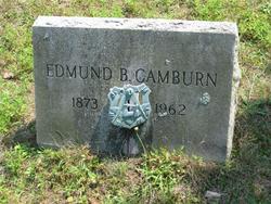
Edmund B. “Edward” Camburn
| Birth | : | 1873 Ocean County, New Jersey, USA |
| Death | : | 1962 Ocean County, New Jersey, USA |
| Burial | : | St. Michael's Anglican Cemetery, Bagdad, Southern Midlands Council, Australia |
| Coordinate | : | -42.6263790, 147.2226500 |
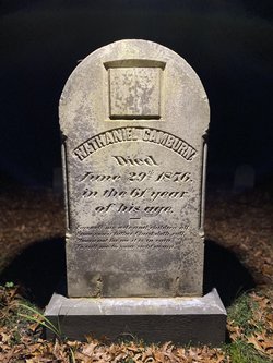
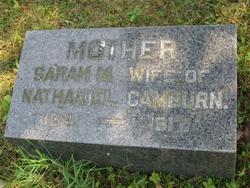
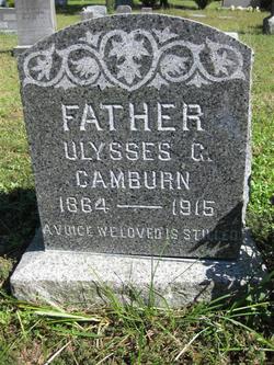
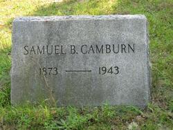
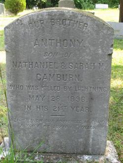
| Description | : | Edmund was the son of Nathaniel and Sarah Matilda Brown, and the twin brother of Samuel B. Camburn. He wad generally known as "Edward". From: [email protected] Subject: Re: 1880 Census, Ocean Twp, Ocean County, NJ * Sarah Camburn, 40 (Sarah Matilda Brown, mother, daughter of Samuel Brown and Penelopy Chamberlin, widow of Nathaniel Camburn, August 7, 1841 - February 8, 1917, buried in Cedar Grove Cemetery in Waretown, second wife of Nathaniel Camburn) * Ulysses Camburn, 16 (Ulysses Grant Camburn, son, November 1, 1864 - November 30, 1915, buried in Cedar Grove Cemetery in Waretown next to his wife Ella Dora... Read More |
frequently asked questions (FAQ):
-
Where is Edmund B. “Edward” Camburn's memorial?
Edmund B. “Edward” Camburn's memorial is located at: St. Michael's Anglican Cemetery, Bagdad, Southern Midlands Council, Australia.
-
When did Edmund B. “Edward” Camburn death?
Edmund B. “Edward” Camburn death on 1962 in Ocean County, New Jersey, USA
-
Where are the coordinates of the Edmund B. “Edward” Camburn's memorial?
Latitude: -42.6263790
Longitude: 147.2226500
Family Members:
Parent
Siblings
Flowers:
Nearby Cemetories:
1. St. Michael's Anglican Cemetery
Bagdad, Southern Midlands Council, Australia
Coordinate: -42.6263790, 147.2226500
2. Bagdad Uniting Church Cemetery
Bagdad, Southern Midlands Council, Australia
Coordinate: -42.6084120, 147.2222760
3. St. Anne's Anglican Church Cemetery
Dysart, Southern Midlands Council, Australia
Coordinate: -42.5753650, 147.2165400
4. St. Mark's Anglican Cemetery
Pontville, Southern Midlands Council, Australia
Coordinate: -42.6807150, 147.2663860
5. Pontville Saint Matthews Roman Catholic Cemetery
Brighton, Brighton Council, Australia
Coordinate: -42.6900390, 147.2629800
6. St. Augustine's Anglican Cemetery
Broadmarsh, Southern Midlands Council, Australia
Coordinate: -42.6380880, 147.1158740
7. Broadmarsh Congregational Cemetery
Broadmarsh, Southern Midlands Council, Australia
Coordinate: -42.6344620, 147.1129760
8. Kempton Congregational Cemetery
Kempton, Southern Midlands Council, Australia
Coordinate: -42.5361860, 147.2038090
9. St. Peter’s Catholic Church Cemetery
Kempton, Southern Midlands Council, Australia
Coordinate: -42.5299560, 147.1968150
10. St Mary’s Anglican Church Cemetery
Kempton, Southern Midlands Council, Australia
Coordinate: -42.5282960, 147.2012760
11. Saint Thomas Anglican Church Cemetery
Tea Tree, Brighton Council, Australia
Coordinate: -42.6915500, 147.3447700
12. St. Mary's Anglican Cemetery
Bridgewater, Brighton Council, Australia
Coordinate: -42.7374010, 147.2282310
13. St George's Church of England Cemetery
Gagebrook, Brighton Council, Australia
Coordinate: -42.7499706, 147.2793948
14. St. James Anglican Cemetery
Colebrook, Southern Midlands Council, Australia
Coordinate: -42.5371373, 147.3641418
15. St Patrick’s Catholic Church Cemetery
Colebrook, Southern Midlands Council, Australia
Coordinate: -42.5349600, 147.3620500
16. Hestercombe Uniting Church Cemetery
Austins Ferry, Glenorchy City, Australia
Coordinate: -42.7695190, 147.2448030
17. Campania General Cemetery
Campania, Southern Midlands Council, Australia
Coordinate: -42.6664560, 147.4182930
18. Melton Mowbray Church of England
Melton Mowbray, Southern Midlands Council, Australia
Coordinate: -42.4721458, 147.1806319
19. Malbina General Cemetery
Malbina, Derwent Valley Council, Australia
Coordinate: -42.7866610, 147.1184830
20. New Norfolk Old Cemetery
New Norfolk, Derwent Valley Council, Australia
Coordinate: -42.7719330, 147.0579860
21. St. Matthew’s Anglican Columbarium Wall
New Norfolk, Derwent Valley Council, Australia
Coordinate: -42.7792220, 147.0673080
22. St John’s Church Cemetery
Richmond, Clarence City, Australia
Coordinate: -42.7311120, 147.4412260
23. Saint Matthew's Anglican Cemetery
New Norfolk, Derwent Valley Council, Australia
Coordinate: -42.7806289, 147.0664250
24. Richmond Congregational Cemetery
Richmond, Clarence City, Australia
Coordinate: -42.7383680, 147.4373610

