
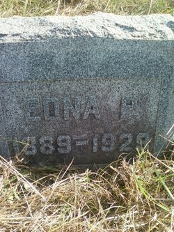
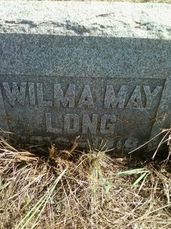
Edna Pearl Baker Long
| Birth | : | 7 Nov 1889 Cedar County, Iowa, USA |
| Death | : | 12 Apr 1929 Cedar County, Iowa, USA |
| Burial | : | Lakeview Cemetery & Mausoleum, Wichita, Sedgwick County, USA |
| Coordinate | : | 37.7086601, -97.1978989 |
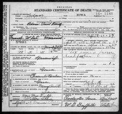
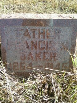
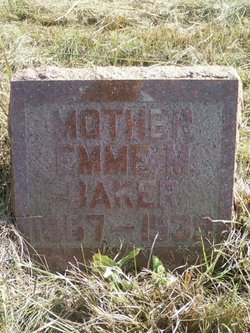
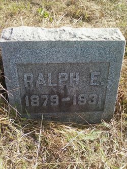
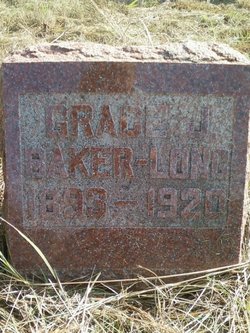
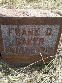
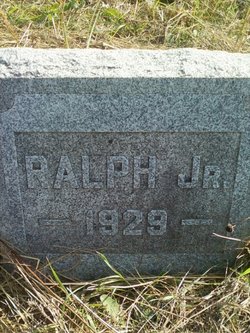
| Description | : | The Davenport Democrat and Leader 12 Apr 1929 pg 24 MRS. RALPH LONG, WILTON, SUMMONED; INFANT SON DIES Wilton, Ia., April 12- Mrs. Ralph Long, aged 39 years, died at midnight last night in her home, northwest of here, shortly after the birth of a son. The child did not live. Mrs. Long, who was formerly Miss Pearl Baker, was born in Rochester township, Nov. 7, 1889 and had spent her life in that community. Her marriage to Mr. Long took place in 1908 and the husband, her parents, Mr. and Mrs. Frank Baker, a daughter, Mona; two sons, Donald and Wayne;... Read More |
frequently asked questions (FAQ):
-
Where is Edna Pearl Baker Long's memorial?
Edna Pearl Baker Long's memorial is located at: Lakeview Cemetery & Mausoleum, Wichita, Sedgwick County, USA.
-
When did Edna Pearl Baker Long death?
Edna Pearl Baker Long death on 12 Apr 1929 in Cedar County, Iowa, USA
-
Where are the coordinates of the Edna Pearl Baker Long's memorial?
Latitude: 37.7086601
Longitude: -97.1978989
Family Members:
Parent
Spouse
Siblings
Children
Flowers:


Nearby Cemetories:
1. Lakeview Cemetery & Mausoleum
Wichita, Sedgwick County, USA
Coordinate: 37.7086601, -97.1978989
2. Pierpont Cemetery
Sedgwick County, USA
Coordinate: 37.7011400, -97.2077500
3. Kensington Gardens Cemetery
Wichita, Sedgwick County, USA
Coordinate: 37.7230988, -97.2040024
4. Saint Stephen's Episcopal Church Columbarium
Wichita, Sedgwick County, USA
Coordinate: 37.6999272, -97.2505590
5. Greenwich Cemetery
Wichita, Sedgwick County, USA
Coordinate: 37.7518997, -97.2266998
6. Seltzer Cemetery
Wichita, Sedgwick County, USA
Coordinate: 37.6652000, -97.1672700
7. Andover Cemetery
Andover, Butler County, USA
Coordinate: 37.7296982, -97.1339035
8. Deem Family Cemetery
Benton, Butler County, USA
Coordinate: 37.7491951, -97.1350937
9. Wichita Hebrew Cemetery
Wichita, Sedgwick County, USA
Coordinate: 37.7201004, -97.2798004
10. White Chapel Memorial Gardens
Wichita, Sedgwick County, USA
Coordinate: 37.7162018, -97.2806015
11. Lutheran Cemetery
Wichita, Sedgwick County, USA
Coordinate: 37.7664986, -97.2443008
12. East Heights United Methodist Memorial Garden
Wichita, Sedgwick County, USA
Coordinate: 37.6854100, -97.2845500
13. Ascension Cemetery
Bel Aire, Sedgwick County, USA
Coordinate: 37.7675018, -97.2533035
14. Maple Grove Cemetery
Wichita, Sedgwick County, USA
Coordinate: 37.7036018, -97.2949982
15. Reflection Pointe Cemetery
Wichita, Sedgwick County, USA
Coordinate: 37.6344800, -97.2264100
16. Saint James Episcopal Church Columbarium
Wichita, Sedgwick County, USA
Coordinate: 37.6865600, -97.2930000
17. Mission Chapel Mausoleum
Wichita, Sedgwick County, USA
Coordinate: 37.7231200, -97.2955100
18. Old Mission Cemetery
Wichita, Sedgwick County, USA
Coordinate: 37.7243996, -97.2964020
19. Old Mission Mausoleum
Wichita, Sedgwick County, USA
Coordinate: 37.7242600, -97.2967400
20. Wichita Park Cemetery and Mausoleum
Wichita, Sedgwick County, USA
Coordinate: 37.7277985, -97.2960968
21. Highland Cemetery
Wichita, Sedgwick County, USA
Coordinate: 37.7028008, -97.3007965
22. Temple Emanuel Cemetery
Wichita, Sedgwick County, USA
Coordinate: 37.7014000, -97.3008000
23. Mount Saint Mary Convent Cemetery
Wichita, Sedgwick County, USA
Coordinate: 37.6704000, -97.2904000
24. Calvary Cemetery
Wichita, Sedgwick County, USA
Coordinate: 37.6781006, -97.2949982