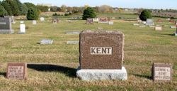
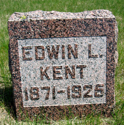
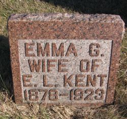
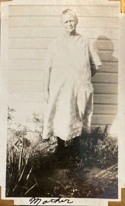
Edwin Lee Kent
| Birth | : | 5 Dec 1871 Cedar County, Iowa, USA |
| Death | : | 13 Dec 1925 Juniata, Adams County, Nebraska, USA |
| Burial | : | Wayland Village Cemetery, Wayland, Steuben County, USA |
| Coordinate | : | 42.5723280, -77.5901780 |
| Plot | : | Block 3, Lot 81, Space 2 |
| Description | : | Buried at Juniata Cemetery per Nebraska State Genealogical Society Tombstone Photo Project, pg 22: http://tombstones.nesgs.org/cemetery.php?cemID=1079&pg=22 |
frequently asked questions (FAQ):
-
Where is Edwin Lee Kent's memorial?
Edwin Lee Kent's memorial is located at: Wayland Village Cemetery, Wayland, Steuben County, USA.
-
When did Edwin Lee Kent death?
Edwin Lee Kent death on 13 Dec 1925 in Juniata, Adams County, Nebraska, USA
-
Where are the coordinates of the Edwin Lee Kent's memorial?
Latitude: 42.5723280
Longitude: -77.5901780
Family Members:
Parent
Spouse
Siblings
Children
Flowers:
Nearby Cemetories:
1. Wayland Village Cemetery
Wayland, Steuben County, USA
Coordinate: 42.5723280, -77.5901780
2. Old Cemetery
Wayland, Steuben County, USA
Coordinate: 42.5671330, -77.5946220
3. Saint Joseph's Cemetery
Wayland, Steuben County, USA
Coordinate: 42.5625200, -77.6044980
4. Old Saint Joseph's Cemetery
Wayland, Steuben County, USA
Coordinate: 42.5594800, -77.6075600
5. Ashley Cemetery
Springwater, Livingston County, USA
Coordinate: 42.5928001, -77.5877991
6. Bowles Corners Cemetery
Cohocton, Steuben County, USA
Coordinate: 42.5674550, -77.5383230
7. Pleasant Valley West Cemetery
Livingston County, USA
Coordinate: 42.5911789, -77.6376953
8. East Wayland Cemetery
Wayland, Steuben County, USA
Coordinate: 42.5349998, -77.5691986
9. Sacred Heart Cemetery
Perkinsville, Steuben County, USA
Coordinate: 42.5411800, -77.6266930
10. Garnsey Family Cemetery
Cohocton, Steuben County, USA
Coordinate: 42.5781800, -77.5329500
11. Green Gull Cemetery
Springwater, Livingston County, USA
Coordinate: 42.6154500, -77.5754900
12. Parshall Cemetery
Springwater, Livingston County, USA
Coordinate: 42.6119230, -77.5504730
13. Saint Peter's Cemetery
Perkinsville, Steuben County, USA
Coordinate: 42.5285988, -77.6256027
14. Pleasant Valley East Cemetery
Springwater, Livingston County, USA
Coordinate: 42.6036797, -77.5219345
15. Kidd - Fronk Cemetery
Dansville, Livingston County, USA
Coordinate: 42.5730553, -77.6724854
16. Mount Vernon Evergreen Cemetery
Springwater, Livingston County, USA
Coordinate: 42.6330986, -77.6085968
17. Capron Cemetery
Springwater, Livingston County, USA
Coordinate: 42.6372757, -77.5895691
18. North Loon Lake Cemetery
Wayland, Steuben County, USA
Coordinate: 42.5050880, -77.5665250
19. Haight Cemetery
Cohocton, Steuben County, USA
Coordinate: 42.5155830, -77.5347020
20. Sandy Hill Church Cemetery
Perkinsville, Steuben County, USA
Coordinate: 42.5093500, -77.6317100
21. Holy Cross Cemetery
Dansville, Livingston County, USA
Coordinate: 42.5433006, -77.6769028
22. Reeds Corners Cemetery
Sparta, Livingston County, USA
Coordinate: 42.6001053, -77.6808090
23. Green Mount Cemetery
Dansville, Livingston County, USA
Coordinate: 42.5430984, -77.6813965
24. Reed Cemetery
Sparta, Livingston County, USA
Coordinate: 42.6001663, -77.6826096

