
| Birth | : | 10 Nov 1918 Iowa, USA |
| Death | : | 2 Jan 2012 Nebraska, USA |
| Burial | : | Calvary Cemetery, Omaha, Douglas County, USA |
| Coordinate | : | 41.2364006, -96.0294037 |
| Plot | : | Station 1, Row 18, Lot 29, Space 4 |
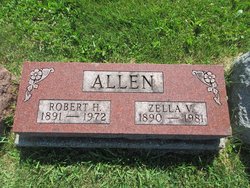
| Description | : | Born in Jamesville, Iowa. Preceded in death by parents, Robert and Zella Allen; sister, Roberta Brustkern of Waterloo, IA. Survived by wife of 42 years, Catherine (Giles) Allen; 5 nephews and 2 nieces. Edwin graduated from high school in Waterloo, IA, entered the service during WWII and attended officers' training school. He was supervisor of sales for Del Monte Company in San Francisco, CA, covering 22 states. He later moved to Omaha, where he was owner and president of Husker Brokerage Company, a food brokerage firm. He had offices and employees in Lincoln, Grand Island and Norfolk, NE, and in... Read More |
frequently asked questions (FAQ):
-
Where is Edwin Mader Allen's memorial?
Edwin Mader Allen's memorial is located at: Calvary Cemetery, Omaha, Douglas County, USA.
-
When did Edwin Mader Allen death?
Edwin Mader Allen death on 2 Jan 2012 in Nebraska, USA
-
Where are the coordinates of the Edwin Mader Allen's memorial?
Latitude: 41.2364006
Longitude: -96.0294037
Family Members:
Parent

Spouse

Siblings
Flowers:


Nearby Cemetories:
1. Calvary Cemetery
Omaha, Douglas County, USA
Coordinate: 41.2364006, -96.0294037
2. Evergreen Memorial Park Cemetery
Omaha, Douglas County, USA
Coordinate: 41.2393990, -96.0355988
3. Resurrection Cemetery
Omaha, Douglas County, USA
Coordinate: 41.2344208, -96.0365448
4. Ak-Sar-Ben Racetrack Grounds
Omaha, Douglas County, USA
Coordinate: 41.2414703, -96.0159607
5. Saint Andrews Episcopal Church Columbarium
Omaha, Douglas County, USA
Coordinate: 41.2492500, -96.0427500
6. Countryside Community Church Columbarium
Omaha, Douglas County, USA
Coordinate: 41.2483660, -96.0500270
7. Westlawn-Hillcrest Memorial Park
Omaha, Douglas County, USA
Coordinate: 41.2346992, -95.9966965
8. Bohemian Cemetery
Omaha, Douglas County, USA
Coordinate: 41.2388992, -95.9955978
9. Beth El Cemetery
Ralston, Douglas County, USA
Coordinate: 41.2117004, -96.0428009
10. Holy Sepulchre Cemetery
Omaha, Douglas County, USA
Coordinate: 41.2543983, -95.9875031
11. Douglas County Poor Farm Cemetery
Omaha, Douglas County, USA
Coordinate: 41.2437240, -95.9723480
12. Graceland Park Cemetery
Omaha, Douglas County, USA
Coordinate: 41.2113991, -95.9785995
13. Saint Mary Magdalene Cemetery
Omaha, Douglas County, USA
Coordinate: 41.2039420, -95.9850610
14. All Saints Episcopal Church Columbarium
Omaha, Douglas County, USA
Coordinate: 41.2785000, -96.0579000
15. First Central Congregational Columbarium
Omaha, Douglas County, USA
Coordinate: 41.2563456, -95.9658365
16. Nash Chapel Crypt
Omaha, Douglas County, USA
Coordinate: 41.2665090, -95.9721790
17. Saint Mary's Cemetery
Omaha, Douglas County, USA
Coordinate: 41.2042007, -95.9646988
18. Papillion Cemetery
Papillion, Sarpy County, USA
Coordinate: 41.1758003, -96.0410995
19. Portal Cemetery
Sarpy County, USA
Coordinate: 41.1838989, -96.0802994
20. Servants of Mary Cemetery
Omaha, Douglas County, USA
Coordinate: 41.3017170, -96.0258260
21. Prospect Hill Cemetery
Omaha, Douglas County, USA
Coordinate: 41.2780991, -95.9593964
22. Mount Hope Cemetery
Omaha, Douglas County, USA
Coordinate: 41.3041992, -96.0310974
23. Saint Johns Cemetery
Bellevue, Sarpy County, USA
Coordinate: 41.1864014, -95.9682999
24. Pleasant Hill Cemetery
Omaha, Douglas County, USA
Coordinate: 41.2558975, -96.1194687