
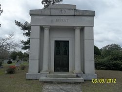
Elaine Davis Bryant
| Birth | : | 1 Sep 1946 Orangeburg, Orangeburg County, South Carolina, USA |
| Death | : | 20 Oct 2005 Phoenix, Maricopa County, Arizona, USA |
| Burial | : | St. Mary's Churchyard, North Stoke, South Oxfordshire District, England |
| Coordinate | : | 51.5714910, -1.1228080 |
| Description | : | Phoenix, Ariz. - Elaine D. Bryant, 59, of 3525 West Mauna Loa Lane, Phoenix, Ariz., formerly of Orangeburg, died Thursday, Oct. 20, 2005. Funeral services will be held at 11 a.m. Thursday, Oct. 27, at Dukes-Harley Funeral Home Chapel, with the Rev. Jim Parnell officiating. Burial will be in Sunnyside Cemetery. Pallbearers will be Megan Bryant, Jessica Bryant, Holly Bryant, Brooke Bryant, Mason Bryant, Taylor Bryant, Jack Sprott Jr., Morgan Sprott and Richard Davis. Ms. Bryant was born in Orangeburg, a daughter of the late Bennie H. and Bonnie W. Davis. She was a dedicated wife and loving mother who... Read More |
frequently asked questions (FAQ):
-
Where is Elaine Davis Bryant's memorial?
Elaine Davis Bryant's memorial is located at: St. Mary's Churchyard, North Stoke, South Oxfordshire District, England.
-
When did Elaine Davis Bryant death?
Elaine Davis Bryant death on 20 Oct 2005 in Phoenix, Maricopa County, Arizona, USA
-
Where are the coordinates of the Elaine Davis Bryant's memorial?
Latitude: 51.5714910
Longitude: -1.1228080
Family Members:
Parent

Siblings
Flowers:


Nearby Cemetories:
1. St. Mary's Churchyard
North Stoke, South Oxfordshire District, England
Coordinate: 51.5714910, -1.1228080
2. St. John the Baptist Church (Defunct)
Mongwell, South Oxfordshire District, England
Coordinate: 51.5860980, -1.1233580
3. St. Mary the Virgin Cemetery
Ipsden, South Oxfordshire District, England
Coordinate: 51.5674164, -1.0866686
4. St. Mary's Churchyard
Cholsey, South Oxfordshire District, England
Coordinate: 51.5788078, -1.1589500
5. St John the Baptist
Moulsford, South Oxfordshire District, England
Coordinate: 51.5531050, -1.1482640
6. St Andrew Churchyard
South Stoke, South Oxfordshire District, England
Coordinate: 51.5479065, -1.1377167
7. St. Leonard's Churchyard
Wallingford, South Oxfordshire District, England
Coordinate: 51.5972711, -1.1230712
8. St. Mary-le-More Churchyard
Wallingford, South Oxfordshire District, England
Coordinate: 51.5993878, -1.1249488
9. St Mary Magdalene Churchyard
Crowmarsh Gifford, South Oxfordshire District, England
Coordinate: 51.5992169, -1.1139564
10. Saint Peter's Churchyard
Wallingford, South Oxfordshire District, England
Coordinate: 51.6005819, -1.1215970
11. All Hallows Graveyard
Wallingford, South Oxfordshire District, England
Coordinate: 51.6020520, -1.1242267
12. Wallingford Cemetery
Wallingford, South Oxfordshire District, England
Coordinate: 51.6058200, -1.1232000
13. St. John the Baptist South Moreton
South Moreton, South Oxfordshire District, England
Coordinate: 51.5881630, -1.1895850
14. Saint James Churchyard
Brightwell cum Sotwell, South Oxfordshire District, England
Coordinate: 51.6120200, -1.1549800
15. St Michael's Cemetery
Aston Tirrold, South Oxfordshire District, England
Coordinate: 51.5730994, -1.1967145
16. South Moreton Strict Baptist Chapel
South Moreton, South Oxfordshire District, England
Coordinate: 51.5900300, -1.1924310
17. St. Leonard's Churchyard
Woodcote, South Oxfordshire District, England
Coordinate: 51.5348117, -1.0731299
18. St. Helen's Churchyard
Benson, South Oxfordshire District, England
Coordinate: 51.6200200, -1.1127400
19. St. Helen Churchyard Extension
Benson, South Oxfordshire District, England
Coordinate: 51.6201400, -1.1121200
20. St. Mary Churchyard
Streatley, West Berkshire Unitary Authority, England
Coordinate: 51.5240170, -1.1449500
21. St. Agatha New Churchyard
Brightwell cum Sotwell, South Oxfordshire District, England
Coordinate: 51.6131480, -1.1665480
22. Benson War Memorial
Benson, South Oxfordshire District, England
Coordinate: 51.6207890, -1.1108700
23. Whitehill Burial Ground
Goring, South Oxfordshire District, England
Coordinate: 51.5214730, -1.1180180
24. All Saints Churchyard
Aston Upthorpe, South Oxfordshire District, England
Coordinate: 51.5715900, -1.2037500