
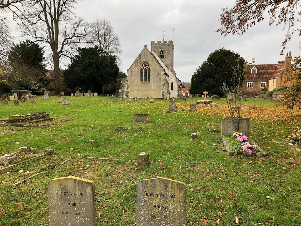
| Memorials | : | 228 |
| Location | : | South Stoke, South Oxfordshire District, England |
| Coordinate | : | 51.5479065, -1.1377167 |
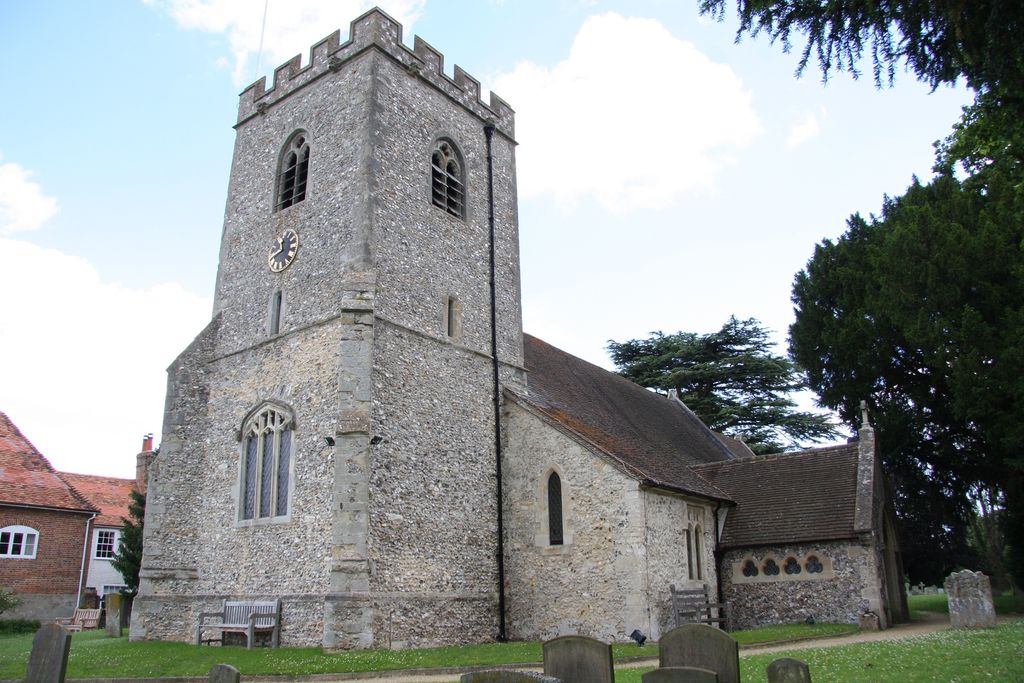
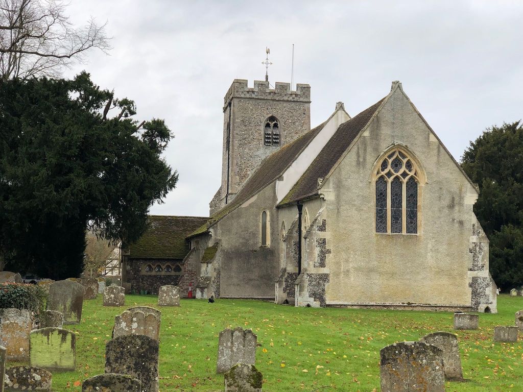
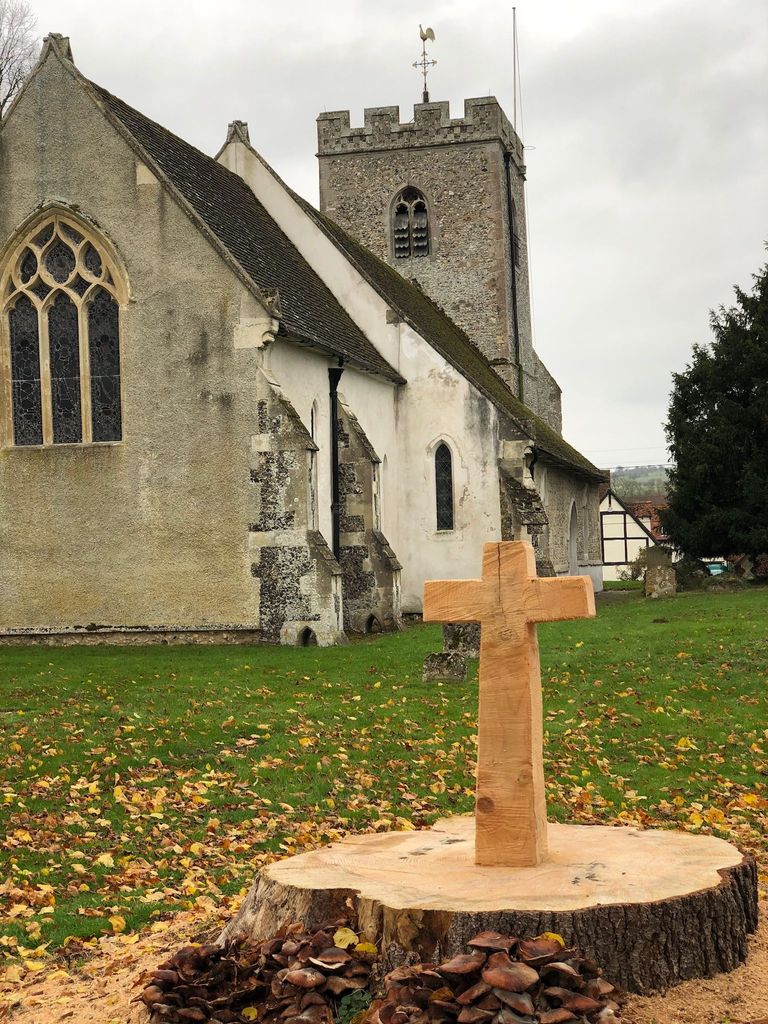
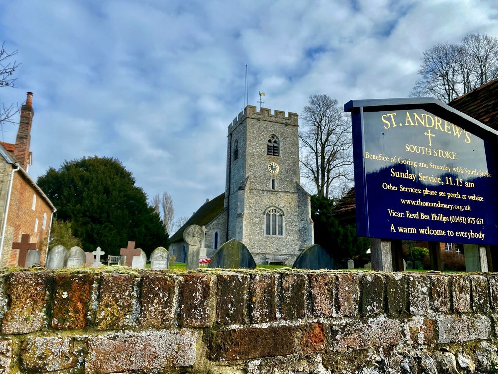
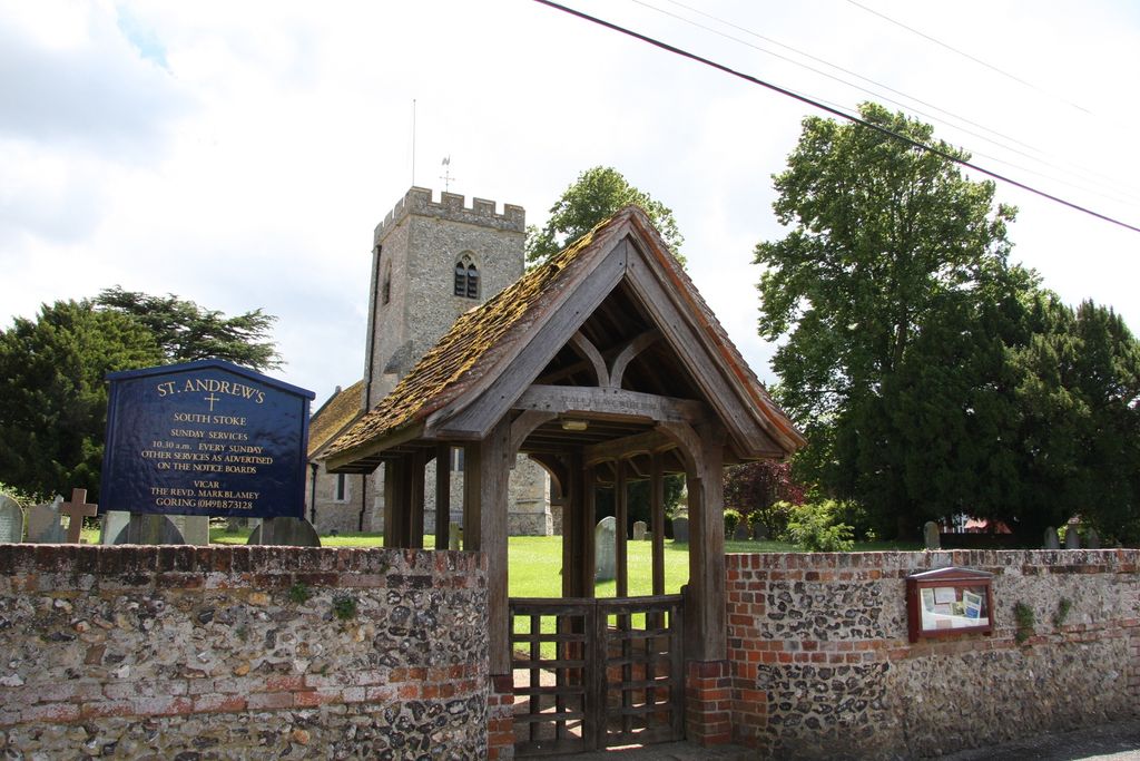
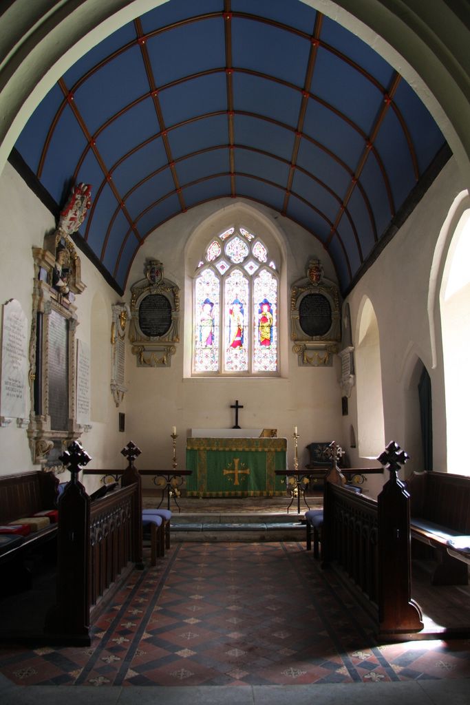
| Description | : | St Andrew's Church, South Stoke, was built in the early 1200s although it is believed there may have been an earlier church. It is one of the most beautiful churches in the district with a large and well-kept churchyard. The Parish of South Stoke cum Woodcote is believed to have been founded in Anglo-Saxon times, possibly by St. Birinus. In 1984 South Stoke became a separate parish in The United Benefice of Goring with South Stoke. The church is built of local flint rubble with stone dressings and comprises a nave, north and south aisles, south porch, vestry and a... Read More |
frequently asked questions (FAQ):
-
Where is St Andrew Churchyard?
St Andrew Churchyard is located at The Street South Stoke, South Oxfordshire District ,Oxfordshire , RG8 0JSEngland.
-
St Andrew Churchyard cemetery's updated grave count on graveviews.com?
200 memorials
-
Where are the coordinates of the St Andrew Churchyard?
Latitude: 51.5479065
Longitude: -1.1377167
Nearby Cemetories:
1. St John the Baptist
Moulsford, South Oxfordshire District, England
Coordinate: 51.5531050, -1.1482640
2. St. Mary Churchyard
Streatley, West Berkshire Unitary Authority, England
Coordinate: 51.5240170, -1.1449500
3. St. Mary's Churchyard
North Stoke, South Oxfordshire District, England
Coordinate: 51.5714910, -1.1228080
4. St. Thomas of Canterbury Churchyard
Goring, South Oxfordshire District, England
Coordinate: 51.5221440, -1.1399970
5. Whitehill Burial Ground
Goring, South Oxfordshire District, England
Coordinate: 51.5214730, -1.1180180
6. St. Mary's Churchyard
Cholsey, South Oxfordshire District, England
Coordinate: 51.5788078, -1.1589500
7. St. Mary the Virgin Cemetery
Ipsden, South Oxfordshire District, England
Coordinate: 51.5674164, -1.0866686
8. St. John the Baptist Church (Defunct)
Mongwell, South Oxfordshire District, England
Coordinate: 51.5860980, -1.1233580
9. St. Leonard's Churchyard
Woodcote, South Oxfordshire District, England
Coordinate: 51.5348117, -1.0731299
10. St Michael's Cemetery
Aston Tirrold, South Oxfordshire District, England
Coordinate: 51.5730994, -1.1967145
11. All Saints Churchyard
Aston Upthorpe, South Oxfordshire District, England
Coordinate: 51.5715900, -1.2037500
12. St. Leonard's Churchyard
Wallingford, South Oxfordshire District, England
Coordinate: 51.5972711, -1.1230712
13. St. John the Baptist South Moreton
South Moreton, South Oxfordshire District, England
Coordinate: 51.5881630, -1.1895850
14. St. Mary-le-More Churchyard
Wallingford, South Oxfordshire District, England
Coordinate: 51.5993878, -1.1249488
15. St Mary Magdalene Churchyard
Crowmarsh Gifford, South Oxfordshire District, England
Coordinate: 51.5992169, -1.1139564
16. Saint Peter's Churchyard
Wallingford, South Oxfordshire District, England
Coordinate: 51.6005819, -1.1215970
17. South Moreton Strict Baptist Chapel
South Moreton, South Oxfordshire District, England
Coordinate: 51.5900300, -1.1924310
18. All Hallows Graveyard
Wallingford, South Oxfordshire District, England
Coordinate: 51.6020520, -1.1242267
19. St. John the Baptist Churchyard
Whitchurch Hill, South Oxfordshire District, England
Coordinate: 51.5050469, -1.0824315
20. St. Mary the Virgin Churchyard
Aldworth, West Berkshire Unitary Authority, England
Coordinate: 51.5106800, -1.2030150
21. Checkendon Churchyard
Checkendon, South Oxfordshire District, England
Coordinate: 51.5424461, -1.0449720
22. Wallingford Cemetery
Wallingford, South Oxfordshire District, England
Coordinate: 51.6058200, -1.1232000
23. All Saints Churchyard
North Moreton, South Oxfordshire District, England
Coordinate: 51.6021922, -1.1898247
24. St. Michael Churchyard
Blewbury, Vale of White Horse District, England
Coordinate: 51.5693100, -1.2346100