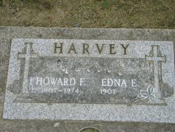
| Birth | : | 18 Nov 1913 Herrick, Gregory County, South Dakota, USA |
| Death | : | 6 Feb 1988 Omaha, Douglas County, Nebraska, USA |
| Burial | : | Independent Burial Ground Argyle Chapel, Bath, Bath and North East Somerset Unitary Authority, England |
| Coordinate | : | 51.3925420, -2.3536920 |
| Description | : | Grand Island (Nebraska) Independent Monday, 8 February 1988 SARGENT - Harriet Elender Grace Meyer, 74, of Sargent, died Saturday, Feb. 6, at Omaha. Services will be Wednesday at 2 p.m. at Rhoad Funeral Chapel in Sargent. The Rev. Wayne Hasselquist will officiate. Burial will be in Mt. Hope Cemetery at Sargent. Mrs. Meyer was born Nov. 18, 1913, at Herrick, S.D., the daughter of Phelps and Sadie Harvey. She grew up in South Dakota and was a graduate of Bonesteele, S.D. High School. After graduation she attended the school of nursing in Pierre, S.D. On Nov. 12, 1934, she married Floyd Meyer at... Read More |
frequently asked questions (FAQ):
-
Where is Elender Grace Harvey Meyer's memorial?
Elender Grace Harvey Meyer's memorial is located at: Independent Burial Ground Argyle Chapel, Bath, Bath and North East Somerset Unitary Authority, England.
-
When did Elender Grace Harvey Meyer death?
Elender Grace Harvey Meyer death on 6 Feb 1988 in Omaha, Douglas County, Nebraska, USA
-
Where are the coordinates of the Elender Grace Harvey Meyer's memorial?
Latitude: 51.3925420
Longitude: -2.3536920
Family Members:
Parent
Spouse
Siblings
Children
Flowers:
Nearby Cemetories:
1. Independent Burial Ground Argyle Chapel
Bath, Bath and North East Somerset Unitary Authority, England
Coordinate: 51.3925420, -2.3536920
2. Walcot Methodist Chapel Burial Ground
Bath, Bath and North East Somerset Unitary Authority, England
Coordinate: 51.3897080, -2.3579610
3. St. John the Baptist Churchyard
Bathwick, Bath and North East Somerset Unitary Authority, England
Coordinate: 51.3886890, -2.3547030
4. St. Mary's Churchyard
Bathwick, Bath and North East Somerset Unitary Authority, England
Coordinate: 51.3876120, -2.3543540
5. St. Swithin Churchyard
Bath, Bath and North East Somerset Unitary Authority, England
Coordinate: 51.3885480, -2.3594500
6. St Saviour's Church Crypt
Larkhall, Bath and North East Somerset Unitary Authority, England
Coordinate: 51.3956300, -2.3465100
7. St. Michael's Burial Ground
Bath, Bath and North East Somerset Unitary Authority, England
Coordinate: 51.3838810, -2.3594090
8. Ss Michael & Paul Churchyard
Bath, Bath and North East Somerset Unitary Authority, England
Coordinate: 51.3834970, -2.3596980
9. Quaker Meeting House
Bath, Bath and North East Somerset Unitary Authority, England
Coordinate: 51.3823280, -2.3604380
10. Bath General Hospital Burial Ground
Bath and North East Somerset Unitary Authority, England
Coordinate: 51.3824715, -2.3614742
11. Bath Abbey
Bath, Bath and North East Somerset Unitary Authority, England
Coordinate: 51.3815310, -2.3586640
12. St. Mary de Stall Churchyard (Defunct)
Bath, Bath and North East Somerset Unitary Authority, England
Coordinate: 51.3813350, -2.3600353
13. St Mary's Chapel, Queens Square
Bath, Bath and North East Somerset Unitary Authority, England
Coordinate: 51.3827790, -2.3649790
14. Old Orchard Street Catholic Burial Vault
Bath, Bath and North East Somerset Unitary Authority, England
Coordinate: 51.3800370, -2.3579910
15. Blessed Virgin Mary Churchyard
Charlcombe, Bath and North East Somerset Unitary Authority, England
Coordinate: 51.4046040, -2.3629440
16. St James Old Burial Ground
Bath, Bath and North East Somerset Unitary Authority, England
Coordinate: 51.3798600, -2.3610100
17. Baptist Burial Ground
Widcombe, Bath and North East Somerset Unitary Authority, England
Coordinate: 51.3764216, -2.3556947
18. Saint Mark's Churchyard
Widcombe, Bath and North East Somerset Unitary Authority, England
Coordinate: 51.3766660, -2.3588010
19. Moravian Burial Ground
Bath, Bath and North East Somerset Unitary Authority, England
Coordinate: 51.3894150, -2.3798150
20. St. James' Cemetery
Bath, Bath and North East Somerset Unitary Authority, England
Coordinate: 51.3802000, -2.3722200
21. Old Baptist Burial Ground
Walcot, Bath and North East Somerset Unitary Authority, England
Coordinate: 51.3755070, -2.3544360
22. Abbey & St James' Graveyard for the Poor
Widcombe, Bath and North East Somerset Unitary Authority, England
Coordinate: 51.3753550, -2.3545640
23. St Mary Magdalen Chapel
Widcombe, Bath and North East Somerset Unitary Authority, England
Coordinate: 51.3760486, -2.3643405
24. Smallcombe Vale Cemetery
Bathwick, Bath and North East Somerset Unitary Authority, England
Coordinate: 51.3757400, -2.3429400


