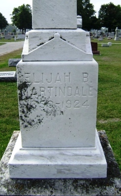
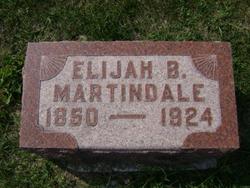
Elijah B Martindale
| Birth | : | 27 Oct 1850 Henry County, Indiana, USA |
| Death | : | 29 Jan 1924 |
| Burial | : | Papatoetoe Cemetery, Papatoetoe, Auckland Council, New Zealand |
| Coordinate | : | -36.9893110, 174.8373530 |
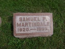
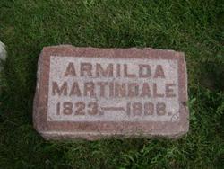
| Description | : | Mr. Martindale, became a part of the Tipton life, when he came here with his parents, in 1870. He was at that time twenty years of age, having been born in Henry county, Oct. 27th, 1850, and was the son of Samuel Pl and Armilda Martindale. When he first came to Tipton he was associated with his father in the mercantile business for three years. He then taught school in the county for four years and later engaged in the insurance and real estate business in which he was engaged at the time of his death. ... Read More |
frequently asked questions (FAQ):
-
Where is Elijah B Martindale's memorial?
Elijah B Martindale's memorial is located at: Papatoetoe Cemetery, Papatoetoe, Auckland Council, New Zealand.
-
When did Elijah B Martindale death?
Elijah B Martindale death on 29 Jan 1924 in
-
Where are the coordinates of the Elijah B Martindale's memorial?
Latitude: -36.9893110
Longitude: 174.8373530
Family Members:
Parent
Spouse
Siblings
Children
Flowers:
Nearby Cemetories:
1. Papatoetoe Cemetery
Papatoetoe, Auckland Council, New Zealand
Coordinate: -36.9893110, 174.8373530
2. Manukau Memorial Gardens
Manukau, Auckland Council, New Zealand
Coordinate: -36.9944380, 174.8397300
3. St. John's Presbyterian Church Cemetery
Papatoetoe, Auckland Council, New Zealand
Coordinate: -36.9674185, 174.8598178
4. Woodside Methodist Cemetery
Manukau, Auckland Council, New Zealand
Coordinate: -36.9929680, 174.8837860
5. Mangere Presbyterian Cemetery
Mangere, Auckland Council, New Zealand
Coordinate: -36.9750197, 174.7924783
6. Nixon Memorial
Ōtāhūhū, Auckland Council, New Zealand
Coordinate: -36.9499366, 174.8449909
7. St. David's Anglican Churchyard
Wiri, Auckland Council, New Zealand
Coordinate: -37.0025400, 174.8886150
8. St. Joseph and St. Joachim Catholic Cemetery
Ōtāhūhū, Auckland Council, New Zealand
Coordinate: -36.9436100, 174.8490100
9. Mangere Lawn Cemetery
Mangere, Auckland Council, New Zealand
Coordinate: -36.9626150, 174.7857000
10. Otahuhu Public Cemetery
Ōtāhūhū, Auckland Council, New Zealand
Coordinate: -36.9377500, 174.8432390
11. Holy Trinity Memorial Park
Ōtāhūhū, Auckland Council, New Zealand
Coordinate: -36.9374510, 174.8448580
12. Laurie-Gibbons Memorial Park
Weymouth, Auckland Council, New Zealand
Coordinate: -37.0440600, 174.8586790
13. St. John's Church Cemetery
East Tamaki, Auckland Council, New Zealand
Coordinate: -36.9522250, 174.8964540
14. St. Paul's Anglican Cemetery
East Tamaki, Auckland Council, New Zealand
Coordinate: -36.9615200, 174.9082000
15. Mangere Piriti Urupā St. James Churchyard
Mangere, Auckland Council, New Zealand
Coordinate: -36.9418970, 174.7835260
16. Flat Bush Cemetery
East Tamaki, Auckland Council, New Zealand
Coordinate: -36.9563500, 174.9097100
17. Waikaraka Cemetery
Ōnehunga, Auckland Council, New Zealand
Coordinate: -36.9297140, 174.7967170
18. Onehunga Catholic Cemetery
Ōnehunga, Auckland Council, New Zealand
Coordinate: -36.9224360, 174.7884560
19. Our Lady of the Assumption Catholic Church
Ōnehunga, Auckland Council, New Zealand
Coordinate: -36.9223690, 174.7884530
20. St. Peter's Anglican Cemetery
Ōnehunga, Auckland Council, New Zealand
Coordinate: -36.9227113, 174.7847550
21. St Matthias Churchyard
Panmure, Auckland Council, New Zealand
Coordinate: -36.9053300, 174.8577200
22. St. Patrick's Roman Catholic Church Cemetery
Panmure, Auckland Council, New Zealand
Coordinate: -36.9029680, 174.8564960
23. Alfriston Cemetery
Auckland Council, New Zealand
Coordinate: -37.0133660, 174.9479400
24. Hillsborough Cemetery
Hillsborough, Auckland Council, New Zealand
Coordinate: -36.9246600, 174.7524030

