Elizabeth Ann Robertson Yost
| Birth | : | 11 May 1838 Indiana, USA |
| Death | : | 25 Oct 1864 Iowa, USA |
| Burial | : | Bethel Cemetery, Birmingham, Van Buren County, USA |
| Coordinate | : | 40.8967018, -92.0056000 |
| Plot | : | Row 7 |
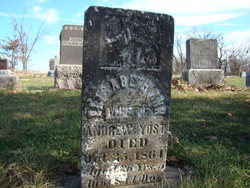
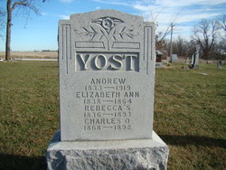
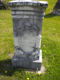
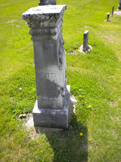
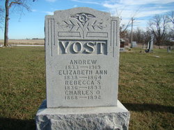
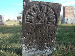
| Description | : | Wife of Andrew Yost. Note: The spelling of the first given name appears as Elizabeth and as Elisabeth, on the two separate headstones for her. Age at death according to individual headstone (transcription from cemetery listing) was 26 years 5 months 14 days. Also shares large monument with Andrew Yost, Rebecca S Robertson Yost, and Charles O Yost. |
frequently asked questions (FAQ):
-
Where is Elizabeth Ann Robertson Yost's memorial?
Elizabeth Ann Robertson Yost's memorial is located at: Bethel Cemetery, Birmingham, Van Buren County, USA.
-
When did Elizabeth Ann Robertson Yost death?
Elizabeth Ann Robertson Yost death on 25 Oct 1864 in Iowa, USA
-
Where are the coordinates of the Elizabeth Ann Robertson Yost's memorial?
Latitude: 40.8967018
Longitude: -92.0056000
Family Members:
Parent
Spouse
Siblings
Children
Flowers:
Nearby Cemetories:
1. Bethel Cemetery
Birmingham, Van Buren County, USA
Coordinate: 40.8967018, -92.0056000
2. Thompson Cemetery
Jefferson County, USA
Coordinate: 40.9155998, -91.9772034
3. Cumberland Cemetery
Jefferson County, USA
Coordinate: 40.9248000, -91.9903000
4. Clinkinbeard Family Cemetery
Libertyville, Jefferson County, USA
Coordinate: 40.9083300, -91.9583300
5. Jefferson County Poor Farm Cemetery
Libertyville, Jefferson County, USA
Coordinate: 40.9416900, -91.9996200
6. United Presbyterian Cemetery
Birmingham, Van Buren County, USA
Coordinate: 40.8796000, -91.9438000
7. Methodist Episcopal Cemetery
Birmingham, Van Buren County, USA
Coordinate: 40.8788000, -91.9427000
8. White Chapel Cemetery
Birmingham, Van Buren County, USA
Coordinate: 40.8417015, -92.0203018
9. Maple Hill Cemetery
Birmingham, Van Buren County, USA
Coordinate: 40.8778020, -91.9354496
10. Zion Lutheran Cemetery
Douds, Van Buren County, USA
Coordinate: 40.8563000, -92.0664000
11. Mount Moriah Cemetery
Douds, Van Buren County, USA
Coordinate: 40.8710000, -92.0860000
12. Fell Cemetery
Libertyville, Jefferson County, USA
Coordinate: 40.9375000, -92.0772018
13. Roth Cemetery
Fairfield, Jefferson County, USA
Coordinate: 40.9589005, -91.9574966
14. Smith Cemetery
Birmingham, Van Buren County, USA
Coordinate: 40.8807983, -91.8964005
15. Parkerville Cemetery
Birmingham, Van Buren County, USA
Coordinate: 40.8666920, -91.9001710
16. Winchester Cemetery
Winchester, Van Buren County, USA
Coordinate: 40.8499985, -91.9047012
17. Pattison Cemetery
Fairfield, Jefferson County, USA
Coordinate: 40.9444008, -91.9049988
18. Winsell Cemetery
Fairfield, Jefferson County, USA
Coordinate: 40.9067001, -92.1247025
19. Leando Cemetery
Douds, Van Buren County, USA
Coordinate: 40.8269005, -92.0883026
20. Kilbourne Cemetery
Van Buren County, USA
Coordinate: 40.8045000, -91.9705000
21. Topping Cemetery
Stockport, Van Buren County, USA
Coordinate: 40.8500000, -91.8879670
22. Boyer Family Cemetery
Leando, Van Buren County, USA
Coordinate: 40.8333560, -92.1112885
23. Smith Family Cemetery
Libertyville, Jefferson County, USA
Coordinate: 40.9972416, -92.0362857
24. Wilson Family Cemetery
Van Buren County, USA
Coordinate: 40.7951500, -91.9681000

