

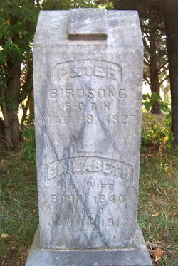
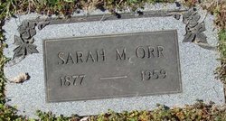
Elizabeth Jobe Birdsong
| Birth | : | 1840 Moniteau County, Missouri, USA |
| Death | : | 14 Jan 1912 California, Moniteau County, Missouri, USA |
| Burial | : | Center Haverhill Cemetery, Center Haverhill, Grafton County, USA |
| Coordinate | : | 44.0770650, -71.9868740 |
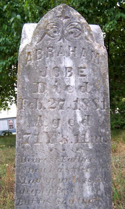
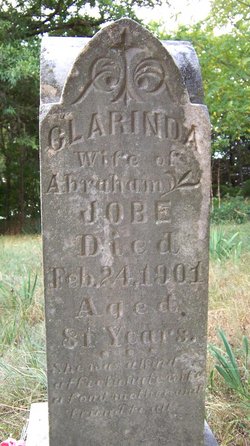
| Description | : | Daughter of Abraham Jobe of Tennessee and Celarender(?) Chandler Jobe |
frequently asked questions (FAQ):
-
Where is Elizabeth Jobe Birdsong's memorial?
Elizabeth Jobe Birdsong's memorial is located at: Center Haverhill Cemetery, Center Haverhill, Grafton County, USA.
-
When did Elizabeth Jobe Birdsong death?
Elizabeth Jobe Birdsong death on 14 Jan 1912 in California, Moniteau County, Missouri, USA
-
Where are the coordinates of the Elizabeth Jobe Birdsong's memorial?
Latitude: 44.0770650
Longitude: -71.9868740
Family Members:
Parent
Spouse

Siblings
Children


Nearby Cemetories:
1. Center Haverhill Cemetery
Center Haverhill, Grafton County, USA
Coordinate: 44.0770650, -71.9868740
2. Abbott Cemetery
North Haverhill, Grafton County, USA
Coordinate: 44.0821730, -72.0186420
3. Oxbow Cemetery
Newbury, Orange County, USA
Coordinate: 44.0881830, -72.0486670
4. East Haverhill Cemetery
East Haverhill, Grafton County, USA
Coordinate: 44.0289688, -71.9889297
5. Horse Meadow Annex Cemetery
North Haverhill, Grafton County, USA
Coordinate: 44.1056820, -72.0408260
6. Horse Meadow Cemetery
North Haverhill, Grafton County, USA
Coordinate: 44.1068880, -72.0405500
7. Number 6 Cemetery
East Haverhill, Grafton County, USA
Coordinate: 44.0326400, -71.9518600
8. Swiftwater Cemetery
Bath, Grafton County, USA
Coordinate: 44.1303400, -71.9574300
9. Ladd Street Cemetery
Haverhill, Grafton County, USA
Coordinate: 44.0439600, -72.0532800
10. Pine Grove Cemetery
Woodsville, Grafton County, USA
Coordinate: 44.1380997, -72.0188980
11. West Cemetery
Benton, Grafton County, USA
Coordinate: 44.1033700, -71.9014000
12. East Cemetery
Benton, Grafton County, USA
Coordinate: 44.0985985, -71.8846970
13. Rodimon-Cross Cemetery
Piermont, Grafton County, USA
Coordinate: 43.9901100, -71.9924500
14. Wells River Cemetery
Wells River, Orange County, USA
Coordinate: 44.1535988, -72.0547028
15. Lund Cemetery
Warren, Grafton County, USA
Coordinate: 43.9882800, -71.9589200
16. Oliverian Road Cemetery
Benton, Grafton County, USA
Coordinate: 43.9978145, -71.9209265
17. Bath Village Cemetery
Bath, Grafton County, USA
Coordinate: 44.1693500, -71.9617800
18. West Bath Cemetery
Bath, Grafton County, USA
Coordinate: 44.1750930, -71.9865080
19. West Newbury Cemetery
West Newbury, Orange County, USA
Coordinate: 44.0591800, -72.1246900
20. Town House Cemetery
Newbury Center, Orange County, USA
Coordinate: 44.1066322, -72.1256943
21. Brown Farmstead Cemetery
Benton, Grafton County, USA
Coordinate: 44.0778000, -71.8420830
22. Carbee Cemetery
Bath, Grafton County, USA
Coordinate: 44.1724640, -72.0466980
23. Rogers Hill Cemetery
West Newbury, Orange County, USA
Coordinate: 44.0550003, -72.1322021
24. Boltonville Cemetery
Boltonville, Orange County, USA
Coordinate: 44.1575012, -72.0877991