| Birth | : | 1787 |
| Death | : | 25 Apr 1849 |
| Burial | : | Chatham Palmerston Road Cemetery, Chatham, Medway Unitary Authority, England |
| Coordinate | : | 51.3678600, 0.5267300 |
| Inscription | : | IN MEMORY/ OF/ ELIZABETH STEWART/ Consort of/ JOHN STEWART;/ And Daughter of/ JOHN. AND SARAH LATTA./ (Who lie at her feet.)/ Who died 25th April A. D. 1849./ Aged 62 Years, 7 Months,/ And 5 Days./ |
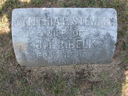
| Description | : | ELIZABETH LATTA Born in 1787, and died in 1849. Lived in Lancaster Co. South Carolina, and buried in Old Waxhaw Cemetery. Married John Stewart, who was born in 1778, and died in 1849. Children: 1. Robert S. Cynthia, m. Mr. Belk, one child, Lillie, m. Mr. Meacham, who has one child, Ruth, who in 1938 lived at Fort Mill, South Carolina. 2. Mary Jane, m. Mr. Mone. 3. Martha m. Mr. Sparrow. 4. Harriet m. Mr. Williamson. ************************************************************ MARY STEWART Departed this life in Union Co., N. C. on the 18th of February, 1858, Mrs. Mary Stewart, wife of John Stewart, Esq., in the 61st year of her... Read More |
frequently asked questions (FAQ):
-
Where is Elizabeth Latta Stewart's memorial?
Elizabeth Latta Stewart's memorial is located at: Chatham Palmerston Road Cemetery, Chatham, Medway Unitary Authority, England.
-
When did Elizabeth Latta Stewart death?
Elizabeth Latta Stewart death on 25 Apr 1849 in
-
Where are the coordinates of the Elizabeth Latta Stewart's memorial?
Latitude: 51.3678600
Longitude: 0.5267300
Family Members:
Parent
Spouse
Children
Flowers:
Nearby Cemetories:
1. Chatham Palmerston Road Cemetery
Chatham, Medway Unitary Authority, England
Coordinate: 51.3678600, 0.5267300
2. Chatham Maidstone Road Cemetery
Chatham, Medway Unitary Authority, England
Coordinate: 51.3703300, 0.5227600
3. Christ Church Cemetery
Chatham, Medway Unitary Authority, England
Coordinate: 51.3716730, 0.5462690
4. Fort Pitt Military Cemetery
Rochester, Medway Unitary Authority, England
Coordinate: 51.3769790, 0.5114570
5. St. Augustine's Church
Gillingham, Medway Unitary Authority, England
Coordinate: 51.3745050, 0.5474930
6. Chatham Unitarian Church
Chatham, Medway Unitary Authority, England
Coordinate: 51.3826090, 0.5195850
7. Chatham Naval Memorial
Chatham, Medway Unitary Authority, England
Coordinate: 51.3836479, 0.5321670
8. Chatham Burial Ground
Chatham, Medway Unitary Authority, England
Coordinate: 51.3849900, 0.5272600
9. St. Nicholas's Cemetery
Rochester, Medway Unitary Authority, England
Coordinate: 51.3780081, 0.5021076
10. St. Margaret's Cemetery
Rochester, Medway Unitary Authority, England
Coordinate: 51.3777000, 0.5011600
11. St. Barnabas Church
Gillingham, Medway Unitary Authority, England
Coordinate: 51.3801400, 0.5505370
12. St Mary Churchyard
Chatham, Medway Unitary Authority, England
Coordinate: 51.3874550, 0.5244280
13. Rochester Baptist Church
Rochester, Medway Unitary Authority, England
Coordinate: 51.3871570, 0.5052370
14. St Margaret Churchyard
Rochester, Medway Unitary Authority, England
Coordinate: 51.3849380, 0.4993630
15. Brompton War Memorial
Chatham, Medway Unitary Authority, England
Coordinate: 51.3932140, 0.5293660
16. St Matthew Churchyard
Borstal, Medway Unitary Authority, England
Coordinate: 51.3736150, 0.4868020
17. Rochester Cathedral
Rochester, Medway Unitary Authority, England
Coordinate: 51.3889750, 0.5031160
18. St Nicholas Churchyard
Rochester, Medway Unitary Authority, England
Coordinate: 51.3894170, 0.5035320
19. Rochester Castle Moat Burial Ground
Rochester, Medway Unitary Authority, England
Coordinate: 51.3894140, 0.5024580
20. St George Churchyard
Chatham, Medway Unitary Authority, England
Coordinate: 51.3974070, 0.5346770
21. Woodlands Cemetery
Gillingham, Medway Unitary Authority, England
Coordinate: 51.3839989, 0.5680000
22. St Mary Magdalene Churchyard
Gillingham, Medway Unitary Authority, England
Coordinate: 51.3903530, 0.5622230
23. Grange Road Cemetery
Gillingham, Medway Unitary Authority, England
Coordinate: 51.3902512, 0.5639850
24. Strood Cemetery
Strood, Medway Unitary Authority, England
Coordinate: 51.3900220, 0.4838640


