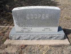
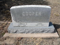
Elizabeth “Libbie” Bundy Cooper
| Birth | : | 25 Sep 1878 Kearney County, Nebraska, USA |
| Death | : | 27 Aug 1963 Lewellen, Garden County, Nebraska, USA |
| Burial | : | Temple Bruer St John the Baptist Churchyard, Temple Bruer with Temple High Grange, North Kesteven District, England |
| Description | : | Garden County News (Oshkosh, Nebraska) - 5 Sep 1963, p 1 Funeral services were held Iast Saturday afternoon for Mrs. Libby Cooper at the Lewellen Methodist church with burial in the Ash Hollow cemetery and final rites being by Wright Funeral Home. The Rev. W. R. Vert was in charge of the services with Miss Marian Matthews singing "The Old Rugged Cross" and "Safe in the Arms of Jesus" accompanied at the organ by Miss Carolyn Nass. Pallbearers were Henry Rohlfing, Archie Johnson, Fred Johnson, Bill Eggers, Ray Brown and Wes Orr. |
frequently asked questions (FAQ):
-
Where is Elizabeth “Libbie” Bundy Cooper's memorial?
Elizabeth “Libbie” Bundy Cooper's memorial is located at: Temple Bruer St John the Baptist Churchyard, Temple Bruer with Temple High Grange, North Kesteven District, England.
-
When did Elizabeth “Libbie” Bundy Cooper death?
Elizabeth “Libbie” Bundy Cooper death on 27 Aug 1963 in Lewellen, Garden County, Nebraska, USA
Family Members:
Parent
Spouse
Siblings
Children
Flowers:
Nearby Cemetories:
1. St Denys' Churchyard
Aswarby, North Kesteven District, England
Coordinate: 53.1637001, -0.4151000
2. St. Oswald's Churchyard
Blankney, North Kesteven District, England
Coordinate: 53.1204000, -0.6795000
3. Brant Broughton Quaker Burial Ground
Brant Broughton, North Kesteven District, England
Coordinate: 53.1203200, -0.6716900
4. St Helen's Churchyard
Brant Broughton, North Kesteven District, England
Coordinate: 53.1203000, -0.6717000
5. All Saints Churchyard
Coleby, North Kesteven District, England
Coordinate: 53.1696789, -0.5998978
6. All Saints Far Lane Churchyard Extension
Coleby, North Kesteven District, England
7. Dunston Back Lane Cemetery
Dunston, North Kesteven District, England
Coordinate: 52.9035930, -0.4252890
8. St Peters Churchyard
Dunston, North Kesteven District, England
Coordinate: 53.0420800, -0.3397200
9. Great Hale New Cemetery
Great Hale, North Kesteven District, England
Coordinate: 53.0414520, -0.3391170
10. St John the Baptist Churchyard
Great Hale, North Kesteven District, England
Coordinate: 52.9367820, -0.4470450
11. St. Oswald's Churchyard
Howell, North Kesteven District, England
12. St Andrew Churchyard
Leasingham, North Kesteven District, England
Coordinate: 53.2159000, -0.5236900
13. All Saints Churchyard
Nocton, North Kesteven District, England
Coordinate: 53.1637001, -0.4151000
14. St Michael's Church
Norton Disney, North Kesteven District, England
Coordinate: 53.1204000, -0.6795000
15. St Peter's Churchyard
Norton Disney, North Kesteven District, England
Coordinate: 53.1203200, -0.6716900
16. St. Peter's Churchyard
Norton Disney, North Kesteven District, England
Coordinate: 53.1203000, -0.6717000
17. Saint Michael's Churchyard
South Hykeham, North Kesteven District, England
Coordinate: 53.1696789, -0.5998978
18. St Michael's Church Cemetery
Swaton, North Kesteven District, England
19. St Nicholas Churchyard
Walcot, North Kesteven District, England
Coordinate: 52.9035930, -0.4252890
20. Anwick Church Lane Churchyard Extension
Anwick, North Kesteven District, England
Coordinate: 53.0420800, -0.3397200
21. St Edith's Church
Anwick, North Kesteven District, England
Coordinate: 53.0414520, -0.3391170
22. St Thomas Churchyard
Aunsby, North Kesteven District, England
Coordinate: 52.9367820, -0.4470450
23. Saint Mary the Virgin Churchyard
Bloxholm, North Kesteven District, England
24. All Saints Churchyard
Canwick, North Kesteven District, England
Coordinate: 53.2159000, -0.5236900

