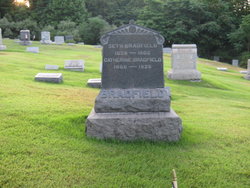
| Birth | : | 1818 Pennsylvania, USA |
| Death | : | 15 May 1872 USA |
| Burial | : | Union Cemetery, Pomeroy, Calhoun County, USA |
| Coordinate | : | 42.5539017, -94.6789017 |
| Plot | : | Old Section 1 Row 15 |
| Inscription | : | age 52 y 8 mo 22 d |
| Description | : | birth date estimated This Elias Lower was said to marry secondly after 1872, the widow of Peter Rauch who was Catherine Peters d/o John Peters of New Springfield. To add to this confusion, there is a Caroline Lower buried in this cemetery listed as "mother", however her dates are different from the Caroline Peters Rauch Lower b. 1821 who is buried in Glenview Cemetery in East Palestine. Further research needs to be done on this as year (2010) progresses. |
frequently asked questions (FAQ):
-
Where is Elizabeth Star Lower's memorial?
Elizabeth Star Lower's memorial is located at: Union Cemetery, Pomeroy, Calhoun County, USA.
-
When did Elizabeth Star Lower death?
Elizabeth Star Lower death on 15 May 1872 in USA
-
Where are the coordinates of the Elizabeth Star Lower's memorial?
Latitude: 42.5539017
Longitude: -94.6789017
Family Members:
Spouse
Children
Flowers:
Nearby Cemetories:
1. Union Cemetery
Pomeroy, Calhoun County, USA
Coordinate: 42.5539017, -94.6789017
2. Saint Marys Catholic Cemetery
Pomeroy, Calhoun County, USA
Coordinate: 42.5558014, -94.6889038
3. Memorial Park Cemetery
Calhoun County, USA
Coordinate: 42.5189018, -94.6194000
4. Swedish Cemetery
Manson, Calhoun County, USA
Coordinate: 42.5426295, -94.5992013
5. Swedish Mission Bethany Cemetery
Pocahontas County, USA
Coordinate: 42.6138992, -94.6774979
6. Evangelical Covenant Cemetery
Pomeroy, Calhoun County, USA
Coordinate: 42.6165720, -94.6803640
7. Elfsborg Lutheran Cemetery
Palmer, Pocahontas County, USA
Coordinate: 42.6169014, -94.6875000
8. Crown Hill Cemetery
Jolley, Calhoun County, USA
Coordinate: 42.4808006, -94.7360992
9. Palmer Cemetery
Palmer, Pocahontas County, USA
Coordinate: 42.6166992, -94.5894012
10. Saint Josephs Cemetery
Palmer, Pocahontas County, USA
Coordinate: 42.6342010, -94.6188965
11. Saint Paul Lutheran Cemetery
Palmer, Pocahontas County, USA
Coordinate: 42.6176000, -94.5893500
12. Saint Paul Lutheran Cemetery
Pocahontas County, USA
Coordinate: 42.5610000, -94.5392000
13. Grant Township Cemetery
Pocahontas, Pocahontas County, USA
Coordinate: 42.6571999, -94.6996994
14. Leith Cemetery
Manson, Calhoun County, USA
Coordinate: 42.4878006, -94.5667038
15. Saint Thomas Cemetery
Manson, Calhoun County, USA
Coordinate: 42.5208500, -94.5365000
16. Twin Lakes Cemetery
Jolley, Calhoun County, USA
Coordinate: 42.4427986, -94.6889038
17. Mount Zion Cemetery
Fonda, Pocahontas County, USA
Coordinate: 42.5821991, -94.8300018
18. Rose Hill Cemetery
Manson, Calhoun County, USA
Coordinate: 42.5228004, -94.5243988
19. Cedar Township Cemetery
Fonda, Pocahontas County, USA
Coordinate: 42.5810000, -94.8375000
20. Hope Cemetery
Manson, Calhoun County, USA
Coordinate: 42.4994011, -94.5199966
21. Saint Johns Lutheran Cemetery
Palmer, Pocahontas County, USA
Coordinate: 42.6268997, -94.5205994
22. Lizard Cemetery
Palmer, Pocahontas County, USA
Coordinate: 42.5875015, -94.4796982
23. Garfield Cemetery
Calhoun County, USA
Coordinate: 42.4275017, -94.7902985
24. Saint Columbkilles Cemetery
Varina, Pocahontas County, USA
Coordinate: 42.6467018, -94.8443985


