
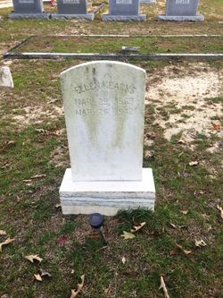


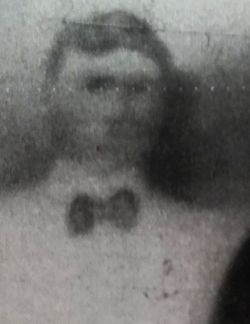
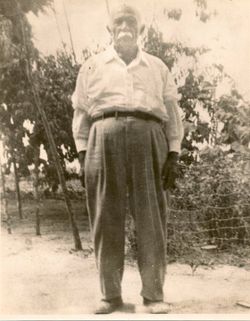
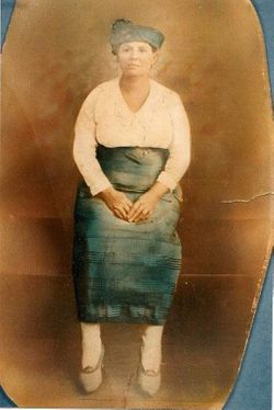
Ellen “Ella” Clark Kearns
| Birth | : | 29 Mar 1869 Marlboro County, South Carolina, USA |
| Death | : | 25 Mar 1942 Scotland County, North Carolina, USA |
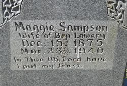
| Burial | : | Oak Grove Cemetery, Scotland County, USA |
| Coordinate | : | 34.6685000, -79.4691200 |
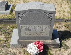
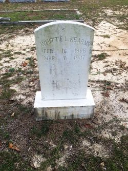
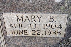
| Description | : | Ellen "Ella" Clark, Native American, was the daughter of John "Wesley" Clark and Mary Locklear. She married Jesse Lee Kerns. Their children were: Alexander Kerns, Adaline Kerns, Whittey Kerns, Clyde Kerns, Verde Kerns, Mary Bash Kerns, Emma Kerns, and Riley Wesley Kerns. Ella passed away on March 25th, 1942. |
frequently asked questions (FAQ):
-
Where is Ellen “Ella” Clark Kearns's memorial?
Ellen “Ella” Clark Kearns's memorial is located at: Oak Grove Cemetery, Scotland County, USA.
-
When did Ellen “Ella” Clark Kearns death?
Ellen “Ella” Clark Kearns death on 25 Mar 1942 in Scotland County, North Carolina, USA
-
Where are the coordinates of the Ellen “Ella” Clark Kearns's memorial?
Latitude: 34.6685000
Longitude: -79.4691200
Family Members:
Parent
Spouse
Siblings

Children
Flowers:


Nearby Cemetories:
1. Oak Grove Cemetery
Scotland County, USA
Coordinate: 34.6685000, -79.4691200
2. Good News Chapel Church Cemetery
Laurinburg, Scotland County, USA
Coordinate: 34.6671200, -79.4822700
3. Locklear Native Cemetery
Johns, Scotland County, USA
Coordinate: 34.6818761, -79.4581009
4. Smyrna Presbyterian Church Cemetery
Johns, Scotland County, USA
Coordinate: 34.6588554, -79.4526520
5. Bowen Family Cemetery
Laurinburg, Scotland County, USA
Coordinate: 34.6527500, -79.4887100
6. Smiling Family Cemetery
Laurinburg, Scotland County, USA
Coordinate: 34.6649550, -79.5036320
7. Priest Cemetery
McColl, Marlboro County, USA
Coordinate: 34.6447100, -79.4885200
8. Reedy Branch Baptist Church
Marlboro County, USA
Coordinate: 34.6254900, -79.4757300
9. Brown Cemetery #2
McColl, Marlboro County, USA
Coordinate: 34.6415140, -79.5130430
10. Bethel Bible Believing Church Cemetery
McColl, Marlboro County, USA
Coordinate: 34.6389610, -79.5123580
11. Greater Fair Plains AME Zion Church Cemetery
McColl, Marlboro County, USA
Coordinate: 34.6650590, -79.5321980
12. Seales Family Cemetery
Laurinburg, Scotland County, USA
Coordinate: 34.7008290, -79.5199050
13. Old Reedy Branch Cemetery
Clio, Marlboro County, USA
Coordinate: 34.6160300, -79.4836400
14. Daniels Chapel Cemetery
Marlboro County, USA
Coordinate: 34.6192000, -79.4993600
15. Mount Misery Cemetery
McColl, Marlboro County, USA
Coordinate: 34.6725520, -79.5395280
16. McLaurin Cemetery
McColl, Marlboro County, USA
Coordinate: 34.6688995, -79.5417023
17. Caledonia United Methodist Church Cemetery
Laurinburg, Scotland County, USA
Coordinate: 34.7290916, -79.4603958
18. Pee Dee Chapel Baptist Church Cemetery
Carolina, Dillon County, USA
Coordinate: 34.6074638, -79.4516678
19. Harris Family Cemetery
Laurinburg, Scotland County, USA
Coordinate: 34.7160960, -79.4189630
20. Britt-Brock Cemetery
Clio, Marlboro County, USA
Coordinate: 34.6121670, -79.5049090
21. Laurinburg Memorial Park
Laurinburg, Scotland County, USA
Coordinate: 34.7114700, -79.5264800
22. Red Bluff Cemetery
Clio, Marlboro County, USA
Coordinate: 34.6117783, -79.5053711
23. Graham Plantation Cemetery
Laurinburg, Scotland County, USA
Coordinate: 34.6997300, -79.5389800
24. Gibson Cemetery
McColl, Marlboro County, USA
Coordinate: 34.6639230, -79.5518280