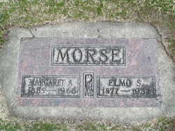
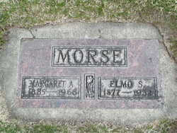
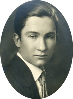
Elmo Stanford Morse
| Birth | : | 8 Dec 1877 O'Brien County, Iowa, USA |
| Death | : | 3 Feb 1932 Manson, Chelan County, Washington, USA |
| Burial | : | Manoora Public Cemetery, Manoora, District Council of Clare and Gilbert Valleys, Australia |
| Coordinate | : | -34.0127090, 138.8140030 |
| Plot | : | South Fraternal Row59 BLK58 LS5 |
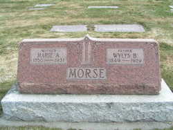
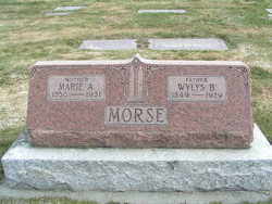
| Description | : | Death came at 8 pm Wednesday, Feb. 3, to relieve the suffering of Elmo S. Morse, well known resident and orchardist of the Manson district where he has lived for the past 28 years. Mr. Morse, who was 54 years old, was the son of Mr. and Mrs. W. B. Morse, both deceased. Mr. Morse's illness dates back about three weeks when he was taken to the Thompson hospital, where his condition so improved that he was removed to the home of his sister, Mrs. L. H. Watson of Manson. A relapse a few days ago brought about the end.... Read More |
frequently asked questions (FAQ):
-
Where is Elmo Stanford Morse's memorial?
Elmo Stanford Morse's memorial is located at: Manoora Public Cemetery, Manoora, District Council of Clare and Gilbert Valleys, Australia.
-
When did Elmo Stanford Morse death?
Elmo Stanford Morse death on 3 Feb 1932 in Manson, Chelan County, Washington, USA
-
Where are the coordinates of the Elmo Stanford Morse's memorial?
Latitude: -34.0127090
Longitude: 138.8140030
Family Members:
Parent
Spouse
Siblings
Children
Flowers:
Nearby Cemetories:
1. Manoora Public Cemetery
Manoora, District Council of Clare and Gilbert Valleys, Australia
Coordinate: -34.0127090, 138.8140030
2. Manoora Catholic Cemetery
Manoora, District Council of Clare and Gilbert Valleys, Australia
Coordinate: -33.9911920, 138.8144040
3. St. Johns Lutheran Church Cemetery
Waterloo, District Council of Clare and Gilbert Valleys, Australia
Coordinate: -34.0148720, 138.8722190
4. Waterloo Methodist Cemetery
Waterloo, District Council of Clare and Gilbert Valleys, Australia
Coordinate: -33.9891100, 138.8809620
5. Auburn Cemetery
Auburn, District Council of Clare and Gilbert Valleys, Australia
Coordinate: -34.0314560, 138.7036850
6. Tothill Creek Cemetery
Tothill Creek, District Council of Clare and Gilbert Valleys, Australia
Coordinate: -34.0781820, 138.9170250
7. St John’s Anglican Cemetery
Auburn, District Council of Clare and Gilbert Valleys, Australia
Coordinate: -34.0264310, 138.6835587
8. Tothill Creek St Edmund's Anglican Cemetery
Marrabel, District Council of Clare and Gilbert Valleys, Australia
Coordinate: -34.0888160, 138.9094860
9. Apoinga Cemetery
Apoinga, Goyder Regional Council, Australia
Coordinate: -33.9603800, 138.9407500
10. Undalya St. Patrick's Catholic Cemetery
Undalya, District Council of Clare and Gilbert Valleys, Australia
Coordinate: -34.0756230, 138.6930860
11. Mintaro Cemetery
Mintaro, District Council of Clare and Gilbert Valleys, Australia
Coordinate: -33.9175520, 138.7164540
12. Mintaro Catholic Cemetery
Mintaro, District Council of Clare and Gilbert Valleys, Australia
Coordinate: -33.9124530, 138.7194630
13. St. Agnes Catholic Cemetery
Marrabel, District Council of Clare and Gilbert Valleys, Australia
Coordinate: -34.1411778, 138.8630086
14. Watervale Cemetery
Clare, District Council of Clare and Gilbert Valleys, Australia
Coordinate: -33.9678890, 138.6546991
15. Black Springs Cemetery
Black Springs, District Council of Clare and Gilbert Valleys, Australia
Coordinate: -33.8884150, 138.8909940
16. Riverton Cemetery
Riverton, District Council of Clare and Gilbert Valleys, Australia
Coordinate: -34.1406080, 138.7459360
17. Ettrick United Presbyterian Cemetery
Riverton, District Council of Clare and Gilbert Valleys, Australia
Coordinate: -34.1532230, 138.8141270
18. Peters Hill St Peter Lutheran Cemetery
Riverton, District Council of Clare and Gilbert Valleys, Australia
Coordinate: -34.1537489, 138.8236644
19. Peters Hill Pioneer Cemetery
Riverton, District Council of Clare and Gilbert Valleys, Australia
Coordinate: -34.1683610, 138.8283480
20. Peter's Hill Huppatz Lutheran Cemetery
Marrabel, District Council of Clare and Gilbert Valleys, Australia
Coordinate: -34.1688000, 138.8232000
21. Leasingham Upper Skilly Cemetery
Auburn, District Council of Clare and Gilbert Valleys, Australia
Coordinate: -33.9996690, 138.6179280
22. Brady Creek Lutheran Cemetery
Brady Creek, Goyder Regional Council, Australia
Coordinate: -33.9510160, 138.9975130
23. St. Philip's Anglican Church Cemetery
Marrabel, District Council of Clare and Gilbert Valleys, Australia
Coordinate: -34.1760370, 138.8658570
24. Woolshed Flat Wesleyan Cemetery
Rhynie, District Council of Clare and Gilbert Valleys, Australia
Coordinate: -34.1220610, 138.6575830

