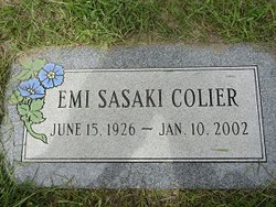
Emi Nagamitsu Sasaki Colier
| Birth | : | 15 Jun 1926 Belt, Cascade County, Montana, USA |
| Death | : | 10 Jan 2002 Havre, Hill County, Montana, USA |
| Burial | : | Galt Cemetery, Wright County, USA |
| Coordinate | : | 42.7030983, -93.5960999 |
| Plot | : | Space 499 Block 31 |
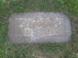
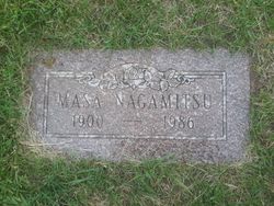
| Description | : | Emi Colier, 75, a loving mother and devoted grandmother, died Thursday, Jan. 10, 2002, at a Havre hospital of natural causes. A memorial service was held at St. Jude Catholic Church. A committal service followed at the Highland Cemetery in Havre. Emi was born June 15, 1926, to Masao and Masa Miyake Nagamitsu in Belt. The family then moved to Box Elder where she attended Box Elder Elementary and High School. She graduated from Box Elder High School in 1944 and continued her education at the Sacred Heart Nursing School where she became a registered nurse in 1948. She... Read More |
frequently asked questions (FAQ):
-
Where is Emi Nagamitsu Sasaki Colier's memorial?
Emi Nagamitsu Sasaki Colier's memorial is located at: Galt Cemetery, Wright County, USA.
-
When did Emi Nagamitsu Sasaki Colier death?
Emi Nagamitsu Sasaki Colier death on 10 Jan 2002 in Havre, Hill County, Montana, USA
-
Where are the coordinates of the Emi Nagamitsu Sasaki Colier's memorial?
Latitude: 42.7030983
Longitude: -93.5960999
Family Members:
Parent
Spouse
Flowers:
Nearby Cemetories:
1. Galt Cemetery
Wright County, USA
Coordinate: 42.7030983, -93.5960999
2. Graceland Cemetery
Rowan, Wright County, USA
Coordinate: 42.7453003, -93.5714035
3. Saint Johns Cemetery
Clarion, Wright County, USA
Coordinate: 42.7324982, -93.7039032
4. Fairview Cemetery
Dows, Wright County, USA
Coordinate: 42.6511002, -93.5044022
5. Evergreen Cemetery
Clarion, Wright County, USA
Coordinate: 42.7313995, -93.7069016
6. Mount Hope Cemetery
Morgan Township, Franklin County, USA
Coordinate: 42.6777992, -93.4792023
7. Vernon Township Lutheran Cemetery
Dows, Wright County, USA
Coordinate: 42.5864000, -93.5994000
8. Otis Grove Cemetery
Franklin County, USA
Coordinate: 42.6164017, -93.4880981
9. Saint Francis Cemetery
Belmond, Wright County, USA
Coordinate: 42.8297005, -93.5905991
10. Olson Cemetery
Popejoy, Franklin County, USA
Coordinate: 42.6383018, -93.4403000
11. Belmond Cemetery
Belmond, Wright County, USA
Coordinate: 42.8360000, -93.6020000
12. Morgan Cemetery
Morgan Township, Franklin County, USA
Coordinate: 42.6741982, -93.4100037
13. Alexander Cemetery
Alexander, Franklin County, USA
Coordinate: 42.8041687, -93.4591675
14. Saint Josephs Cemetery
Wright County, USA
Coordinate: 42.6296997, -93.7838974
15. Saint Peter's Lutheran Church Cemetery
Coulter, Franklin County, USA
Coordinate: 42.7167015, -93.3803024
16. Immanuel Reformed Cemetery
Belmond, Wright County, USA
Coordinate: 42.8635000, -93.5484000
17. Oak Hill Cemetery
Popejoy, Franklin County, USA
Coordinate: 42.5816994, -93.4447021
18. Coulter Cemetery
Coulter, Franklin County, USA
Coordinate: 42.7388916, -93.3716736
19. Saint Pauls Evangelical Lutheran Cemetery
Latimer, Franklin County, USA
Coordinate: 42.7652817, -93.3719406
20. Holmes Lutheran Cemetery
Holmes, Wright County, USA
Coordinate: 42.7172012, -93.8424988
21. Holland Cemetery
Wisner Township, Franklin County, USA
Coordinate: 42.8638916, -93.4791718
22. French Church Cemetery
Woolstock, Wright County, USA
Coordinate: 42.5724000, -93.7719000
23. Ringsaker Cemetery
Wright County, USA
Coordinate: 42.8636017, -93.7244034
24. Saint Olaf Lutheran Cemetery
Belmond, Wright County, USA
Coordinate: 42.8634000, -93.7317000

