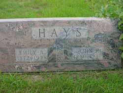
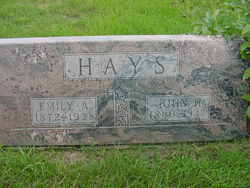
Emily O'Brien Hays
| Birth | : | 15 Jul 1872 England |
| Death | : | 10 Jan 1938 Chicago, Cook County, Illinois, USA |
| Burial | : | Garrison Cemetery, Garrison, McLean County, USA |
| Coordinate | : | 47.6650000, -101.4201000 |
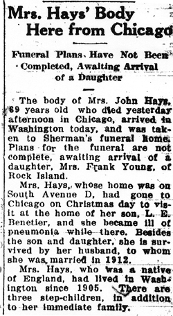
| Description | : | Middle name (if any) has not been determined. Emily's parents have not been determined. Birth location in England has not been determined. Emily first married Anthony Benetier. Details on this husband and marriage have not been determined. They had one identified son. Emily then married John Harrison Hays (1861-1947) on February 20, 1912 in Washington County, Iowa. No identified children. Obituary reports she married John H. Hays on "February 12, 1912" which disagrees with a county marriage index. Index assumed correct. |
frequently asked questions (FAQ):
-
Where is Emily O'Brien Hays's memorial?
Emily O'Brien Hays's memorial is located at: Garrison Cemetery, Garrison, McLean County, USA.
-
When did Emily O'Brien Hays death?
Emily O'Brien Hays death on 10 Jan 1938 in Chicago, Cook County, Illinois, USA
-
Where are the coordinates of the Emily O'Brien Hays's memorial?
Latitude: 47.6650000
Longitude: -101.4201000
Family Members:
Spouse
Flowers:
Nearby Cemetories:
1. Garrison Cemetery
Garrison, McLean County, USA
Coordinate: 47.6650000, -101.4201000
2. Saint Nicholas Cemetery
Garrison, McLean County, USA
Coordinate: 47.6469210, -101.3976590
3. Kloestitz German Cemetery
McLean County, USA
Coordinate: 47.6739490, -101.3461250
4. Saint Pauls Cemetery
Garrison, McLean County, USA
Coordinate: 47.6570200, -101.3344940
5. Fort Stevenson Post Cemetery
McLean County, USA
Coordinate: 47.5758800, -101.4453500
6. Saint Pauls Lutheran Cemetery
Douglas Township, McLean County, USA
Coordinate: 47.7476349, -101.4856491
7. Endres Catholic Cemetery
Max, McLean County, USA
Coordinate: 47.7099075, -101.2397003
8. Zion Lutheran Cemetery
Max, McLean County, USA
Coordinate: 47.7653999, -101.2937622
9. Clifton Cemetery
McLean County, USA
Coordinate: 47.7317009, -101.6235962
10. Saint Peter Cemetery
Emmet, McLean County, USA
Coordinate: 47.6742020, -101.6510010
11. Geminde Cemetery
Mercer County, USA
Coordinate: 47.5172005, -101.5061035
12. Saint Johns Congregational Cemetery
Max, McLean County, USA
Coordinate: 47.6871730, -101.1750700
13. Max City Cemetery
Max, McLean County, USA
Coordinate: 47.8127100, -101.2935300
14. Miller Cemetery
Pick City, Mercer County, USA
Coordinate: 47.5018480, -101.5100250
15. Max City Cemetery Old
Max, McLean County, USA
Coordinate: 47.8268088, -101.3014727
16. Evangelical Lutheran Cemetery
Max, McLean County, USA
Coordinate: 47.8268000, -101.3000000
17. Saint Mathew Cemetery
Max, McLean County, USA
Coordinate: 47.7755740, -101.1972780
18. Trinity Mannhaven Cemetery
Pick City, Mercer County, USA
Coordinate: 47.4880260, -101.5064950
19. Immaculate Conception Cemetery
Max, McLean County, USA
Coordinate: 47.8177986, -101.2613983
20. Lilly Dale Cemetery
Emmet, McLean County, USA
Coordinate: 47.5887050, -101.6742500
21. First German Baptist Cemetery
Max, McLean County, USA
Coordinate: 47.6887283, -101.1341629
22. First Baptist Cemetery
Ward County, USA
Coordinate: 47.8484612, -101.2989349
23. Douglas City Cemetery
Douglas, Ward County, USA
Coordinate: 47.8610600, -101.4975100
24. Coleharbor Cemetery
Coleharbor, McLean County, USA
Coordinate: 47.5024986, -101.2369003


