
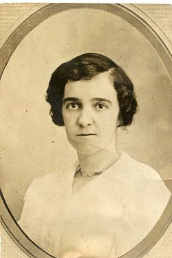
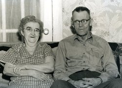
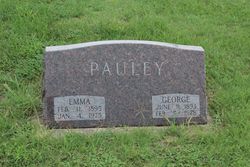
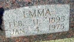
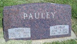
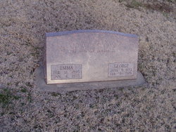
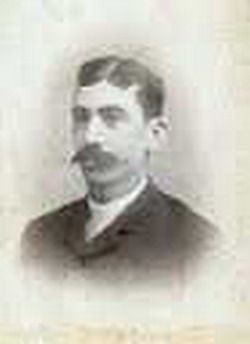
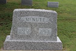
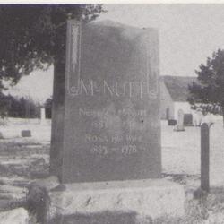
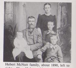
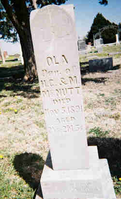
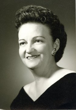
Emma Edith McNutt Pauley
| Birth | : | 11 Feb 1895 Woodston, Rooks County, Kansas, USA |
| Death | : | 4 Jan 1975 Woodston, Rooks County, Kansas, USA |
| Burial | : | Saint Marys Cemetery, Woodburn, Clarke County, USA |
| Coordinate | : | 41.0190000, -93.6045000 |
| Plot | : | Block 3 Lot 21 Space 8 |
frequently asked questions (FAQ):
-
Where is Emma Edith McNutt Pauley's memorial?
Emma Edith McNutt Pauley's memorial is located at: Saint Marys Cemetery, Woodburn, Clarke County, USA.
-
When did Emma Edith McNutt Pauley death?
Emma Edith McNutt Pauley death on 4 Jan 1975 in Woodston, Rooks County, Kansas, USA
-
Where are the coordinates of the Emma Edith McNutt Pauley's memorial?
Latitude: 41.0190000
Longitude: -93.6045000
Family Members:
Parent
Spouse
Siblings

Children
Flowers:


Nearby Cemetories:
1. Saint Marys Cemetery
Woodburn, Clarke County, USA
Coordinate: 41.0190000, -93.6045000
2. Woodburn Cemetery
Woodburn, Clarke County, USA
Coordinate: 41.0080000, -93.6000000
3. Ottawa Cemetery
Ottawa, Clarke County, USA
Coordinate: 41.0231018, -93.5899963
4. Lewis Cemetery
Woodburn, Clarke County, USA
Coordinate: 40.9975014, -93.6485977
5. Horton Cemetery
Smyrna, Clarke County, USA
Coordinate: 40.9734192, -93.6321793
6. Last Chance Cemetery
Last Chance, Lucas County, USA
Coordinate: 40.9579000, -93.5535000
7. Lost Chord Cemetery
Smyrna, Clarke County, USA
Coordinate: 40.9412689, -93.6088333
8. Smyrna Cemetery
Smyrna, Clarke County, USA
Coordinate: 40.9364014, -93.6156006
9. Old Smyrna Cemetery
Smyrna, Clarke County, USA
Coordinate: 40.9361000, -93.6159500
10. Rose Hill Cemetery
Lucas, Lucas County, USA
Coordinate: 41.0435000, -93.4985000
11. Wren Hill Pioneer Cemetery
Otter Creek Township, Lucas County, USA
Coordinate: 41.0887760, -93.5262200
12. Harrison Cemetery
Liberty, Clarke County, USA
Coordinate: 41.1156000, -93.5896000
13. Twyford Cemetery
Liberty, Clarke County, USA
Coordinate: 41.1083295, -93.6670303
14. Walker Cemetery
Lucas County, USA
Coordinate: 41.1150017, -93.5567017
15. Jones Plot
Osceola, Clarke County, USA
Coordinate: 40.9692726, -93.7288284
16. Union Chapel Cemetery
Osceola, Clarke County, USA
Coordinate: 41.0811005, -93.7213974
17. Blair Cemetery
Smyrna, Clarke County, USA
Coordinate: 40.9098816, -93.6254883
18. Hebron Cemetery
Clarke County, USA
Coordinate: 40.9291992, -93.6911011
19. Goshen Baptist Cemetery
Lucas, Lucas County, USA
Coordinate: 40.9690000, -93.4710000
20. Brinegar Cemetery
Lucas, Lucas County, USA
Coordinate: 41.1015000, -93.4960000
21. Bethel Chapel Cemetery
Liberty, Clarke County, USA
Coordinate: 41.1395000, -93.5785000
22. Fry Hill Cemetery
Lucas, Lucas County, USA
Coordinate: 41.0425000, -93.4450000
23. Fisher-Webb Cemetery
Lucas County, USA
Coordinate: 40.9480000, -93.4713000
24. Vawn Cemetery
Osceola, Clarke County, USA
Coordinate: 41.0760498, -93.7514648