Emma Jane DeWitt Caswell
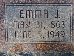
| Birth | : | 31 May 1863 |
| Death | : | 6 Jun 1949 Pawnee County, Nebraska, USA |
| Burial | : | Okato Cemetery, Okato, New Plymouth District, New Zealand |
| Coordinate | : | -39.1904200, 173.8821100 |
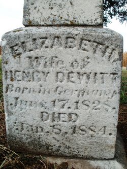
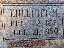
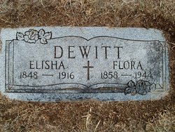
| Description | : | Daughter of Henry J. & Eve Elizabeth Wilmon DeWitt. Married to William Harvey Caswell on Oct. 3, 1880 at Cincinnati, Pawnee County, Nebraska. (Pawnee Library, book of obits in the Pawnee Republican.) ******************************************************** COURIER TRIBUNE (Seneca, Kansas)- Monday, June 13, 1949- Page 1. Attend Services for Aunt, A DuBois-Pawnee Pioneer Mr. and Mrs. George Britt and Lish Britt, Seneca, were at Pawnee Thursday to attend funeral services for an aunt, Mrs. Emma Jane Caswell about 86 years of age, a pioneer of the Old Cincinnati- DuBois area and who had lived near Pawnee the past 25 or 30... Read More |
frequently asked questions (FAQ):
-
Where is Emma Jane DeWitt Caswell's memorial?
Emma Jane DeWitt Caswell's memorial is located at: Okato Cemetery, Okato, New Plymouth District, New Zealand.
-
When did Emma Jane DeWitt Caswell death?
Emma Jane DeWitt Caswell death on 6 Jun 1949 in Pawnee County, Nebraska, USA
-
Where are the coordinates of the Emma Jane DeWitt Caswell's memorial?
Latitude: -39.1904200
Longitude: 173.8821100
Family Members:
Parent
Spouse
Siblings
Children
Flowers:
Nearby Cemetories:
1. Okato Cemetery
Okato, New Plymouth District, New Zealand
Coordinate: -39.1904200, 173.8821100
2. Tataraimaka Cemetery
Oakura, New Plymouth District, New Zealand
Coordinate: -39.1503230, 173.9138870
3. Parihaka Pā Urupa
Parihaka Pa, South Taranaki District, New Zealand
Coordinate: -39.2897366, 173.8370149
4. Waireka Cemetery
Omata, New Plymouth District, New Zealand
Coordinate: -39.0929300, 174.0087200
5. Rahotu Cemetery
Rahotu, South Taranaki District, New Zealand
Coordinate: -39.3339080, 173.7992810
6. Hurdon Cemetery
New Plymouth, New Plymouth District, New Zealand
Coordinate: -39.0870420, 174.0529740
7. Otaka Park
New Plymouth District, New Zealand
Coordinate: -39.0614948, 174.0363927
8. Port Taranaki
New Plymouth, New Plymouth District, New Zealand
Coordinate: -39.0615099, 174.0420725
9. Taranaki Crematorium
New Plymouth, New Plymouth District, New Zealand
Coordinate: -39.1216900, 174.1149500
10. Marsland Hill
New Plymouth, New Plymouth District, New Zealand
Coordinate: -39.0607490, 174.0733470
11. St Mary's Anglican Churchyard
New Plymouth, New Plymouth District, New Zealand
Coordinate: -39.0601390, 174.0734240
12. Mangapouri Cemetery
Egmont Village, New Plymouth District, New Zealand
Coordinate: -39.1347278, 174.1282396
13. Awanui Cemetery
New Plymouth, New Plymouth District, New Zealand
Coordinate: -39.0670040, 174.0972140
14. Te Henui Cemetery
New Plymouth, New Plymouth District, New Zealand
Coordinate: -39.0558000, 174.0910000
15. Henui Primitive Methodist Burial Ground
Fitzroy, New Plymouth District, New Zealand
Coordinate: -39.0502937, 174.0987132
16. St. Luke's Cemetery Biblical Garden and Labyrinth
Bell Block, New Plymouth District, New Zealand
Coordinate: -39.0348800, 174.1475250
17. Inglewood Cemetery
Inglewood, New Plymouth District, New Zealand
Coordinate: -39.1554140, 174.2145930
18. Opunake Cemetery
Opunake, South Taranaki District, New Zealand
Coordinate: -39.4515370, 173.8458110
19. St Luke's Methodist Church Cemetery
Bell Block, New Plymouth District, New Zealand
Coordinate: -39.0331650, 174.1537750
20. St Lukes Churchyard
New Plymouth, New Plymouth District, New Zealand
Coordinate: -39.0332876, 174.1539411
21. Taumata Historic Reserve
Bell Block, New Plymouth District, New Zealand
Coordinate: -39.0478297, 174.1720073
22. Lepperton Cemetery
Lepperton, New Plymouth District, New Zealand
Coordinate: -39.0575500, 174.2086000
23. Midhirst Cemetery
Midhirst, Stratford District, New Zealand
Coordinate: -39.2913640, 174.2724620
24. Huirangi Cemetery
Huirangi, New Plymouth District, New Zealand
Coordinate: -39.0500060, 174.2513380

