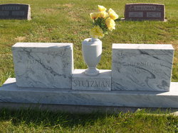
| Birth | : | 16 Jan 1893 Milford, Seward County, Nebraska, USA |
| Death | : | 17 Jan 1986 Saint Paul, Howard County, Nebraska, USA |
| Burial | : | Lakeville United Baptist Cemetery, Lakeville, Carleton County, Canada |
| Coordinate | : | 46.3355280, -67.6859400 |
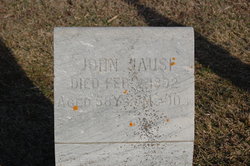
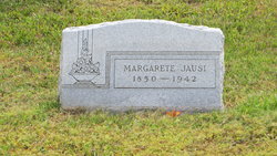
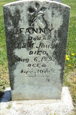
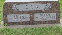
| Description | : | daughter of John Jausi and Margarete Bronc; wife of David A Stutzman - married Feb 9, 1911 |
frequently asked questions (FAQ):
-
Where is Emma Jausi Stutzman's memorial?
Emma Jausi Stutzman's memorial is located at: Lakeville United Baptist Cemetery, Lakeville, Carleton County, Canada.
-
When did Emma Jausi Stutzman death?
Emma Jausi Stutzman death on 17 Jan 1986 in Saint Paul, Howard County, Nebraska, USA
-
Where are the coordinates of the Emma Jausi Stutzman's memorial?
Latitude: 46.3355280
Longitude: -67.6859400
Family Members:
Parent
Spouse
Siblings
Children
Flowers:
Nearby Cemetories:
1. Lakeville United Baptist Cemetery
Lakeville, Carleton County, Canada
Coordinate: 46.3355280, -67.6859400
2. St. Bonaventure Roman Catholic
Lakeville, Carleton County, Canada
Coordinate: 46.3193550, -67.6819770
3. Avondale Cemetery
Avondale, Carleton County, Canada
Coordinate: 46.3078400, -67.6432200
4. Williamstown Cemetery
Bradley Corner, Carleton County, Canada
Coordinate: 46.3756420, -67.6982140
5. Pioneer Methodist Cemetery
Carleton County, Canada
Coordinate: 46.3815804, -67.6998596
6. Charleston Cemetery
Charleston, Carleton County, Canada
Coordinate: 46.3762560, -67.6437790
7. Bloomfield Cemetery
Bloomfield, Carleton County, Canada
Coordinate: 46.3202300, -67.7608200
8. Wilmot Cemetery
Carleton County, Canada
Coordinate: 46.3088200, -67.6149700
9. Carvell Cemetery
Carvell, Carleton County, Canada
Coordinate: 46.3613000, -67.7698700
10. Good Corner Cemetery
Good Corner, Carleton County, Canada
Coordinate: 46.3864400, -67.7408800
11. Waterville United Baptist Cemetery
Lower Waterville, Carleton County, Canada
Coordinate: 46.2833150, -67.6070870
12. Connell Garrison Burying Ground
Connell, Carleton County, Canada
Coordinate: 46.3971600, -67.6108000
13. Simonds Upper Cemetery
Simonds, Carleton County, Canada
Coordinate: 46.3579060, -67.5640420
14. Hunter Community Cemetery
Stickney, Carleton County, Canada
Coordinate: 46.3884120, -67.5803780
15. Simonds Lower Cemetery
Simonds, Carleton County, Canada
Coordinate: 46.3338000, -67.5545300
16. Harmon Cemetery
Peel, Carleton County, Canada
Coordinate: 46.3520565, -67.5545527
17. Connell Cemetery
Connell, Carleton County, Canada
Coordinate: 46.4197240, -67.6206290
18. Jacksontown Cemetery
Jacksontown, Carleton County, Canada
Coordinate: 46.2490500, -67.6202300
19. Upper Brighton Cemetery
Upper Brighton, Carleton County, Canada
Coordinate: 46.3295900, -67.5446700
20. United Baptist Church Cemetery
Centreville, Carleton County, Canada
Coordinate: 46.4323100, -67.7075500
21. St. James Anglican Church Cemetery
Centreville, Carleton County, Canada
Coordinate: 46.4331400, -67.7119700
22. St. Paul's United Church Cemetery
Centreville, Carleton County, Canada
Coordinate: 46.4331605, -67.7121574
23. Waterville Community Cemetery
Lower Waterville, Carleton County, Canada
Coordinate: 46.2667530, -67.5822040
24. East Florenceville Cemetery
Florenceville-Bristol, Carleton County, Canada
Coordinate: 46.4228510, -67.6136030

