Emma Thomas Brandenburg Rees
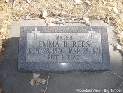
| Birth | : | 28 Sep 1874 Missouri, USA |
| Death | : | 25 Mar 1971 Big Timber, Sweet Grass County, Montana, USA |
| Burial | : | North Fork Cemetery, Long Creek, Macon County, USA |
| Coordinate | : | 39.8463898, -88.8752747 |
| Plot | : | Section 5 Block 27 Lot 1 Grave 4 |
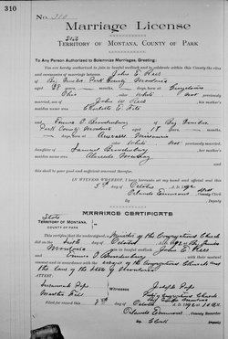
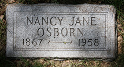
| Description | : | ************** On Oct 17, 1861, Alverda Murray, daughter of Elizabeth (Urie) and John Murray married Samuel Brandenburg son of Mary L (Smith) and Jonathan Brandenburg. They had 7 children; 1863 Jackson Davis 1865-1949 Mary Susan 1867-1958 Nancy Jane 1869-1960 Carrie Jerusha 1872-1939 Algie Mason 1874-1971 Emma Thomas 1877-1880 Samuel Edward Emma was the 6th of their 7 children; Her Mom died in 1879 and her Dad and little brother Samuel in 1880. After the deaths of Samuel and his son the younger children went to Montana by train and coach with their Uncle Thomas Murray to live with Aunt Susan (Murray) and Uncle... Read More |
frequently asked questions (FAQ):
-
Where is Emma Thomas Brandenburg Rees's memorial?
Emma Thomas Brandenburg Rees's memorial is located at: North Fork Cemetery, Long Creek, Macon County, USA.
-
When did Emma Thomas Brandenburg Rees death?
Emma Thomas Brandenburg Rees death on 25 Mar 1971 in Big Timber, Sweet Grass County, Montana, USA
-
Where are the coordinates of the Emma Thomas Brandenburg Rees's memorial?
Latitude: 39.8463898
Longitude: -88.8752747
Family Members:
Parent
Spouse
Siblings
Children
Nearby Cemetories:
1. North Fork Cemetery
Long Creek, Macon County, USA
Coordinate: 39.8463898, -88.8752747
2. Lester R Barnett Memorial Cemetery
Decatur, Macon County, USA
Coordinate: 39.8511100, -88.8661000
3. Spangler Cemetery
Decatur, Macon County, USA
Coordinate: 39.8511009, -88.8989029
4. Saint Johns Lutheran Cemetery
Decatur, Macon County, USA
Coordinate: 39.8637886, -88.8975677
5. Wheeler Cemetery
Oakley, Macon County, USA
Coordinate: 39.8833008, -88.8581009
6. Ritchie Cemetery
Oakley, Macon County, USA
Coordinate: 39.8842010, -88.8419037
7. Florey Cemetery
Long Creek, Macon County, USA
Coordinate: 39.8107986, -88.8319016
8. Garver Cemetery
Oreana, Macon County, USA
Coordinate: 39.9008331, -88.8747253
9. Point Pleasant Cemetery
Long Creek, Macon County, USA
Coordinate: 39.8055992, -88.8274994
10. Peach Orchard Cemetery (Defunct)
Decatur, Macon County, USA
Coordinate: 39.8942020, -88.9254740
11. Saint Johns Episcopal Church Columbarium
Decatur, Macon County, USA
Coordinate: 39.8461020, -88.9570160
12. Greenwood Cemetery
Decatur, Macon County, USA
Coordinate: 39.8319016, -88.9582977
13. Cross Cemetery
Oakley, Macon County, USA
Coordinate: 39.9006004, -88.8268967
14. Turpin Cemetery
Turpin, Macon County, USA
Coordinate: 39.7941680, -88.9272250
15. Hays Cemetery
Decatur, Macon County, USA
Coordinate: 39.8888890, -88.9422220
16. Turpin Cemetery
Mount Zion, Macon County, USA
Coordinate: 39.7830560, -88.8455560
17. Mount Zion Township Cemetery
Mount Zion, Macon County, USA
Coordinate: 39.7769440, -88.8775000
18. Ridge Cemetery
Long Creek Township, Macon County, USA
Coordinate: 39.8363991, -88.7830963
19. Mount Zion Presbyterian Cemetery
Mount Zion, Macon County, USA
Coordinate: 39.7708330, -88.8755560
20. Union Cemetery
Oreana, Macon County, USA
Coordinate: 39.9202766, -88.8488922
21. Calvary Catholic Cemetery
Decatur, Macon County, USA
Coordinate: 39.8452072, -88.9765015
22. Graceland Cemetery
Decatur, Macon County, USA
Coordinate: 39.8616982, -88.9764023
23. Gibson Cemetery
Mount Zion, Macon County, USA
Coordinate: 39.7779840, -88.8215490
24. Goodwin Family Cemetery
Mount Zion, Macon County, USA
Coordinate: 39.7776260, -88.8222140

