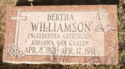
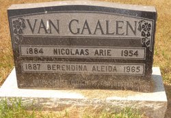
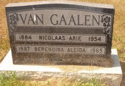
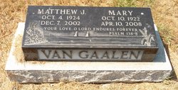
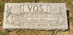
Engelbertha Geertruida Johanna “Bertha” Van Gaalen Williamson
| Birth | : | 8 Apr 1921 Foremost, Medicine Hat Census Division, Alberta, Canada |
| Death | : | 17 Apr 1991 Fort Macleod, Claresholm Census Division, Alberta, Canada |
| Burial | : | Granum Christian Reformed Church Cemetery, Granum, Claresholm Census Division, Canada |
| Coordinate | : | 49.8622100, -113.3436600 |
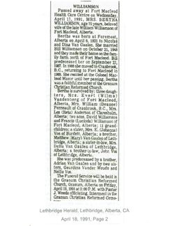
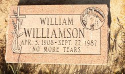
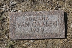
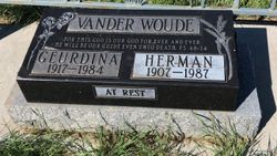
| Description | : | Lethbridge Herald Thursday, April 18, 1991, Lethbridge, Alberta page 2 Bertha Williamson died in Fort Macleod, AB April 17 1991 at age 70 yeras - widow of William Williamson of Fort Macleod, AB - born April 8 1921 to Nicolas & Dina Van Gaalen at Foremost, AB - married Bill Williamson Oct 21 1948 - farmed north of Fort Macleod, AB - predeceased by her husband Bill on Sept 27 1987 - moved to Cranbrook, BC in 1988 and returned to Fort Macleod in 1989 - lived at Colonel Macleod Manor - faithful member of the Granum Christian Reform Church |
frequently asked questions (FAQ):
-
Where is Engelbertha Geertruida Johanna “Bertha” Van Gaalen Williamson's memorial?
Engelbertha Geertruida Johanna “Bertha” Van Gaalen Williamson's memorial is located at: Granum Christian Reformed Church Cemetery, Granum, Claresholm Census Division, Canada.
-
When did Engelbertha Geertruida Johanna “Bertha” Van Gaalen Williamson death?
Engelbertha Geertruida Johanna “Bertha” Van Gaalen Williamson death on 17 Apr 1991 in Fort Macleod, Claresholm Census Division, Alberta, Canada
-
Where are the coordinates of the Engelbertha Geertruida Johanna “Bertha” Van Gaalen Williamson's memorial?
Latitude: 49.8622100
Longitude: -113.3436600
Family Members:
Parent
Spouse
Siblings
Nearby Cemetories:
1. Granum Christian Reformed Church Cemetery
Granum, Claresholm Census Division, Canada
Coordinate: 49.8622100, -113.3436600
2. Jumbo Valley Hutterite Cemetery
Granum, Claresholm Census Division, Canada
Coordinate: 49.8452911, -113.3425358
3. White Lake Cemetery
Nobleford, Lethbridge Census Division, Canada
Coordinate: 49.9018700, -113.2107750
4. White Lake Hutterite Cemetery
Nobleford, Lethbridge Census Division, Canada
Coordinate: 49.9154153, -113.2084160
5. Granum Cemetery
Granum, Claresholm Census Division, Canada
Coordinate: 49.8812800, -113.5251600
6. Orton Cemetery
Orton, Claresholm Census Division, Canada
Coordinate: 49.7484600, -113.2540900
7. Union Cemetery
Fort Macleod, Claresholm Census Division, Canada
Coordinate: 49.7306500, -113.3882000
8. Holy Cross Cemetery
Fort Macleod, Claresholm Census Division, Canada
Coordinate: 49.7283000, -113.3882400
9. Nobleford Monarch Cemetery
Nobleford, Lethbridge Census Division, Canada
Coordinate: 49.8456500, -113.0942100
10. Granum Hutterite Cemetery
Granum, Claresholm Census Division, Canada
Coordinate: 49.8513248, -113.6038772
11. Monarch Cemetery
Monarch, Lethbridge Census Division, Canada
Coordinate: 49.8020980, -113.0953220
12. Five Mile Cemetery
Claresholm, Claresholm Census Division, Canada
Coordinate: 50.0188250, -113.4705730
13. Elinor Cemetery
Barons, Lethbridge Census Division, Canada
Coordinate: 50.0271520, -113.2340240
14. Barons Cemetery
Barons, Lethbridge Census Division, Canada
Coordinate: 49.9756500, -113.0993100
15. Saint Peter's Lutheran Cemetery
Claresholm, Claresholm Census Division, Canada
Coordinate: 50.0487620, -113.4822460
16. Claresholm Cemetery
Claresholm, Claresholm Census Division, Canada
Coordinate: 50.0114784, -113.5946503
17. Keho Lake Hutterite Cemetery
Barons, Lethbridge Census Division, Canada
Coordinate: 49.9891594, -113.0160634
18. Carmangay Cemetery
Carmangay, Strathmore Census Division, Canada
Coordinate: 50.1214300, -113.1434300
19. Albion Ridge Cemetery
Barons, Lethbridge Census Division, Canada
Coordinate: 49.9598350, -112.9169650
20. Alston Cemetery
Vulcan, Strathmore Census Division, Canada
Coordinate: 50.1652820, -113.2450470
21. Carmangay Hutterite Cemetery
Carmangay, Strathmore Census Division, Canada
Coordinate: 50.0841743, -113.0067984
22. Archmount Cemetery
Lethbridge, Lethbridge Census Division, Canada
Coordinate: 49.7057900, -112.9017500
23. Isol Russell Grave
Champion, Strathmore Census Division, Canada
Coordinate: 50.1792300, -113.2102100
24. Bratton Family Cemetery
Spring Point, Claresholm Census Division, Canada
Coordinate: 49.7150200, -113.8017500

