Eric Rockwell “Bud” Wood
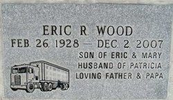
| Birth | : | 26 Feb 1928 Okanogan County, Washington, USA |
| Death | : | 2 Dec 2007 Ritzville, Adams County, Washington, USA |
| Burial | : | West Park Cemetery, Cleveland, Cuyahoga County, USA |
| Coordinate | : | 41.4482994, -81.7416992 |
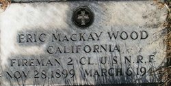
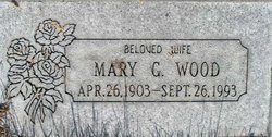
| Description | : | The Chronicle Eric (Bud) Rockwell Wood was born on the Colville Indian Reservation in Lafleur, Wash., February 28, 1928 to Eric and Mary "Wells" Wood. Going to the Great Provider on December 2, 2007. He married Patricia Ann Boyd, September 12, 1948 in Omak and just celebrated their 59th Anniversary. Bud worked at Claire Greeley's gas station in Okanogan as a young man. They owned a ranch on the Columbia River at Kartar Valley before moving to Bridgeport. In 1958, they moved to Omak where he enjoyed raising his family, driving trucks and mechanic'n for John Figenshow in Tonasket. In 1976,... Read More |
frequently asked questions (FAQ):
-
Where is Eric Rockwell “Bud” Wood's memorial?
Eric Rockwell “Bud” Wood's memorial is located at: West Park Cemetery, Cleveland, Cuyahoga County, USA.
-
When did Eric Rockwell “Bud” Wood death?
Eric Rockwell “Bud” Wood death on 2 Dec 2007 in Ritzville, Adams County, Washington, USA
-
Where are the coordinates of the Eric Rockwell “Bud” Wood's memorial?
Latitude: 41.4482994
Longitude: -81.7416992
Family Members:
Parent
Siblings
Flowers:
Nearby Cemetories:
1. West Park Cemetery
Cleveland, Cuyahoga County, USA
Coordinate: 41.4482994, -81.7416992
2. Ridge Road Cemetery
Brooklyn, Cuyahoga County, USA
Coordinate: 41.4523964, -81.7375488
3. Chesed Shel Emeth Cemetery
Cleveland, Cuyahoga County, USA
Coordinate: 41.4546165, -81.7378311
4. Saint Theodosius Orthodox Cemetery
Brooklyn, Cuyahoga County, USA
Coordinate: 41.4305992, -81.7403030
5. Brookmere Cemetery
Cleveland, Cuyahoga County, USA
Coordinate: 41.4432983, -81.7102966
6. Lutheran Cemetery
Cleveland, Cuyahoga County, USA
Coordinate: 41.4308014, -81.7174988
7. Saint Mary Cemetery
Cleveland, Cuyahoga County, USA
Coordinate: 41.4704900, -81.7119750
8. Riverside Cemetery
Cleveland, Cuyahoga County, USA
Coordinate: 41.4555206, -81.7008667
9. Denison Cemetery
Cleveland, Cuyahoga County, USA
Coordinate: 41.4517400, -81.6993300
10. Fir Street Cemetery
Cleveland, Cuyahoga County, USA
Coordinate: 41.4794006, -81.7281036
11. Gods Acre Cemetery
Cleveland, Cuyahoga County, USA
Coordinate: 41.4314003, -81.7807999
12. Brooklyn Heights Cemetery
Cleveland, Cuyahoga County, USA
Coordinate: 41.4286003, -81.7035980
13. Brooklyn Union Burial Ground
Cleveland, Cuyahoga County, USA
Coordinate: 41.4362488, -81.6974411
14. Willet Street Cemetery
Cleveland, Cuyahoga County, USA
Coordinate: 41.4771996, -81.7106018
15. Holy Spirit Cemetery
Parma, Cuyahoga County, USA
Coordinate: 41.4121017, -81.7247620
16. Workmens Circle Cemetery
Parma, Cuyahoga County, USA
Coordinate: 41.4124985, -81.7210999
17. Congregation Sherith Israel Cemetery
Parma Heights, Cuyahoga County, USA
Coordinate: 41.4125697, -81.7208435
18. Polish National Catholic Cemetery
Parma, Cuyahoga County, USA
Coordinate: 41.4118996, -81.7225037
19. Berger Cemetery
Parma, Cuyahoga County, USA
Coordinate: 41.4121430, -81.7202790
20. Monroe Street Cemetery
Cleveland, Cuyahoga County, USA
Coordinate: 41.4787700, -81.7066600
21. Scranton Road Cemetery
Cleveland, Cuyahoga County, USA
Coordinate: 41.4733391, -81.6962891
22. Saint Stanislaus Cemetery
Parma, Cuyahoga County, USA
Coordinate: 41.4088300, -81.7102600
23. Saint Mary Polish National Church Cemetery
Parma, Cuyahoga County, USA
Coordinate: 41.4155830, -81.6919290
24. Parma Heights Cemetery
Parma Heights, Cuyahoga County, USA
Coordinate: 41.3988304, -81.7513504

