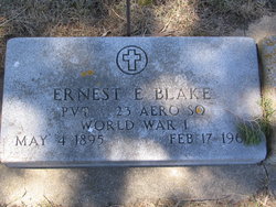
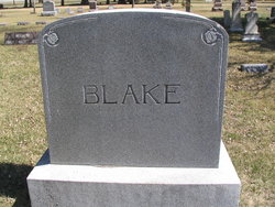
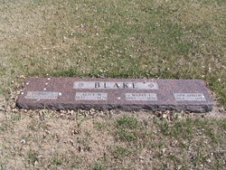
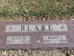
Ernest Elon Blake
| Birth | : | 4 May 1895 Spink County, South Dakota, USA |
| Death | : | 17 Feb 1967 Norwalk, Los Angeles County, California, USA |
| Burial | : | Mount Olivet Cemetery, Watertown, Litchfield County, USA |
| Coordinate | : | 41.6185989, -73.1492004 |
| Plot | : | Blk D Lot 6 |
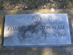
| Description | : | Ernest Elon Blake was buried 24 Feb 1967 at the age of 71yrs. 1930 Mellette, Spink, SD census Blake Ernest, head, 33, [email protected], SD; Elizabeth (Newton), wife, 28 [email protected], Wis. Check the obit sites of Elizabeth Newton Blake and his parents Alice May Newell Blake and Richard Elon Blake. |
frequently asked questions (FAQ):
-
Where is Ernest Elon Blake's memorial?
Ernest Elon Blake's memorial is located at: Mount Olivet Cemetery, Watertown, Litchfield County, USA.
-
When did Ernest Elon Blake death?
Ernest Elon Blake death on 17 Feb 1967 in Norwalk, Los Angeles County, California, USA
-
Where are the coordinates of the Ernest Elon Blake's memorial?
Latitude: 41.6185989
Longitude: -73.1492004
Family Members:
Parent
Spouse
Siblings
Flowers:
Nearby Cemetories:
1. Mount Olivet Cemetery
Watertown, Litchfield County, USA
Coordinate: 41.6185989, -73.1492004
2. Evergreen Cemetery
Watertown, Litchfield County, USA
Coordinate: 41.6082993, -73.1235962
3. Mount Saint James Cemetery
Watertown, Litchfield County, USA
Coordinate: 41.6100006, -73.1093979
4. Old Watertown Cemetery
Watertown, Litchfield County, USA
Coordinate: 41.5993996, -73.1138992
5. Abbey of Regina Laudis Cemetery
Bethlehem, Litchfield County, USA
Coordinate: 41.6116400, -73.2100800
6. Evergreen Cemetery
Bethlehem, Litchfield County, USA
Coordinate: 41.6306000, -73.2099991
7. Old Bethlehem Cemetery
Bethlehem, Litchfield County, USA
Coordinate: 41.6486015, -73.2089005
8. All Saints Episcopal Church Memorial Garden
Oakville, Litchfield County, USA
Coordinate: 41.5885620, -73.0856160
9. Hillside Cemetery
Thomaston, Litchfield County, USA
Coordinate: 41.6685982, -73.0819016
10. Fort Hill Cemetery
Waterbury, New Haven County, USA
Coordinate: 41.5943413, -73.0548553
11. Farband Cemetery
Morris, Litchfield County, USA
Coordinate: 41.6890182, -73.1839447
12. Morris Burying Ground
Morris, Litchfield County, USA
Coordinate: 41.6883300, -73.1865400
13. Carmel Hill Cemetery
Bethlehem, Litchfield County, USA
Coordinate: 41.6385994, -73.2481003
14. Thomaston Veterans Monument
Thomaston, Litchfield County, USA
Coordinate: 41.6739640, -73.0727780
15. New North Cemetery
Woodbury, Litchfield County, USA
Coordinate: 41.5519280, -73.2106860
16. Old North Cemetery
Woodbury, Litchfield County, USA
Coordinate: 41.5506070, -73.2096290
17. Orton Family Plot
Woodbury, Litchfield County, USA
Coordinate: 41.5488777, -73.2097855
18. West Side Cemetery
Goshen, Litchfield County, USA
Coordinate: 41.6707993, -73.0603027
19. West Cemetery
Plymouth, Litchfield County, USA
Coordinate: 41.6709595, -73.0592499
20. Northfield Cemetery
Northfield, Litchfield County, USA
Coordinate: 41.6972008, -73.1031036
21. Middlebury Cemetery
Middlebury, New Haven County, USA
Coordinate: 41.5341988, -73.1264038
22. Plymouth Burying Ground
Plymouth, Litchfield County, USA
Coordinate: 41.6726913, -73.0542374
23. Beth El Cemetery
Waterbury, New Haven County, USA
Coordinate: 41.5951385, -73.0333328
24. South Cemetery
Woodbury, Litchfield County, USA
Coordinate: 41.5407982, -73.2091980

