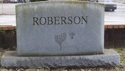
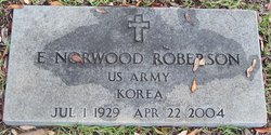
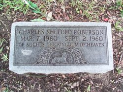
Ernest Norwood Roberson Sr.
| Birth | : | 1 Jul 1929 McClellanville, Charleston County, South Carolina, USA |
| Death | : | 22 Apr 2004 South Carolina, USA |
| Burial | : | Hillcrest Cemetery, Derby, Sedgwick County, USA |
| Coordinate | : | 37.5194435, -97.2202759 |
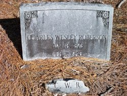
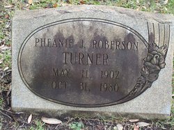
| Description | : | Georgetown: E. Norwood Roberson, 74, died Thursday, April 22, 2004, at his residence. Mr. Roberson was born in McClellanville on July 1, 1929, a son of the late Charles Wesley Roberson and Phenie Jacobs Roberson Turner. He grew up in Georgetown and graduated from Winyah High School. Mr. Roberson served in the Army during the Korean Conflict. He was a rural mail carrier and retired from the U. S. Postal Service in 1984. Mr. Roberson was an active member of Duncan Memorial United Methodist Church. He served his church in a number of capacities including head usher, Commission on Worship member, and Administrative... Read More |
frequently asked questions (FAQ):
-
Where is Ernest Norwood Roberson Sr.'s memorial?
Ernest Norwood Roberson Sr.'s memorial is located at: Hillcrest Cemetery, Derby, Sedgwick County, USA.
-
When did Ernest Norwood Roberson Sr. death?
Ernest Norwood Roberson Sr. death on 22 Apr 2004 in South Carolina, USA
-
Where are the coordinates of the Ernest Norwood Roberson Sr.'s memorial?
Latitude: 37.5194435
Longitude: -97.2202759
Family Members:
Parent
Spouse
Siblings
Children
Flowers:
Nearby Cemetories:
1. Hillcrest Cemetery
Derby, Sedgwick County, USA
Coordinate: 37.5194435, -97.2202759
2. Prairie Home Scattering Garden
Derby, Sedgwick County, USA
Coordinate: 37.5482715, -97.1903412
3. El Paso Cemetery
Derby, Sedgwick County, USA
Coordinate: 37.5418015, -97.2624969
4. Mulvane Cemetery
Mulvane, Sumner County, USA
Coordinate: 37.4724998, -97.2067032
5. Union Cemetery
Derby, Sedgwick County, USA
Coordinate: 37.5271988, -97.1532974
6. Littleton Cemetery
Gore Township, Sumner County, USA
Coordinate: 37.4498400, -97.2075500
7. Branson Cemetery
Derby, Sedgwick County, USA
Coordinate: 37.6074982, -97.2067032
8. Rose Hill Cemetery
Rose Hill, Butler County, USA
Coordinate: 37.5633011, -97.1177979
9. Prairie Garden Cemetery
Peck, Sumner County, USA
Coordinate: 37.4653015, -97.3146973
10. Waco Cemetery
Waco, Sedgwick County, USA
Coordinate: 37.5242004, -97.3419037
11. Richland Cemetery
Douglass, Butler County, USA
Coordinate: 37.5119019, -97.0808029
12. Friends Cemetery
Rose Hill, Butler County, USA
Coordinate: 37.5625000, -97.0896988
13. Reflection Pointe Cemetery
Wichita, Sedgwick County, USA
Coordinate: 37.6344800, -97.2264100
14. Roll Cemetery
Sedgwick County, USA
Coordinate: 37.5206030, -97.3739950
15. Red Bud Community Cemetery
Cowley County, USA
Coordinate: 37.4411011, -97.0963974
16. Council Hill Cemetery
Peck, Sumner County, USA
Coordinate: 37.4466600, -97.3497600
17. Dunlap Cemetery
Rose Hill, Butler County, USA
Coordinate: 37.5993996, -97.0975037
18. Red Bud Catholic Cemetery
Cowley County, USA
Coordinate: 37.4336600, -97.0787100
19. Paradise Valley Cemetery
Belle Plaine, Sumner County, USA
Coordinate: 37.3844150, -97.2761580
20. Belle Plaine Cemetery
Belle Plaine, Sumner County, USA
Coordinate: 37.3852310, -97.2841797
21. Seltzer Cemetery
Wichita, Sedgwick County, USA
Coordinate: 37.6652000, -97.1672700
22. Udall Cemetery
Udall, Cowley County, USA
Coordinate: 37.3843994, -97.1268997
23. Brookshire Cemetery
Cowley County, USA
Coordinate: 37.4524994, -97.0425034
24. Mount Saint Mary Convent Cemetery
Wichita, Sedgwick County, USA
Coordinate: 37.6704000, -97.2904000

