
| Birth | : | 15 Dec 1881 Andrew County, Missouri, USA |
| Death | : | 1927 |
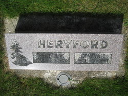
| Burial | : | Yale Memorial Cemetery, Ariel, Cowlitz County, USA |
| Coordinate | : | 45.9580727, -122.5778961 |
| Description | : | Frank was raised in the Andrew County area of Missouri. Between 1890 and 1900, the family immigrated the Oregon trail to Oregon and then on to Cowlitz Washington State in 1900. Ervin and father were loggers in the St Helens area of Washington. While at a logging camp in 1902, Ervin lost his mother in the Yacolt burn forest fire. In 1907 Ervin meets Mary Murray at a logging camp and they are married. United States Census 1910 Name: Ervin F Graves Titles and Terms: Event Type: Census Event Year: 1910 Event Place: Mineral, Cowlitz, Washington, United States District: 92 Gender: Male Age: 26 Marital Status: Married Race: White Race (Original):... Read More |
frequently asked questions (FAQ):
-
Where is Ervin Frank Graves's memorial?
Ervin Frank Graves's memorial is located at: Yale Memorial Cemetery, Ariel, Cowlitz County, USA.
-
When did Ervin Frank Graves death?
Ervin Frank Graves death on 1927 in
-
Where are the coordinates of the Ervin Frank Graves's memorial?
Latitude: 45.9580727
Longitude: -122.5778961
Family Members:
Parent

Spouse
Siblings
Flowers:


Nearby Cemetories:
1. Yale Memorial Cemetery
Ariel, Cowlitz County, USA
Coordinate: 45.9580727, -122.5778961
2. Frank Abel Cemetery
Woodland, Cowlitz County, USA
Coordinate: 45.9393700, -122.6353550
3. Mountain View Cemetery
La Center, Clark County, USA
Coordinate: 45.9025002, -122.5513000
4. Lone Pine Cemetery
Ariel, Cowlitz County, USA
Coordinate: 45.9989014, -122.5028000
5. Highland Cemetery
La Center, Clark County, USA
Coordinate: 45.9056015, -122.6371994
6. Hayes Cemetery
Hayes, Clark County, USA
Coordinate: 45.9317017, -122.6781006
7. Amboy Cemetery
Amboy, Clark County, USA
Coordinate: 45.9276009, -122.4620972
8. Mount Zion Cemetery
La Center, Clark County, USA
Coordinate: 45.8667984, -122.6548004
9. Red Rock Cemetery
Clark County, USA
Coordinate: 45.9173000, -122.7219000
10. Voight Family Cemetery
Kalama, Cowlitz County, USA
Coordinate: 46.0340960, -122.6981890
11. Odd Fellows Cemetery
Woodland, Cowlitz County, USA
Coordinate: 45.9182900, -122.7433900
12. John Pollock Gravesite
La Center, Clark County, USA
Coordinate: 45.8551559, -122.6723022
13. Chelatchie Cemetery
Amboy, Clark County, USA
Coordinate: 45.9318810, -122.3790970
14. Pioneer Cemetery
Ridgefield, Clark County, USA
Coordinate: 45.8231010, -122.6389008
15. Lewisville Cemetery
Battle Ground, Clark County, USA
Coordinate: 45.8167000, -122.5472031
16. Saint Marys Catholic Church Cemetery
Ridgefield, Clark County, USA
Coordinate: 45.8264999, -122.6824036
17. Yacolt Cemetery
Yacolt, Clark County, USA
Coordinate: 45.8599510, -122.4026031
18. Martins Bluff Cemetery
Cowlitz County, USA
Coordinate: 45.9610340, -122.8035450
19. Sacred Heart Catholic Cemetery
Battle Ground, Clark County, USA
Coordinate: 45.8019470, -122.5370190
20. Kinder Cemetery
Deer Island, Columbia County, USA
Coordinate: 45.9138985, -122.8236008
21. Crawford Cemetery
Battle Ground, Clark County, USA
Coordinate: 45.7992000, -122.4665000
22. Ridgefield Cemetery
Ridgefield, Clark County, USA
Coordinate: 45.8125992, -122.7360992
23. Bethel Evangelical Methodist Church Cemetery
Ridgefield, Clark County, USA
Coordinate: 45.7935000, -122.6935000
24. Masonic Cemetery
Saint Helens, Columbia County, USA
Coordinate: 45.8777888, -122.8196074