| Birth | : | 18 Dec 1863 Minnesota, USA |
| Death | : | 20 Jun 1934 Granger, Yakima County, Washington, USA |
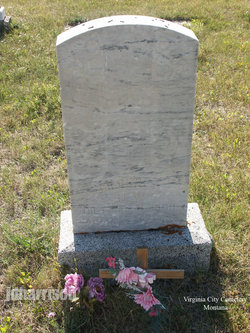
| Burial | : | Prosser Pioneer Cemetery, Prosser, Benton County, USA |
| Coordinate | : | 46.1947937, -119.8095245 |
| Description | : | 1910 United States Federal Census Record Name: Estella D Willer [Estella D Miller] Age in 1910: 46 Estimated Birth Year: abt 1864 BirthPlace: Minnesota Relation to Head of House: Wife Father's Birth Place: New York Mother's Birth Place: New York Spouses's Name: Santford Home in 1910: East Prosser, Benton, Washington Marital Status: Married Race: White Gender: Female Wife of Santford Miller. ∼Daughter of Richard Allen Rew and Henrietta M Smith,married 1st to Lawrence C Lee in 1882--4 children and to Sanford Miller in 1907. To Washington about 1878 from Blue Earth County,Minnesota. |
frequently asked questions (FAQ):
-
Where is Estella Lee “Stella” Rew Miller's memorial?
Estella Lee “Stella” Rew Miller's memorial is located at: Prosser Pioneer Cemetery, Prosser, Benton County, USA.
-
When did Estella Lee “Stella” Rew Miller death?
Estella Lee “Stella” Rew Miller death on 20 Jun 1934 in Granger, Yakima County, Washington, USA
-
Where are the coordinates of the Estella Lee “Stella” Rew Miller's memorial?
Latitude: 46.1947937
Longitude: -119.8095245
Family Members:
Parent
Spouse
Siblings
Children
Flowers:
Nearby Cemetories:
1. Prosser Pioneer Cemetery
Prosser, Benton County, USA
Coordinate: 46.1947937, -119.8095245
2. Prosser Cemetery
Prosser, Benton County, USA
Coordinate: 46.2047539, -119.7541504
3. Grandview Cemetery
Grandview, Yakima County, USA
Coordinate: 46.2658005, -119.8902969
4. Mabton Cemetery
Mabton, Yakima County, USA
Coordinate: 46.2285995, -119.9852982
5. Holy Trinity Episcopal Close
Sunnyside, Yakima County, USA
Coordinate: 46.3235000, -120.0158500
6. Lower Valley Memorial Gardens
Sunnyside, Yakima County, USA
Coordinate: 46.3450012, -120.0117035
7. Outlook Cemetery
Yakima, Yakima County, USA
Coordinate: 46.3208008, -120.0811005
8. Glade Cemetery
Yakima County, USA
Coordinate: 46.0778008, -120.0914001
9. Horse Heaven Hills Cemetery
Benton County, USA
Coordinate: 46.1551018, -119.4826736
10. Evergreen Cemetery
Benton City, Benton County, USA
Coordinate: 46.2867012, -119.4938965
11. Paterson Memorial Cemetery
Paterson, Benton County, USA
Coordinate: 45.9437943, -119.5705566
12. Smohalla Cemetery
Toppenish, Yakima County, USA
Coordinate: 46.3009660, -120.2186250
13. Black Rock Cemetery
Moxee City, Yakima County, USA
Coordinate: 46.5111084, -119.9985962
14. Beaver Cemetery
Yakima County, USA
Coordinate: 46.0993996, -120.2866974
15. Sixprong Cemetery
Sixprong, Klickitat County, USA
Coordinate: 45.8810997, -120.0224991
16. Riverview Cemetery
Boardman, Morrow County, USA
Coordinate: 45.8493996, -119.6939011
17. Sunset Memorial Gardens
Richland, Benton County, USA
Coordinate: 46.2825127, -119.3098602
18. Pine Creek Cemetery
Roosevelt, Klickitat County, USA
Coordinate: 45.8373400, -119.9295600
19. McCoy Cemetery
Toppenish, Yakima County, USA
Coordinate: 46.3835983, -120.2755966
20. Zillah German Baptist Cemetery
Zillah, Yakima County, USA
Coordinate: 46.4128550, -120.2506400
21. All Saints Episcopal Church Memorial Garden
Richland, Benton County, USA
Coordinate: 46.2875000, -119.2824000
22. Resthaven Cemetery
Richland, Benton County, USA
Coordinate: 46.2861023, -119.2804413
23. Desert Lawn Memorial Cemetery
Irrigon, Morrow County, USA
Coordinate: 45.8972015, -119.4721985
24. Methodist Cemetery
Bickleton, Klickitat County, USA
Coordinate: 46.0041161, -120.2838135


