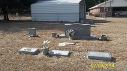
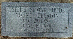
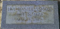
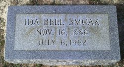
Estelle Isabell Fields Young Smoak Gleaton
| Birth | : | 25 Dec 1920 Orangeburg, Orangeburg County, South Carolina, USA |
| Death | : | 19 Jun 1989 Lexington, Lexington County, South Carolina, USA |
| Burial | : | Anderson District Cemetery, Anderson, Shasta County, USA |
| Coordinate | : | 40.4419518, -122.2967300 |
| Description | : | Estelle Smoak Fields Young Gleaton Obituary in The Times and Democrat, Orangeburg, SC, 20 Jun 1999: Mrs. Estelle Fields Young Gleaon, 68, of Route 2, Box 340, Orangeburg, died Monday at Manor Care Nursing Home in Lexington. The funeral will be held at 11 a.m. Wednesday at Double Branch Baptist Church near Neeses, with the Rev. Paul Reid and the Rev. Bryan Fogle officiating. Burial will be in the church cemetery. The casket will be placed in the church at 10 a.m. Pallbearers will be James C. Young, Jr., Johnny Fields, Robert Fields, Donnie Bozard and Mitchell Davidson. Mrs. Gleaton... Read More |
frequently asked questions (FAQ):
-
Where is Estelle Isabell Fields Young Smoak Gleaton's memorial?
Estelle Isabell Fields Young Smoak Gleaton's memorial is located at: Anderson District Cemetery, Anderson, Shasta County, USA.
-
When did Estelle Isabell Fields Young Smoak Gleaton death?
Estelle Isabell Fields Young Smoak Gleaton death on 19 Jun 1989 in Lexington, Lexington County, South Carolina, USA
-
Where are the coordinates of the Estelle Isabell Fields Young Smoak Gleaton's memorial?
Latitude: 40.4419518
Longitude: -122.2967300
Family Members:
Parent
Spouse
Siblings
Children
Flowers:
Nearby Cemetories:
1. Anderson District Cemetery
Anderson, Shasta County, USA
Coordinate: 40.4419518, -122.2967300
2. Oddfellows Cemetery
Anderson, Shasta County, USA
Coordinate: 40.4431590, -122.2907070
3. Anderson Pioneer Cemetery
Anderson, Shasta County, USA
Coordinate: 40.4439011, -122.2904968
4. Sleepy Hollow Pet Cemetery
Anderson, Shasta County, USA
Coordinate: 40.4199430, -122.2858410
5. Cottonwood Cemetery
Cottonwood, Shasta County, USA
Coordinate: 40.3856100, -122.2936500
6. Cottonwood Creek Ranch Cemetery
Cottonwood, Shasta County, USA
Coordinate: 40.3663100, -122.2598800
7. Major Pierson B Reading Family Cemetery
Cottonwood, Shasta County, USA
Coordinate: 40.3924300, -122.2126900
8. Parkville Cemetery
Anderson, Shasta County, USA
Coordinate: 40.4640200, -122.1897500
9. Haggard Family Ranch Cemetery
Palo Cedro, Shasta County, USA
Coordinate: 40.5105600, -122.2227800
10. Bates Pioneer Cemetery
Shasta County, USA
Coordinate: 40.5348816, -122.2968674
11. Happy Valley Cemetery
Redding, Shasta County, USA
Coordinate: 40.4668999, -122.4535980
12. Shasta General Hospital Cemetery
Redding, Shasta County, USA
Coordinate: 40.5509200, -122.3841800
13. Shasta General Hospital Cemetery
Redding, Shasta County, USA
Coordinate: 40.5516000, -122.3894000
14. Lawncrest Memorial Park
Redding, Shasta County, USA
Coordinate: 40.5732994, -122.3432999
15. Texas Springs Cemetery
Redding, Shasta County, USA
Coordinate: 40.5116844, -122.4516144
16. Millville Masonic Cemetery
Millville, Shasta County, USA
Coordinate: 40.5555000, -122.1842804
17. Beck Cemetery
Shasta County, USA
Coordinate: 40.5487400, -122.1720900
18. Millville IOOF Cemetery
Millville, Shasta County, USA
Coordinate: 40.5539017, -122.1663971
19. Old Saint Joseph Cemetery
Redding, Shasta County, USA
Coordinate: 40.5781326, -122.3912811
20. Inks Creek Cemetery
Tehama County, USA
Coordinate: 40.3419800, -122.1297100
21. Redding Memorial Park
Redding, Shasta County, USA
Coordinate: 40.5894814, -122.3872833
22. Middletown Cemetery
Redding, Shasta County, USA
Coordinate: 40.5392800, -122.4748700
23. Barbara Glass Gravesite
Shasta County, USA
Coordinate: 40.5067600, -122.5049700
24. Saint Joseph Cemetery
Redding, Shasta County, USA
Coordinate: 40.5824509, -122.4310989

