Esther Green Schneider
| Birth | : | 18 Jul 1912 Walla Walla, Walla Walla County, Washington, USA |
| Death | : | 4 Aug 1967 Helena, Lewis and Clark County, Montana, USA |
| Burial | : | East View Cemetery, Salem, Salem County, USA |
| Coordinate | : | 39.5627480, -75.4561081 |
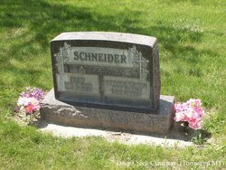
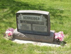
| Description | : | Townsend Woman Dies in Helena; Services Tuesday Funeral services will be conducted at 2 p.m. , Tuesday from Connor's Mortuary in Townsend for Esther Schneider, 55, who died Friday at St. John's Hospital following an extended illness. The Rev. Frank Grant of the Townsend Methodist Church will officiate. Interment will be in the Deep Creek Cemetery near that community. Mrs. Schneider was born July 18, 1912 in Walla Walla, Wash., the daughter of Louis and Amelia Sterkel Green. She was married Nov. 8, 1938, to Fred Schneider, who proceded her in death March 17, 1967. She was... Read More |
frequently asked questions (FAQ):
-
Where is Esther Green Schneider's memorial?
Esther Green Schneider's memorial is located at: East View Cemetery, Salem, Salem County, USA.
-
When did Esther Green Schneider death?
Esther Green Schneider death on 4 Aug 1967 in Helena, Lewis and Clark County, Montana, USA
-
Where are the coordinates of the Esther Green Schneider's memorial?
Latitude: 39.5627480
Longitude: -75.4561081
Family Members:
Parent
Spouse
Siblings
Children
Flowers:
Nearby Cemetories:
1. East View Cemetery
Salem, Salem County, USA
Coordinate: 39.5627480, -75.4561081
2. Baptist Cemetery
Salem, Salem County, USA
Coordinate: 39.5621681, -75.4611053
3. Mount Hope United Methodist Church Cemetery
Salem, Salem County, USA
Coordinate: 39.5660667, -75.4606781
4. Saint Mary's Roman Catholic Cemetery
Salem, Salem County, USA
Coordinate: 39.5637856, -75.4684753
5. First United Methodist Church Cemetery
Salem, Salem County, USA
Coordinate: 39.5695496, -75.4670868
6. Mount Pisgah AME Cemetery
Salem County, USA
Coordinate: 39.5549700, -75.4663900
7. Evergreen Cemetery
Salem, Salem County, USA
Coordinate: 39.5540000, -75.4652000
8. First Presbyterian Cemetery
Salem, Salem County, USA
Coordinate: 39.5736351, -75.4648819
9. Saint John's Episcopal Churchyard
Salem, Salem County, USA
Coordinate: 39.5744705, -75.4655151
10. Salem Friends Burial Ground
Salem, Salem County, USA
Coordinate: 39.5732307, -75.4705963
11. Mill Hollow Cemetery
Quinton, Salem County, USA
Coordinate: 39.5563120, -75.4305770
12. Alloway Creek Old Quaker Burial Ground
Lower Alloways Creek Township, Salem County, USA
Coordinate: 39.5202900, -75.4597000
13. Hancocks Bridge United Methodist Church Cemetery
Harmersville, Salem County, USA
Coordinate: 39.5023537, -75.4411850
14. Cedar Hill Friends Cemetery
Harmersville, Salem County, USA
Coordinate: 39.5014720, -75.4387800
15. Alloway Baptist Church Cemetery
Alloway, Salem County, USA
Coordinate: 39.5606308, -75.3655090
16. Battle of Quintons Bridge Graveyard
Quinton, Salem County, USA
Coordinate: 39.5130650, -75.3884040
17. Dunham Family Cemetery
Pennsville, Salem County, USA
Coordinate: 39.6138890, -75.5268330
18. Alloway United Methodist Church Cemetery
Alloway, Salem County, USA
Coordinate: 39.5623207, -75.3586273
19. Little Bethel A.M.E Church Cemetery
Marshalltown, Salem County, USA
Coordinate: 39.6381190, -75.4537830
20. Berrys Chapel Cemetery
Quinton, Salem County, USA
Coordinate: 39.5137900, -75.3779510
21. Old Alloway Cemetery
Alloway, Salem County, USA
Coordinate: 39.5619545, -75.3549957
22. Mount Zion AUMP Church Cemetery
Marshalltown, Salem County, USA
Coordinate: 39.6410060, -75.4554070
23. Lower Penns Neck Methodist Episcopal Cemetery
Pennsville, Salem County, USA
Coordinate: 39.6383120, -75.5164490
24. Canton Baptist Church Cemetery
Canton, Salem County, USA
Coordinate: 39.4799385, -75.4120789

