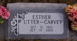
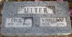
Esther Margeline Utter Carvey
| Birth | : | 31 Oct 1923 Lincoln County, Montana, USA |
| Death | : | 19 Oct 2003 Kalispell, Flathead County, Montana, USA |
| Burial | : | West Lawn Cemetery, Winesburg, Holmes County, USA |
| Coordinate | : | 40.6119003, -81.7014008 |
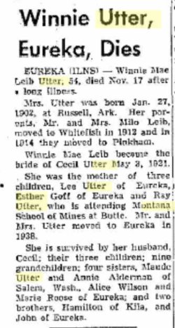
| Description | : | 1st Husband was Floyd Rutherford Goff (1913-2002) married on 9 Sep 1939 in Coeur d"Alene, Kootenai, Idaho, USA Esther Carvey EUREKA - Esther Carvey, 75, died Sunday, Oct. 19, 2003, at Kalispell Regional Medical Center of injuries received in a vehicle-pedestrian accident on Oct. 15 in Eureka. She was born Oct. 31, 1923, on Pinkham Creek near Eureka. Survivors include her children, Louise Goff and Dan Goff of Eureka and Floyd Goff of Missouri; brothers, Lee Utter of Eureka and Robert Ray Utter of Alaska; eight grandchildren; four great-grandchildren; and two great-great-grandchildren. Services will be... Read More |
frequently asked questions (FAQ):
-
Where is Esther Margeline Utter Carvey's memorial?
Esther Margeline Utter Carvey's memorial is located at: West Lawn Cemetery, Winesburg, Holmes County, USA.
-
When did Esther Margeline Utter Carvey death?
Esther Margeline Utter Carvey death on 19 Oct 2003 in Kalispell, Flathead County, Montana, USA
-
Where are the coordinates of the Esther Margeline Utter Carvey's memorial?
Latitude: 40.6119003
Longitude: -81.7014008
Family Members:
Parent
Spouse
Siblings
Flowers:
Nearby Cemetories:
1. West Lawn Cemetery
Winesburg, Holmes County, USA
Coordinate: 40.6119003, -81.7014008
2. Old Winesburg Cemetery
Winesburg, Holmes County, USA
Coordinate: 40.6160480, -81.6930160
3. Schenkelberg Cemetery
Winesburg, Holmes County, USA
Coordinate: 40.6295430, -81.7068100
4. Abe Yoder Farm Cemetery
Winesburg, Holmes County, USA
Coordinate: 40.6110140, -81.7253840
5. Kolb Cemetery
Trail, Holmes County, USA
Coordinate: 40.5917203, -81.6795681
6. Longenecker Mennonite Cemetery
Winesburg, Holmes County, USA
Coordinate: 40.6383930, -81.6948510
7. Yutzy Cemetery
Winesburg, Holmes County, USA
Coordinate: 40.6108017, -81.7371979
8. Milo Yoder Farm Cemetery
Winesburg, Holmes County, USA
Coordinate: 40.6130900, -81.7377900
9. Miller Cemetery
Winesburg, Holmes County, USA
Coordinate: 40.6116982, -81.7414017
10. Enos Weaver Farm Cemetery
Trail, Holmes County, USA
Coordinate: 40.5907860, -81.7301870
11. Moses J Miller Farm Cemetery
Trail, Holmes County, USA
Coordinate: 40.5907850, -81.7302040
12. Pleasant View Mennonite Church Cemetery
Berlin, Holmes County, USA
Coordinate: 40.6026470, -81.7419720
13. Holmes Land Company Farm Cemetery
Trail, Holmes County, USA
Coordinate: 40.5785920, -81.6924510
14. Trail Swiss Church Cemetery
Winesburg, Holmes County, USA
Coordinate: 40.5775530, -81.7078440
15. Yoder Clutch Cemetery
Walnut Creek, Holmes County, USA
Coordinate: 40.5778400, -81.7137880
16. Abe Hershberger Farm Cemetery
Dundee, Tuscarawas County, USA
Coordinate: 40.6299380, -81.6611130
17. Orin Yoder Farm Cemetery
Dundee, Tuscarawas County, USA
Coordinate: 40.6059470, -81.6539030
18. Gospel Light Chapel Cemetery
Holmes County, USA
Coordinate: 40.5774540, -81.7178520
19. Jonas Schrock Farm Cemetery
Trail, Holmes County, USA
Coordinate: 40.5774900, -81.7281670
20. Jonas D Miller Farm Cemetery
Trail, Holmes County, USA
Coordinate: 40.5734380, -81.7182770
21. Monroe A. Miller Farm Cemetery
Bunker Hill, Holmes County, USA
Coordinate: 40.5889960, -81.7470390
22. Emanuel Mullet Farm Cemetery
Trail, Holmes County, USA
Coordinate: 40.5850750, -81.7449220
23. Beidler Cemetery
Paint Township, Holmes County, USA
Coordinate: 40.6472015, -81.6699982
24. Alvin Wengerd and Orie Miller Farms Cemetery
Trail, Holmes County, USA
Coordinate: 40.5700660, -81.7127410

