
| Birth | : | 30 Jun 1758 Norwich, New London County, Connecticut, USA |
| Death | : | 22 Aug 1825 Windham, Windham County, Connecticut, USA |
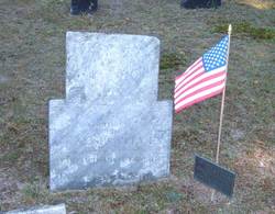
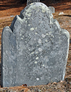
| Burial | : | Brinson Cemetery, Brinson, Decatur County, USA |
| Coordinate | : | 30.9699500, -84.7323330 |
| Description | : | Esther was the second wife of Zacheus Waldo. They married on April 12, 1781 and had eight children. |
frequently asked questions (FAQ):
-
Where is Esther Stevens Waldo's memorial?
Esther Stevens Waldo's memorial is located at: Brinson Cemetery, Brinson, Decatur County, USA.
-
When did Esther Stevens Waldo death?
Esther Stevens Waldo death on 22 Aug 1825 in Windham, Windham County, Connecticut, USA
-
Where are the coordinates of the Esther Stevens Waldo's memorial?
Latitude: 30.9699500
Longitude: -84.7323330
Family Members:
Parent
Spouse

Siblings
Children
Flowers:


Nearby Cemetories:
1. Brinson Cemetery
Brinson, Decatur County, USA
Coordinate: 30.9699500, -84.7323330
2. Jackson Cemetery
Brinson, Decatur County, USA
Coordinate: 30.9703007, -84.7406006
3. Swanswall Baptist Church Cemetery
Brinson, Decatur County, USA
Coordinate: 30.9697300, -84.7122100
4. Pine Grove Baptist Church Cemetery
Brinson, Decatur County, USA
Coordinate: 31.0269430, -84.7118400
5. Bethel Baptist Church Cemetery
Bainbridge, Decatur County, USA
Coordinate: 30.9785860, -84.6604970
6. Lane Cemetery
Decatur County, USA
Coordinate: 31.0408001, -84.7142029
7. Thompson Cemetery
Decatur County, USA
Coordinate: 30.9575005, -84.6489029
8. Nazarene Church Cemetery
Eldorendo, Decatur County, USA
Coordinate: 31.0266200, -84.6433100
9. Mount Olive Baptist Church Cemetery
Bainbridge, Decatur County, USA
Coordinate: 30.8962100, -84.6602800
10. Hornsby Cemetery
Miller County, USA
Coordinate: 31.0727997, -84.7391968
11. Eldorendo Baptist Church Cemetery
Decatur County, USA
Coordinate: 31.0451670, -84.6487890
12. Mount Zion Baptist Church Cemetery
Bainbridge, Decatur County, USA
Coordinate: 30.9843370, -84.6116680
13. Mount Gilead Freewill Baptist Church Cemetery
Decatur County, USA
Coordinate: 30.8667240, -84.7130120
14. Fellowship Baptist Church Cemetery
Bainbridge, Decatur County, USA
Coordinate: 30.8663070, -84.7072160
15. King Cloud Cemetery
Decatur County, USA
Coordinate: 30.8656500, -84.7559600
16. Calvary Assembly of God Church Cemetery
Brinson, Decatur County, USA
Coordinate: 30.8662230, -84.7674660
17. Pilgrims Rest Church Cemetery
Colquitt, Miller County, USA
Coordinate: 31.0788994, -84.7136002
18. Whites Bridge Cemetery
Miller County, USA
Coordinate: 31.0794400, -84.7133000
19. Bethany Baptist Church Cemetery
Brinson, Decatur County, USA
Coordinate: 30.8581470, -84.7248230
20. Breedlove Cemetery
Decatur County, USA
Coordinate: 30.8708000, -84.6703033
21. Mount Olive Missionary Baptist Church Cemetery
Decatur County, USA
Coordinate: 30.9008780, -84.6128330
22. Scarborough Cemetery
Colquitt, Miller County, USA
Coordinate: 31.0938200, -84.7327400
23. Mothers Home Baptist Church Cemetery
Miller County, USA
Coordinate: 31.0916996, -84.7011032
24. Mock Cemetery
Decatur County, USA
Coordinate: 30.8458004, -84.7146988