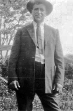
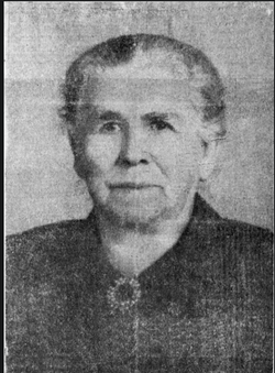
Estil Lee Edwards
| Birth | : | 8 Apr 1873 Pipers Gap, Carroll County, Virginia, USA |
| Death | : | 5 May 1931 Pipers Gap, Carroll County, Virginia, USA |
| Burial | : | Greenwood Cemetery, Glenville, Freeborn County, USA |
| Coordinate | : | 43.5727997, -93.2675018 |
| Description | : | Farmer, single info from death cert https://www.ancestry.com/interactive/9278/43004_162028006056_0039-00197/374598?backurl=https://www.ancestry.com/family-tree/person/tree/17277078/person/28116083476/facts/citation/740108350634/edit/record#?imageId=43004_162028006056_0039-00507 |
frequently asked questions (FAQ):
-
Where is Estil Lee Edwards's memorial?
Estil Lee Edwards's memorial is located at: Greenwood Cemetery, Glenville, Freeborn County, USA.
-
When did Estil Lee Edwards death?
Estil Lee Edwards death on 5 May 1931 in Pipers Gap, Carroll County, Virginia, USA
-
Where are the coordinates of the Estil Lee Edwards's memorial?
Latitude: 43.5727997
Longitude: -93.2675018
Family Members:
Parent
Siblings
Flowers:
Nearby Cemetories:
1. Greenwood Cemetery
Glenville, Freeborn County, USA
Coordinate: 43.5727997, -93.2675018
2. Glenville First Lutheran Cemetery
Glenville, Freeborn County, USA
Coordinate: 43.6002808, -93.3088913
3. Hillcrest Cemetery
Albert Lea, Freeborn County, USA
Coordinate: 43.6100006, -93.3343964
4. Green Cemetery
Twin Lakes, Freeborn County, USA
Coordinate: 43.5758743, -93.3619156
5. Round Prairie Cemetery
Glenville, Freeborn County, USA
Coordinate: 43.5411987, -93.3529968
6. Our Saviors Danish Lutheran Cemetery
Myrtle, Freeborn County, USA
Coordinate: 43.5580400, -93.1697300
7. Wanderers Rest Cemetery
Gordonsville, Freeborn County, USA
Coordinate: 43.5133286, -93.2094421
8. Pilgrims Rest Cemetery
Myrtle, Freeborn County, USA
Coordinate: 43.5430603, -93.1750031
9. North Round Prairie Cemetery
Glenville, Freeborn County, USA
Coordinate: 43.5531006, -93.3649979
10. Hayward Cemetery
Hayward, Freeborn County, USA
Coordinate: 43.6445618, -93.2436066
11. Bohemian National Cemetery
Myrtle, Freeborn County, USA
Coordinate: 43.6152992, -93.1691971
12. Kestner Cemetery
Myrtle, Freeborn County, USA
Coordinate: 43.6083298, -93.1583328
13. Stateline Cemetery
Northwood, Worth County, USA
Coordinate: 43.4874992, -93.2416992
14. Lunder Lutheran Cemetery
Twin Lakes, Freeborn County, USA
Coordinate: 43.5750008, -93.3977814
15. Mockingbird Hill Cemetery (Defunct)
Myrtle, Freeborn County, USA
Coordinate: 43.5574989, -93.1299973
16. Towne Cemetery
Northwood, Worth County, USA
Coordinate: 43.4805000, -93.3502000
17. Lakewood Cemetery
Albert Lea, Freeborn County, USA
Coordinate: 43.6591682, -93.3694382
18. Kennevan Family Cemetery
Myrtle, Freeborn County, USA
Coordinate: 43.6166687, -93.1208267
19. Saint James Cemetery
Twin Lakes, Freeborn County, USA
Coordinate: 43.5346985, -93.4178009
20. Saint Theodores Cemetery
Albert Lea, Freeborn County, USA
Coordinate: 43.6611099, -93.3705597
21. North Shell Rock Cemetery
Northwood, Worth County, USA
Coordinate: 43.4566994, -93.2600021
22. Graceland Cemetery
Albert Lea, Freeborn County, USA
Coordinate: 43.6491699, -93.3930588
23. Oakland Lutheran and Trondhjem Cemetery
Oakland, Freeborn County, USA
Coordinate: 43.6733284, -93.1683273
24. Hillcrest Cemetery
Oakland, Freeborn County, USA
Coordinate: 43.6669388, -93.1569366

