


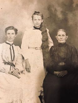
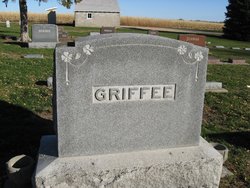
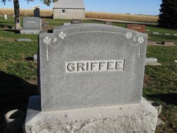
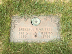
Ethel Amanda Parker Griffee
| Birth | : | 9 Jan 1847 |
| Death | : | Dec 1929 |
| Burial | : | Kelvin United Cemetery, Kelvin, Norfolk County, Canada |
| Coordinate | : | 42.9974900, -80.4591900 |
| Description | : | Mrs. Ethel Parker Griffee whose title and stamp of royalty among her friends was "Grandma Griffee" She was born in Cold Brook,Township, Warren County Ill. January 12, 1817 and died at Lodge Pole Nebraska December 9, 1929, reaching the exceptional age of 82 years, 10 months and 27 days. |
frequently asked questions (FAQ):
-
Where is Ethel Amanda Parker Griffee's memorial?
Ethel Amanda Parker Griffee's memorial is located at: Kelvin United Cemetery, Kelvin, Norfolk County, Canada.
-
When did Ethel Amanda Parker Griffee death?
Ethel Amanda Parker Griffee death on Dec 1929 in
-
Where are the coordinates of the Ethel Amanda Parker Griffee's memorial?
Latitude: 42.9974900
Longitude: -80.4591900
Family Members:
Spouse
Children
Flowers:


Nearby Cemetories:
1. Kelvin United Cemetery
Kelvin, Norfolk County, Canada
Coordinate: 42.9974900, -80.4591900
2. Kelvin Cemetery
Burford, Brant County Municipality, Canada
Coordinate: 43.0005280, -80.4587240
3. Hill Free Methodist Cemetery
Burford, Brant County Municipality, Canada
Coordinate: 43.0044851, -80.4600627
4. Northfield Cemetery
Northfield, Brant County Municipality, Canada
Coordinate: 43.0303600, -80.4847900
5. Miller-Boomer Cemetery
Teeterville, Norfolk County, Canada
Coordinate: 42.9529660, -80.4309030
6. Zion United Cemetery
Vanessa, Norfolk County, Canada
Coordinate: 42.9959500, -80.3873700
7. Teeterville Cemetery
Teeterville, Norfolk County, Canada
Coordinate: 42.9451400, -80.4458000
8. Vanessa Cemetery
Vanessa, Norfolk County, Canada
Coordinate: 42.9689400, -80.3943500
9. Hatchley Cemetery
Hatchley, Brant County Municipality, Canada
Coordinate: 43.0247000, -80.5253000
10. Bookton Cemetery
Bookton, Norfolk County, Canada
Coordinate: 42.9458700, -80.5059800
11. Fairfield Plains United Church Cemetery
Fairfield Plain, Brant County Municipality, Canada
Coordinate: 43.0549170, -80.4102170
12. Scotland Cemetery
Scotland, Brant County Municipality, Canada
Coordinate: 43.0294820, -80.3756580
13. Norwich Gore Cemetery
Norwich, Oxford County Municipality, Canada
Coordinate: 42.9999400, -80.5564000
14. Harley Cemetery
Harley, Brant County Municipality, Canada
Coordinate: 43.0695000, -80.4750214
15. White Cemetery
Harley, Brant County Municipality, Canada
Coordinate: 43.0494000, -80.5377000
16. Dutcher Cemetery
Brant County Municipality, Canada
Coordinate: 43.0772000, -80.4336000
17. Windham Centre Cemetery
Windham Centre, Norfolk County, Canada
Coordinate: 42.9131300, -80.4328800
18. New Durham Cemetery
Oxford County Municipality, Canada
Coordinate: 43.0418091, -80.5674210
19. Oakland Pioneer Cemetery
Oakland, Brant County Municipality, Canada
Coordinate: 43.0315514, -80.3313446
20. Our Lady of LaSalette Roman Catholic Cemetery
La Salette, Norfolk County, Canada
Coordinate: 42.9012500, -80.5037900
21. Sovereign Cemetery
Round Plains, Norfolk County, Canada
Coordinate: 42.9441400, -80.3406900
22. Wilsonville Cemetery
Wilsonville, Norfolk County, Canada
Coordinate: 42.9952090, -80.3196790
23. Oakland Cemetery
Oakland, Brant County Municipality, Canada
Coordinate: 43.0324707, -80.3261032
24. Burford Pioneer Cemetery
Burford, Brant County Municipality, Canada
Coordinate: 43.1019800, -80.4361200