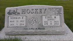
Ethel Mildred “Tootie” Downs Hoskey
| Birth | : | 9 Aug 1923 Montour, Tama County, Iowa, USA |
| Death | : | 19 Apr 2012 Marshalltown, Marshall County, Iowa, USA |
| Burial | : | Maple Hill Cemetery, Montour, Tama County, USA |
| Coordinate | : | 41.9756012, -92.7069016 |
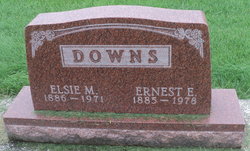
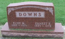
| Description | : | Ethel Mildred Downs Hoskey (affectionately known as "Tootie") of Chelsea, IA, was born August 9, 1923, in a farm home north of Montour, IA. She was the daughter of Ernie and Elsie (Dumbauld) Downs of Montour. She passed away on Thursday, April 19, 2012, at the age of 88, at the Marshalltown Medical Center in Marshalltown, IA. She grew up in Montour, attended rural and Montour elementary schools, and graduated from Montour High School in 1940. Ethel married Norman Hoskey, her husband of 70½ years, in Edina, Missouri, on November 15, 1941. She was employed as the telephone operator in... Read More |
frequently asked questions (FAQ):
-
Where is Ethel Mildred “Tootie” Downs Hoskey's memorial?
Ethel Mildred “Tootie” Downs Hoskey's memorial is located at: Maple Hill Cemetery, Montour, Tama County, USA.
-
When did Ethel Mildred “Tootie” Downs Hoskey death?
Ethel Mildred “Tootie” Downs Hoskey death on 19 Apr 2012 in Marshalltown, Marshall County, Iowa, USA
-
Where are the coordinates of the Ethel Mildred “Tootie” Downs Hoskey's memorial?
Latitude: 41.9756012
Longitude: -92.7069016
Family Members:
Parent
Spouse
Siblings
Flowers:
Nearby Cemetories:
1. Maple Hill Cemetery
Montour, Tama County, USA
Coordinate: 41.9756012, -92.7069016
2. Rouse Cemetery
Montour, Tama County, USA
Coordinate: 41.9967003, -92.6875000
3. Butlerville Cemetery
Tama, Tama County, USA
Coordinate: 41.9973000, -92.7300000
4. McIntosh Cemetery
Tama, Tama County, USA
Coordinate: 41.9868890, -92.6453060
5. West Cemetery
Tama County, USA
Coordinate: 41.9749985, -92.6306000
6. Stavanger Friends Cemetery
Le Grand, Marshall County, USA
Coordinate: 41.9673500, -92.7858000
7. Meskwaki Cemetery
Tama, Tama County, USA
Coordinate: 41.9730988, -92.6256027
8. Strand Lutheran Cemetery
Dunbar, Marshall County, USA
Coordinate: 41.9420433, -92.7793467
9. Friends Cemetery
Le Grand, Marshall County, USA
Coordinate: 42.0062000, -92.7856000
10. Turner Cemetery
Garwin, Tama County, USA
Coordinate: 42.0355988, -92.6691971
11. Pleasant Hill Cemetery
Le Grand, Marshall County, USA
Coordinate: 42.0210991, -92.7758026
12. Croskrey Cemetery
Tama, Tama County, USA
Coordinate: 41.9401000, -92.6242500
13. Mattingly Cemetery
Garwin, Tama County, USA
Coordinate: 42.0527000, -92.6984000
14. Dobson Cemetery
Garwin, Tama County, USA
Coordinate: 42.0527344, -92.7479553
15. Dodson Cemetery
Tama County, USA
Coordinate: 42.0527992, -92.7478027
16. Korns Cemetery
Tama County, USA
Coordinate: 41.8918991, -92.6941986
17. Trinity Lutheran Cemetery
Dillon, Marshall County, USA
Coordinate: 41.9650002, -92.8227997
18. Saint Patricks Cemetery
Tama, Tama County, USA
Coordinate: 41.9789009, -92.5757980
19. Woodlawn Cemetery
Toledo, Tama County, USA
Coordinate: 41.9866982, -92.5699997
20. Maple Grove Cemetery
Tama, Tama County, USA
Coordinate: 41.8913994, -92.6268997
21. Bowles Cemetery
Green Mountain, Marshall County, USA
Coordinate: 42.0493147, -92.8053903
22. Rock Creek Cemetery
Tama County, USA
Coordinate: 42.0793991, -92.7283020
23. Rock Valley Cemetery
Le Grand, Marshall County, USA
Coordinate: 42.0078011, -92.8452988
24. Prairie View Cemetery
Gilman, Marshall County, USA
Coordinate: 41.8871710, -92.7961460


