| Birth | : | 4 Apr 1893 Frederick, Rice County, Kansas, USA |
| Death | : | 15 Oct 1977 Lyons, Rice County, Kansas, USA |
| Burial | : | Frederick Cemetery, Frederick, Rice County, USA |
| Coordinate | : | 38.5077350, -98.2484450 |
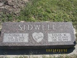
| Description | : | LYONS - Ethel N. Ogden, 84, died Saturday at Lyons District Hospital. Born Ethel Payne April 4, 1893 at Frederick she was married to Ben H. Ogden May 21, 1917 at Frederick. He died May 17, 1964. She lived here since 1947. She was a member of the United Methodist Church, Women's Club, both of Lyons. Survivors include son: Alvin C, Oak Park, Ill.; daughter: Mrs. Norma Sidwell, Lorraine; brother: William Payne, Broken Arrow, Okla.; sister: Mrs. Mable Remmert, Bushton; six grandchildren; three great-grandchildren. Funeral will be 11 a.m. Tuesday at the church, Rev. Jay Anderson. Burial will be Frederick... Read More |
frequently asked questions (FAQ):
-
Where is Ethel Naomi Payne Ogden's memorial?
Ethel Naomi Payne Ogden's memorial is located at: Frederick Cemetery, Frederick, Rice County, USA.
-
When did Ethel Naomi Payne Ogden death?
Ethel Naomi Payne Ogden death on 15 Oct 1977 in Lyons, Rice County, Kansas, USA
-
Where are the coordinates of the Ethel Naomi Payne Ogden's memorial?
Latitude: 38.5077350
Longitude: -98.2484450
Family Members:
Parent
Spouse
Siblings
Children
Flowers:
Nearby Cemetories:
1. Frederick Cemetery
Frederick, Rice County, USA
Coordinate: 38.5077350, -98.2484450
2. Geneseo Cemetery
Geneseo, Rice County, USA
Coordinate: 38.5069008, -98.1680984
3. Lorraine Cemetery
Lorraine, Ellsworth County, USA
Coordinate: 38.5508200, -98.3309800
4. Wesley Chapel Cemetery
Lyons, Rice County, USA
Coordinate: 38.4494200, -98.3308300
5. Baptist Cemetery
Lorraine, Ellsworth County, USA
Coordinate: 38.5657997, -98.3313980
6. Bushton-Farmer Township Cemetery
Bushton, Rice County, USA
Coordinate: 38.5078011, -98.3886032
7. Liscum Cemetery
Geneseo, Rice County, USA
Coordinate: 38.5144005, -98.1082993
8. Shumway Cemetery
Lyons, Rice County, USA
Coordinate: 38.3911018, -98.2356033
9. Ebenezer Church Cemetery
Rice County, USA
Coordinate: 38.3908900, -98.2759000
10. Click Cemetery
Galt, Rice County, USA
Coordinate: 38.5186800, -98.0871200
11. Salem-Friedhof Cemetery
Bushton, Rice County, USA
Coordinate: 38.4655991, -98.4056015
12. Saint Peter Lutheran Cemetery
Holyrood, Ellsworth County, USA
Coordinate: 38.5814460, -98.3879430
13. Henry Family Cemetery
Ellsworth County, USA
Coordinate: 38.6232270, -98.3389780
14. Saint Pauls United Church of Christ Cemetery
Holyrood, Ellsworth County, USA
Coordinate: 38.5840180, -98.4063880
15. Lyons Municipal Cemetery
Lyons, Rice County, USA
Coordinate: 38.3589940, -98.2020190
16. Holy Name Catholic Cemetery
Bushton, Rice County, USA
Coordinate: 38.4929400, -98.4432900
17. Cain City Cemetery
Ellsworth County, USA
Coordinate: 38.5337080, -98.4433460
18. Springdale Cemetery
Chase, Rice County, USA
Coordinate: 38.3630981, -98.3305969
19. Scates Cemetery
Ellsworth County, USA
Coordinate: 38.6194191, -98.1013031
20. Un-Named Cemetery
Lyons, Rice County, USA
Coordinate: 38.3478140, -98.2110390
21. Rice County Poor Farm Cemetery
Rice County, USA
Coordinate: 38.3449410, -98.2387280
22. Old Dunkard Cemetery
Rice County, USA
Coordinate: 38.3549200, -98.1455480
23. Saint Marys Cemetery
Chase, Rice County, USA
Coordinate: 38.3492012, -98.3507996
24. Buckeye Cemetery
Kanopolis, Ellsworth County, USA
Coordinate: 38.6514664, -98.1110001


