
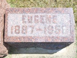
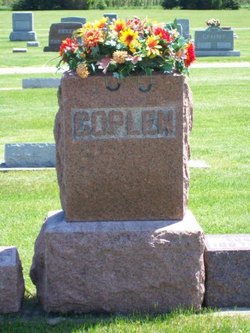
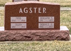
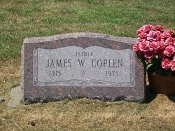
Eugene Coplen
| Birth | : | 15 Jan 1887 |
| Death | : | 20 Sep 1958 |
| Burial | : | South Gower Cemetery, South Gower, Leeds and Grenville United Counties, Canada |
| Coordinate | : | 45.0080338, -75.5640259 |
| Plot | : | Section 12, Row 4 |
| Description | : | Published in The Rochester Sentinel Monday, September 22, 1958 Eugene Coplen Eugene "Gene" COPLEN, 71, a Rochester druggist for 44 years, died at 10:30 a.m. Saturday at the South Side district hospital in Mesa, Ariz., where he had been a patient for three weeks. Mr. Coplen, who left Rochester to reside in Arizona five years ago, lived at 804 North Robson street in Mesa. He had been in ill health for six weeks, seriously the past three weeks. Death was attributed to lung cancer and heart failure. Services will be at 2 p.m. Thursday in the Zimmerman Brothers funeral home here with the Rev. Richard... Read More |
frequently asked questions (FAQ):
-
Where is Eugene Coplen's memorial?
Eugene Coplen's memorial is located at: South Gower Cemetery, South Gower, Leeds and Grenville United Counties, Canada.
-
When did Eugene Coplen death?
Eugene Coplen death on 20 Sep 1958 in
-
Where are the coordinates of the Eugene Coplen's memorial?
Latitude: 45.0080338
Longitude: -75.5640259
Family Members:
Parent

Spouse

Siblings
Children
Flowers:


Nearby Cemetories:
1. D. Guy Farm Cemetery
Brinston, Stormont, Dundas and Glengarry United Counties, Canada
Coordinate: 45.0334000, -75.4993300
2. Kemptville Public Cemetery
Kemptville, Leeds and Grenville United Counties, Canada
Coordinate: 45.0245800, -75.6447300
3. Saint James Anglican Cemetery
Kemptville, Leeds and Grenville United Counties, Canada
Coordinate: 45.0160300, -75.6489300
4. Holy Cross Cemetery
Kemptville, Leeds and Grenville United Counties, Canada
Coordinate: 45.0131000, -75.6544000
5. South Mountain Union Cemetery
South Mountain, Stormont, Dundas and Glengarry United Counties, Canada
Coordinate: 44.9785970, -75.4610540
6. Oxford Mills Anglican Cemetery
Oxford Mills, Leeds and Grenville United Counties, Canada
Coordinate: 44.9615300, -75.6732500
7. Oxford Mills Union Cemetery
Oxford Mills, Leeds and Grenville United Counties, Canada
Coordinate: 44.9619500, -75.6738300
8. Van Camp United Church Cemetery
VanCamp, Stormont, Dundas and Glengarry United Counties, Canada
Coordinate: 45.0451460, -75.4458620
9. Reid's Mills Cemetery
Osgoode, Ottawa Municipality, Canada
Coordinate: 45.1036300, -75.5520500
10. Saint Paul's Anglican Cemetery
Becketts Landing, Ottawa Municipality, Canada
Coordinate: 45.0503560, -75.6880560
11. Patterson's Corners Presbyterian Cemetery
Pattersons Corners, Leeds and Grenville United Counties, Canada
Coordinate: 44.9276960, -75.6595480
12. Saint Peter's Anglican Cemetery
South Mountain, Stormont, Dundas and Glengarry United Counties, Canada
Coordinate: 45.0034050, -75.4145880
13. Knight's Cemetery
Inkerman, Stormont, Dundas and Glengarry United Counties, Canada
Coordinate: 45.0441300, -75.4136200
14. North Rideau Methodist Cemetery
Becketts Landing, Ottawa Municipality, Canada
Coordinate: 45.0233710, -75.7330285
15. Inkerman Wesleyan Methodist
Inkerman, Stormont, Dundas and Glengarry United Counties, Canada
Coordinate: 45.0378370, -75.3932470
16. Old Methodist Cemetery
Kemptville, Leeds and Grenville United Counties, Canada
Coordinate: 45.0117400, -75.3862800
17. Shanly Cemetery
Shanly, Leeds and Grenville United Counties, Canada
Coordinate: 44.8872500, -75.4740800
18. Bishops Mills Cemetery
Bishops Mills, Leeds and Grenville United Counties, Canada
Coordinate: 44.8908700, -75.6850700
19. Elmview Cemetery
Kars, Ottawa Municipality, Canada
Coordinate: 45.1438890, -75.6463890
20. Prescott Road Union Cemetery
Osgoode, Ottawa Municipality, Canada
Coordinate: 45.1574840, -75.5709650
21. Hanesville Cemetery New
Hainsville, Stormont, Dundas and Glengarry United Counties, Canada
Coordinate: 44.9047000, -75.4008300
22. Hanesville Cemetery Old
Hainsville, Stormont, Dundas and Glengarry United Counties, Canada
Coordinate: 44.9037000, -75.4010300
23. Rideauvale Cemetery
Kars, Ottawa Municipality, Canada
Coordinate: 45.1545944, -75.6493225
24. Holy Trinity Anglican Church Cemetery
North Gower, Ottawa Municipality, Canada
Coordinate: 45.1261110, -75.7155560