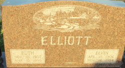
| Birth | : | 31 Jan 1883 Osborne County, Kansas, USA |
| Death | : | 27 Oct 1922 Osborne County, Kansas, USA |
| Burial | : | Cedar Bluff Cemetery, Osborne County, USA |
| Coordinate | : | 39.2496986, -98.8431015 |
| Description | : | NATOMA INDEPENDENT, Natoma, Osborne County, Kansas, Thursday, November 2, 1922 MET A TRAGIC DEATH Mrs. F. M. Elliott Victim of Shotgun Accident at Charivari One of the most distressing accidents in the annals of Osborne County history occurred at the home of Harry Rigby in Liberty township, about twenty six miles southwest of Osborne last Thursday night, resulting in the death of Mrs. F. M. Elliott, one of the best known and most highly respected women of that community, from a gunshot wound from the accidental discharge of a small .410 shotgun in the hands of her son, Floyd Elliott.... Read More |
frequently asked questions (FAQ):
-
Where is Eva Elizabeth Goad Elliott's memorial?
Eva Elizabeth Goad Elliott's memorial is located at: Cedar Bluff Cemetery, Osborne County, USA.
-
When did Eva Elizabeth Goad Elliott death?
Eva Elizabeth Goad Elliott death on 27 Oct 1922 in Osborne County, Kansas, USA
-
Where are the coordinates of the Eva Elizabeth Goad Elliott's memorial?
Latitude: 39.2496986
Longitude: -98.8431015
Family Members:
Parent
Spouse
Children
Flowers:
Nearby Cemetories:
1. Victor Cemetery
Osborne County, USA
Coordinate: 39.2380981, -98.8613968
2. Cole Cemetery
Osborne County, USA
Coordinate: 39.2352982, -98.8060989
3. Covert Cemetery
Osborne County, USA
Coordinate: 39.2896996, -98.8107986
4. IXL Cemetery
Natoma, Osborne County, USA
Coordinate: 39.2491989, -98.9218979
5. Round Mound Cemetery
Osborne County, USA
Coordinate: 39.2630997, -98.9636002
6. Vincent Cemetery
Osborne, Osborne County, USA
Coordinate: 39.1921997, -98.7228012
7. Grand Center Cemetery
Osborne County, USA
Coordinate: 39.1469002, -98.7602997
8. Bristow Cemetery
Osborne, Osborne County, USA
Coordinate: 39.3506012, -98.7506027
9. Immanuel Lutheran Cemetery
Natoma, Osborne County, USA
Coordinate: 39.2708015, -99.0096970
10. Kill Creek Cemetery
Alton, Osborne County, USA
Coordinate: 39.3805528, -98.8967658
11. Mount Hermon Cemetery
Paradise, Russell County, USA
Coordinate: 39.1324997, -98.9439011
12. Potterville Cemetery
Cheyenne, Osborne County, USA
Coordinate: 39.2417500, -98.6576900
13. Mount Hope Cemetery
Bloomington, Osborne County, USA
Coordinate: 39.3939018, -98.8450012
14. Natoma Cemetery
Natoma, Osborne County, USA
Coordinate: 39.1907700, -99.0162700
15. Natoma Lutheran Cemetery
Natoma, Osborne County, USA
Coordinate: 39.1907700, -99.0162700
16. Waldo Catholic Cemetery
Waldo Township, Russell County, USA
Coordinate: 39.1036600, -98.8162400
17. Natoma Catholic Cemetery
Natoma, Osborne County, USA
Coordinate: 39.2054050, -99.0289480
18. Mount Ayr Cemetery
Alton, Osborne County, USA
Coordinate: 39.3764000, -98.9717026
19. Zimmerman Cemetery
Osborne County, USA
Coordinate: 39.3217010, -98.6568985
20. Cheyenne Cemetery
Cheyenne, Osborne County, USA
Coordinate: 39.1767006, -98.6408005
21. Pleasant Plain Cemetery
Osborne County, USA
Coordinate: 39.3367004, -99.0372009
22. Luray Cemetery
Luray, Russell County, USA
Coordinate: 39.1109980, -98.6872380
23. Aurora Cemetery
Laton, Rooks County, USA
Coordinate: 39.2778015, -99.0847015
24. Chalk Mound Cemetery
Laton, Rooks County, USA
Coordinate: 39.3208008, -99.0852966


