
| Birth | : | 27 May 1880 Ohio, USA |
| Death | : | 12 Feb 1960 Ohio, USA |
| Burial | : | West Virginia National Cemetery, Pruntytown, Taylor County, USA |
| Coordinate | : | 39.3350190, -80.0730590 |
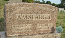
| Description | : | In 1900 she and her parents and her brother John lived on a farm they owned, with a mortgage, in Perry Township, Licking County, OH. She married Thomas about 1902 and in 1910 they were living in Licking County. She married Josiah September 12, 1923 in Newark, OH. In 1930 she and Josiah and his youngest daughter from his first marriage lived in a house they owned at 446 Central Avenue in Newark. Their home was valued at $3800, and they did have a radio. In 1940 just she and her husband lived there. Their home was valued at only $1600 after the... Read More |
frequently asked questions (FAQ):
-
Where is Eva J Wright Davis's memorial?
Eva J Wright Davis's memorial is located at: West Virginia National Cemetery, Pruntytown, Taylor County, USA.
-
When did Eva J Wright Davis death?
Eva J Wright Davis death on 12 Feb 1960 in Ohio, USA
-
Where are the coordinates of the Eva J Wright Davis's memorial?
Latitude: 39.3350190
Longitude: -80.0730590
Family Members:
Parent

Spouse
Siblings
Flowers:


Nearby Cemetories:
1. West Virginia National Cemetery
Pruntytown, Taylor County, USA
Coordinate: 39.3350190, -80.0730590
2. Beulah Cemetery
Pruntytown, Taylor County, USA
Coordinate: 39.3336590, -80.0817140
3. Abram Smith Cemetery
Pruntytown, Taylor County, USA
Coordinate: 39.3314018, -80.0811005
4. Woodsdale Memorial Park
Pruntytown, Taylor County, USA
Coordinate: 39.3408012, -80.0658035
5. Warder Cemetery
Pruntytown, Taylor County, USA
Coordinate: 39.3360670, -80.0549330
6. Keener Cemetery
Grafton, Taylor County, USA
Coordinate: 39.3502370, -80.0503460
7. Wiseman Cemetery
Pruntytown, Taylor County, USA
Coordinate: 39.3602170, -80.0782840
8. Gawthrop Cemetery
Pruntytown, Taylor County, USA
Coordinate: 39.3292360, -80.1095210
9. Grafton National Cemetery
Grafton, Taylor County, USA
Coordinate: 39.3350296, -80.0312500
10. Carder Cemetery
Fetterman, Taylor County, USA
Coordinate: 39.3618760, -80.0409150
11. Old Catholic Cemetery
Taylor County, USA
Coordinate: 39.3445200, -80.0243000
12. Harmony Grove Cemetery
Grafton, Taylor County, USA
Coordinate: 39.3456001, -80.1267014
13. Mount Calvary Catholic Cemetery
Grafton, Taylor County, USA
Coordinate: 39.3492012, -80.0171967
14. Knotts Cemetery
Grafton, Taylor County, USA
Coordinate: 39.3550030, -80.0170860
15. Lantz Ford Cemetery
Grafton, Taylor County, USA
Coordinate: 39.3219370, -80.0132820
16. Bluemont Cemetery
Grafton, Taylor County, USA
Coordinate: 39.3446999, -80.0121994
17. Reese Cemetery
Grafton, Taylor County, USA
Coordinate: 39.3604990, -80.0068620
18. Walnut Grove Cemetery
Webster, Taylor County, USA
Coordinate: 39.2813988, -80.0472031
19. Brown Cemetery
Taylor County, USA
Coordinate: 39.3841630, -80.0295590
20. Coplin Cemetery
Taylor County, USA
Coordinate: 39.3114570, -80.1469800
21. Old Side Cemetery
Taylor County, USA
Coordinate: 39.3116989, -80.1472015
22. Lawler Cemetery
McGee, Taylor County, USA
Coordinate: 39.3845000, -80.1238000
23. Arnold Cemetery
Grafton, Taylor County, USA
Coordinate: 39.2985115, -80.0014712
24. West Hill Cemetery
Taylor County, USA
Coordinate: 39.2782810, -80.0284830