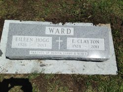
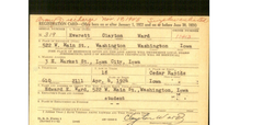
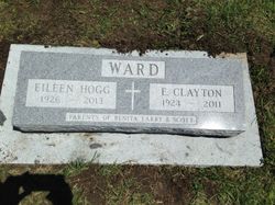
Everett Clayton “Clay” Ward
| Birth | : | 4 Apr 1924 Cedar Rapids, Linn County, Iowa, USA |
| Death | : | 1 Apr 2011 San Jose, Santa Clara County, California, USA |
| Burial | : | Springdale Cemetery, Springdale, Cedar County, USA |
| Coordinate | : | 41.6786003, -91.2581024 |
| Description | : | E. Clayton "Clay" Ward, 4/4/1924 - 4/1/2011, resident of San Jose, passed peacefully at home on April 1, 2011. A life of service to his family, country and God is his legacy. Veteran of WWII he met and married his wife of 64 years, Eileen in Iowa City, Iowa. In the course of a distinguished career as aerospace engineer he and Eileen raised three children, Benita, Larry Scott. He is survived by Eileen, their children, 10 grandchildren and 7 great-grandchildren. A memorial is planned at 10am Saturday, April 9, 2011 at The Atrium 1009 Blossom River Way San Jose, CA... Read More |
frequently asked questions (FAQ):
-
Where is Everett Clayton “Clay” Ward's memorial?
Everett Clayton “Clay” Ward's memorial is located at: Springdale Cemetery, Springdale, Cedar County, USA.
-
When did Everett Clayton “Clay” Ward death?
Everett Clayton “Clay” Ward death on 1 Apr 2011 in San Jose, Santa Clara County, California, USA
-
Where are the coordinates of the Everett Clayton “Clay” Ward's memorial?
Latitude: 41.6786003
Longitude: -91.2581024
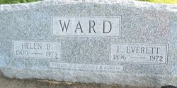
Family Members:
Parent
Spouse
Siblings
Flowers:
Nearby Cemetories:
1. Springdale Cemetery
Springdale, Cedar County, USA
Coordinate: 41.6786003, -91.2581024
2. North Liberty Cemetery
Springdale, Cedar County, USA
Coordinate: 41.6852989, -91.2292023
3. Pee Dee Cemetery
Cedar County, USA
Coordinate: 41.6699982, -91.2142029
4. Hickory Grove Cemetery
Cedar County, USA
Coordinate: 41.6637000, -91.3073000
5. Chamness Burial Plot
Springdale, Cedar County, USA
Coordinate: 41.6597351, -91.3182108
6. Saint Joseph Cemetery
Cedar Valley, Cedar County, USA
Coordinate: 41.7295000, -91.2667000
7. Burnett Burial Site
Rochester, Cedar County, USA
Coordinate: 41.6680782, -91.1834911
8. Saint Bernadette Catholic Church
West Branch, Cedar County, USA
Coordinate: 41.6755750, -91.3396070
9. Honey Grove Cemetery
Cedar County, USA
Coordinate: 41.7158012, -91.3266983
10. Friends Village Cemetery
West Branch, Cedar County, USA
Coordinate: 41.6732000, -91.3470000
11. West Branch Cemetery
West Branch, Cedar County, USA
Coordinate: 41.6765000, -91.3515000
12. Herbert Hoover National Historic Site
West Branch, Cedar County, USA
Coordinate: 41.6681500, -91.3519900
13. Howard Cemetery
Plato, Cedar County, USA
Coordinate: 41.7486303, -91.2918299
14. Dunfee Burial Site
Rochester, Cedar County, USA
Coordinate: 41.6266900, -91.1834904
15. Downey Cemetery
Downey, Cedar County, USA
Coordinate: 41.6119003, -91.3182983
16. Mount Zion Church Cemetery
Cedar County, USA
Coordinate: 41.7343000, -91.1790000
17. West Bethel Cemetery
Cedar County, USA
Coordinate: 41.6502991, -91.1556015
18. United Brethren Cemetery
Cedar County, USA
Coordinate: 41.7445000, -91.3285000
19. North Prairie Cemetery
West Liberty, Muscatine County, USA
Coordinate: 41.5924988, -91.2694016
20. Goodale Cemetery
Tipton, Cedar County, USA
Coordinate: 41.7219380, -91.1567400
21. Woodbridge Cemetery
Buchanan, Cedar County, USA
Coordinate: 41.7644005, -91.2294006
22. Rochester Cemetery
Rochester, Cedar County, USA
Coordinate: 41.6656200, -91.1395800
23. Kizer-Burns Cemetery
Tipton, Cedar County, USA
Coordinate: 41.7559130, -91.1854800
24. Oasis Cemetery
Oasis, Johnson County, USA
Coordinate: 41.7005997, -91.3858032

