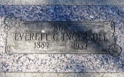
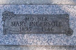
Everett Getchell “Bob” Ingersoll
| Birth | : | 1889 |
| Death | : | 4 Jan 1959 |
| Burial | : | East Wilton Cemetery, Wilton, Franklin County, USA |
| Coordinate | : | 44.6124700, -70.1878800 |
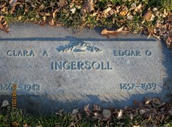
| Description | : | Washington Death Certificate Name Everett Getchell Ingersoll Death Date 04 Jan 1959 Death Place Malott, Okanogan, Washington Gender Male Race (Displayed on Form) Age at Death 69 years Estimated Birth Year 1890 Birth Date Birth Place Marital Status Spouse's Name Father's Name Edgartt E. Ingersoll Father's Birth Place Mother's Name Clara Gordon Mother's Birth Place Occupation Street Address Residence Cemetery Burial Place Burial Date Additional Relatives Film Number 2033816 Digital GS Number 4224596 Image Number 1552 Volume/Page/Certificate Number 1189 |
frequently asked questions (FAQ):
-
Where is Everett Getchell “Bob” Ingersoll's memorial?
Everett Getchell “Bob” Ingersoll's memorial is located at: East Wilton Cemetery, Wilton, Franklin County, USA.
-
When did Everett Getchell “Bob” Ingersoll death?
Everett Getchell “Bob” Ingersoll death on 4 Jan 1959 in
-
Where are the coordinates of the Everett Getchell “Bob” Ingersoll's memorial?
Latitude: 44.6124700
Longitude: -70.1878800
Family Members:
Parent
Spouse
Siblings
Children
Flowers:
Nearby Cemetories:
1. East Wilton Cemetery
Wilton, Franklin County, USA
Coordinate: 44.6124700, -70.1878800
2. Red Schoolhouse Cemetery
Franklin County, USA
Coordinate: 44.6314011, -70.1600037
3. Academy Hill Cemetery
Wilton, Franklin County, USA
Coordinate: 44.5930000, -70.2269700
4. Beans Corner Cemetery
Franklin County, USA
Coordinate: 44.5785800, -70.1788200
5. Wilton Old Town Cemetery
Wilton, Franklin County, USA
Coordinate: 44.5936000, -70.2307460
6. Butterfield Cemetery
Farmington, Franklin County, USA
Coordinate: 44.6520700, -70.1511140
7. Lakeview Cemetery
Wilton, Franklin County, USA
Coordinate: 44.5861015, -70.2438965
8. Webster Cemetery
Franklin County, USA
Coordinate: 44.5924988, -70.1241989
9. Old Burying Ground
Farmington, Franklin County, USA
Coordinate: 44.6638660, -70.1567270
10. Riverside Cemetery
Farmington, Franklin County, USA
Coordinate: 44.6587900, -70.1432600
11. Dan Knowles Cemetery
Wilton, Franklin County, USA
Coordinate: 44.6446000, -70.2530000
12. Russell Mills Cemetery
Farmington, Franklin County, USA
Coordinate: 44.6695862, -70.1945016
13. Fairview Cemetery
Farmington, Franklin County, USA
Coordinate: 44.6581001, -70.1382980
14. Lowell Cemetery
Franklin County, USA
Coordinate: 44.6292000, -70.1102982
15. Case Cemetery
Farmington, Franklin County, USA
Coordinate: 44.6518900, -70.1247900
16. Zions Hill Cemetery
North Chesterville, Franklin County, USA
Coordinate: 44.5918999, -70.1085968
17. Borough Cemetery
Franklin County, USA
Coordinate: 44.5628014, -70.1391983
18. Adams Cemetery
Wilton, Franklin County, USA
Coordinate: 44.6192017, -70.2724991
19. Center Burying Ground
Farmington, Franklin County, USA
Coordinate: 44.6712700, -70.1514400
20. Orchard Hill Cemetery
Temple, Franklin County, USA
Coordinate: 44.6713680, -70.2318424
21. Gower Cemetery
Franklin County, USA
Coordinate: 44.6380997, -70.1010971
22. Belcher Family Graveyard
Farmington, Franklin County, USA
Coordinate: 44.6739269, -70.1488538
23. North Jay Cemetery
Franklin County, USA
Coordinate: 44.5504200, -70.2416900
24. Temple Village Cemetery
Temple, Franklin County, USA
Coordinate: 44.6831017, -70.2210999

