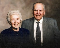
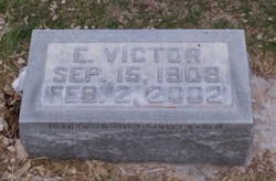
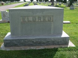
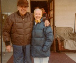
Everett Victor Eldred
| Birth | : | 15 Sep 1908 Nebraska, USA |
| Death | : | 2 Feb 2002 Lakeside, Sheridan County, Nebraska, USA |
| Burial | : | Greenwood Cemetery, Orangeville, Dufferin County, Canada |
| Coordinate | : | 43.9121500, -80.1323500 |
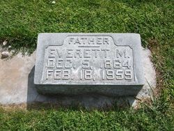
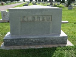
| Description | : | Everett was the son of Everett M. & Mary E. Eldred. He married Martha Miller, daughter of Jessie & Anna (Lux) Miller (owners of the Alliance Hotel). Together they had 3 children; Everett V. (II) (Deceased), Mary Anna (Deceased), Carolyn Sue. Together Everett & Martha owned such a beautiful ranch in Nebraska that even Ted Turner wanted to buy it. They sold the ranch to the Mormons. Taken from the Associated Press/October 5, 2004 "Lincoln, Neb. -- The Mormon church is coming close to media mogul and bison baron Ted Turner for owning the most private land in the state of Nebraska.... Read More |
frequently asked questions (FAQ):
-
Where is Everett Victor Eldred's memorial?
Everett Victor Eldred's memorial is located at: Greenwood Cemetery, Orangeville, Dufferin County, Canada.
-
When did Everett Victor Eldred death?
Everett Victor Eldred death on 2 Feb 2002 in Lakeside, Sheridan County, Nebraska, USA
-
Where are the coordinates of the Everett Victor Eldred's memorial?
Latitude: 43.9121500
Longitude: -80.1323500
Family Members:
Parent
Spouse
Children
Flowers:
Nearby Cemetories:
1. Greenwood Cemetery
Orangeville, Dufferin County, Canada
Coordinate: 43.9121500, -80.1323500
2. Hughson Family Cemetery
Laurel, Dufferin County, Canada
Coordinate: 43.9281000, -80.1348000
3. Providence Methodist Cemetery
East Garafraxa, Dufferin County, Canada
Coordinate: 43.8900590, -80.1656360
4. Forest Lawn Cemetery
Orangeville, Dufferin County, Canada
Coordinate: 43.9349430, -80.0981640
5. Mono College Presbyterian Cemetery
Orangeville, Dufferin County, Canada
Coordinate: 43.9494200, -80.1049200
6. Zion Wesleyan Methodist Cemetery
Mono, Dufferin County, Canada
Coordinate: 43.9548170, -80.1244380
7. Alton Cemetery
Alton, Peel Regional Municipality, Canada
Coordinate: 43.8581581, -80.0661240
8. Laurel Cemetery
Laurel, Dufferin County, Canada
Coordinate: 43.9579300, -80.2106700
9. Saint George's Cemetery
Peel Regional Municipality, Canada
Coordinate: 43.8698226, -80.0325520
10. Caledon United Church Cemetery
Caledon, Peel Regional Municipality, Canada
Coordinate: 43.8648360, -80.0013450
11. Waldemar Cemetery
Dufferin County, Canada
Coordinate: 43.8861500, -80.2820000
12. Huxley Cemetery
Hillsburgh, Wellington County, Canada
Coordinate: 43.7999660, -80.1600710
13. Bethel Presbyterian
East Garafraxa, Dufferin County, Canada
Coordinate: 43.8192000, -80.2348000
14. Price's Corners Cemetery
Prices Corner, Dufferin County, Canada
Coordinate: 43.8186570, -80.2351690
15. Saint Francis Roman Catholic Cemetery
Mono, Dufferin County, Canada
Coordinate: 43.9504493, -79.9726131
16. Hillsburgh Pioneer Cemetery
Hillsburgh, Wellington County, Canada
Coordinate: 43.7870610, -80.1400340
17. The Grove Cemetery
East Garafraxa, Dufferin County, Canada
Coordinate: 43.7988100, -80.2092750
18. Burns Cemetery
Mono, Dufferin County, Canada
Coordinate: 44.0313290, -80.0733000
19. Mono East Cemetery
Mono, Dufferin County, Canada
Coordinate: 43.9743990, -79.9778650
20. Union Cemetery
Grand Valley, Dufferin County, Canada
Coordinate: 43.8922070, -80.3121550
21. Saint Johns Cemetery
Mono, Dufferin County, Canada
Coordinate: 43.9875630, -79.9789050
22. McDougall Cemetery
Grand Valley, Dufferin County, Canada
Coordinate: 43.9452210, -80.3261600
23. Saint Peter's Roman Catholic Cemetery
Oustic, Wellington County, Canada
Coordinate: 43.7620750, -80.1530310
24. Church of the Assumption Catholic Cemetery
Erin Township, Wellington County, Canada
Coordinate: 43.7684288, -80.0688324

