Ferdinand Friedly
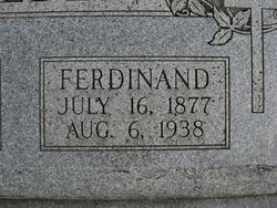
| Birth | : | 16 Jul 1877 Richardson County, Nebraska, USA |
| Death | : | 6 Aug 1938 Pawnee County, Nebraska, USA |
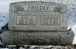
| Burial | : | Ruckman Cemetery, Mill Point, Pocahontas County, USA |
| Coordinate | : | 38.1603830, -80.1676990 |
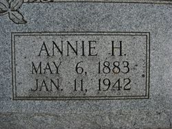
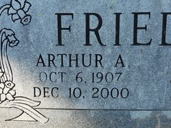
| Description | : | Son of Ferdinand & Antonia (Stanek) Friedly. Married Dec. 26, 1906 to Annie Helen Stanek. Father of Arthur A., Ernest T. & Boyd F. Farmer. Killed when struck by lightning. FARMER NEAR PAWNEE KILLED BY LIGHTNING Ferdinand Friedly of Five Miles Southeast of Here Dies by Sudden Lightning Bolt Saturday Morning- Was Working Alone in Field. A bolt of lightning during light rain Saturday morning struck and instantly killed Ferdinand Friedly, 61, well-known farmer of five miles southeast of Pawnee City. The tragic passing of Friedly was not discovered until nearly 1 o'clock, when his son went to the field after Mr. Friedly failed to return home for... Read More |
frequently asked questions (FAQ):
-
Where is Ferdinand Friedly's memorial?
Ferdinand Friedly's memorial is located at: Ruckman Cemetery, Mill Point, Pocahontas County, USA.
-
When did Ferdinand Friedly death?
Ferdinand Friedly death on 6 Aug 1938 in Pawnee County, Nebraska, USA
-
Where are the coordinates of the Ferdinand Friedly's memorial?
Latitude: 38.1603830
Longitude: -80.1676990
Family Members:
Parent
Spouse
Siblings
Children
Flowers:
Nearby Cemetories:
1. Ruckman Cemetery
Mill Point, Pocahontas County, USA
Coordinate: 38.1603830, -80.1676990
2. McNeel Cemetery
Hillsboro, Pocahontas County, USA
Coordinate: 38.1564850, -80.1954890
3. Pleasant Green Cemetery
Seebert, Pocahontas County, USA
Coordinate: 38.1418940, -80.1897150
4. Steele Cemetery
Seebert, Pocahontas County, USA
Coordinate: 38.1357490, -80.1876080
5. Buckeye Cemetery
Buckeye, Pocahontas County, USA
Coordinate: 38.1823840, -80.1342550
6. Sharp-Raintown Cemetery
Mill Point, Pocahontas County, USA
Coordinate: 38.1817230, -80.2211620
7. Oak Grove Cemetery
Hillsboro, Pocahontas County, USA
Coordinate: 38.1226860, -80.2151660
8. Workman Family Cemetery
Watoga, Pocahontas County, USA
Coordinate: 38.1075961, -80.1456681
9. Kee Cemetery
Buckeye, Pocahontas County, USA
Coordinate: 38.2058720, -80.1231310
10. Messir Cemetery
Pocahontas County, USA
Coordinate: 38.1721992, -80.0699997
11. Marlin's Bottom Confederate Cemetery
Marlinton, Pocahontas County, USA
Coordinate: 38.2210200, -80.1004210
12. Beaver Creek Cemetery
Huntersville, Pocahontas County, USA
Coordinate: 38.1328011, -80.0693970
13. Bruffy's Creek Cemetery
Hillsboro, Pocahontas County, USA
Coordinate: 38.1401599, -80.2689847
14. Denmar Sanitarium Cemetery
Denmar, Pocahontas County, USA
Coordinate: 38.0892400, -80.2200300
15. Alta Price Cemetery
Marlinton, Pocahontas County, USA
Coordinate: 38.2169770, -80.0909510
16. McLaughlin Cemetery
Marlinton, Pocahontas County, USA
Coordinate: 38.2167390, -80.0865550
17. Mountain View Cemetery
Marlinton, Pocahontas County, USA
Coordinate: 38.2141991, -80.0800018
18. Beverage Cemetery
Onoto, Pocahontas County, USA
Coordinate: 38.2447180, -80.1375780
19. McCarty Cemetery
Droop, Pocahontas County, USA
Coordinate: 38.1142120, -80.2630630
20. Emanuel Cemetery
Lobelia, Pocahontas County, USA
Coordinate: 38.1420060, -80.2880320
21. Sharp Family Cemetery
Marlinton, Pocahontas County, USA
Coordinate: 38.2456440, -80.1060940
22. Richard Hill Cemetery
Pocahontas County, USA
Coordinate: 38.1219160, -80.2832880
23. Campbelltown Gay Cemetery
Campbelltown, Pocahontas County, USA
Coordinate: 38.2401580, -80.0912230
24. Whiting Cemetery
Droop, Pocahontas County, USA
Coordinate: 38.1004600, -80.2727400


