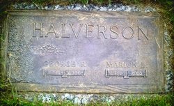
| Birth | : | 16 Jul 1911 Garfield, Whitman County, Washington, USA |
| Death | : | 5 Dec 2007 Seattle, King County, Washington, USA |
| Burial | : | Oakwood Memorial Park, Santa Cruz, Santa Cruz County, USA |
| Coordinate | : | 36.9904709, -121.9850159 |
| Plot | : | Division D, Lot 12, Grave 126. |
| Description | : | Seattle Times and the Seattle Post-Intelligencer, The (WA) - December 9, 2007 Deceased Name: Fern E. "Brownie" Benson Fern E. "Brownie" BENSON Brownie Benson, age 96, was born in Garfield, WA, July 16, 1911, to Oliver and Della Browning and passed away December 5, 2007. After graduating from Garfield HS, she ventured east to Washington, where she met her husband, James W. Benson. She worked for the Post Office Dept in DC and later in Oakland, CA, where she was secretary to the Assistant Postmaster. She excelled in her 13 years of employment with the Santa Cruz School District where she served... Read More |
frequently asked questions (FAQ):
-
Where is Fern Evelyn “Brownie” Browning Benson's memorial?
Fern Evelyn “Brownie” Browning Benson's memorial is located at: Oakwood Memorial Park, Santa Cruz, Santa Cruz County, USA.
-
When did Fern Evelyn “Brownie” Browning Benson death?
Fern Evelyn “Brownie” Browning Benson death on 5 Dec 2007 in Seattle, King County, Washington, USA
-
Where are the coordinates of the Fern Evelyn “Brownie” Browning Benson's memorial?
Latitude: 36.9904709
Longitude: -121.9850159
Family Members:
Parent
Spouse
Siblings
Flowers:
Nearby Cemetories:
1. Oakwood Memorial Park
Santa Cruz, Santa Cruz County, USA
Coordinate: 36.9904709, -121.9850159
2. Holy Cross Cemetery
Santa Cruz, Santa Cruz County, USA
Coordinate: 36.9826431, -121.9897537
3. Old Holy Cross Cemetery
Santa Cruz, Santa Cruz County, USA
Coordinate: 36.9820900, -121.9933243
4. Soquel Cemetery
Soquel, Santa Cruz County, USA
Coordinate: 36.9961624, -121.9562912
5. Beit Olam Cemetery
Soquel, Santa Cruz County, USA
Coordinate: 36.9967700, -121.9557300
6. Santa Cruz Mausoleum
Santa Cruz, Santa Cruz County, USA
Coordinate: 36.9901596, -122.0273068
7. Santa Cruz Memorial Park
Santa Cruz, Santa Cruz County, USA
Coordinate: 36.9904976, -122.0282974
8. Mission Santa Cruz Cemetery
Santa Cruz, Santa Cruz County, USA
Coordinate: 36.9779390, -122.0294940
9. Calvary Episcopal Church Gravesite
Santa Cruz, Santa Cruz County, USA
Coordinate: 36.9721462, -122.0276762
10. Evergreen Cemetery
Santa Cruz, Santa Cruz County, USA
Coordinate: 36.9813805, -122.0350723
11. Pine Knoll Pet Cemetery
Scotts Valley, Santa Cruz County, USA
Coordinate: 37.0149800, -122.0293500
12. Land of Medicine Buddha Stupa
Soquel, Santa Cruz County, USA
Coordinate: 37.0125950, -121.9336400
13. Home of Peace Cemetery
Santa Cruz, Santa Cruz County, USA
Coordinate: 36.9746666, -122.0564041
14. Our Lady of Mount Carmel Cemetery
Aptos, Santa Cruz County, USA
Coordinate: 36.9806366, -121.9095993
15. Christ Lutheran Church Columbarium
Aptos, Santa Cruz County, USA
Coordinate: 36.9700550, -121.8704370
16. Felton Cemetery
Felton, Santa Cruz County, USA
Coordinate: 37.0514526, -122.0795975
17. Day Valley Cemetery
Aptos, Santa Cruz County, USA
Coordinate: 36.9974050, -121.8503360
18. Martin Family Burial Ground
Glenwood, Santa Cruz County, USA
Coordinate: 37.1083870, -121.9868690
19. Saint Josephs Monastery Cemetery
Aptos, Santa Cruz County, USA
Coordinate: 36.9947200, -121.8361700
20. Boulder Creek IOOF Cemetery
Boulder Creek, Santa Cruz County, USA
Coordinate: 37.1216927, -122.1264038
21. Hebbard Cemetery
Los Gatos, Santa Clara County, USA
Coordinate: 37.1727340, -121.9925710
22. Watsonville Catholic Cemetery
Watsonville, Santa Cruz County, USA
Coordinate: 36.9278564, -121.7658463
23. Pioneer Cemetery
Watsonville, Santa Cruz County, USA
Coordinate: 36.9258560, -121.7642790
24. Rundell Cemetery
Los Gatos, Santa Clara County, USA
Coordinate: 37.1872545, -121.9954677


