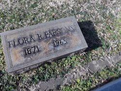
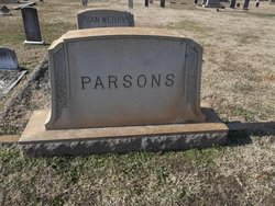
Flora Loudeska Robbins Parsons
| Birth | : | 2 Oct 1871 Randolph County, North Carolina, USA |
| Death | : | 22 Dec 1965 Randleman, Randolph County, North Carolina, USA |
| Burial | : | Mount Lebanon United Methodist Church Cemetery, Randleman, Randolph County, USA |
| Coordinate | : | 35.8267230, -79.8039770 |
| Description | : | Father: Joseph ROBBINS b: 1827 in Randolph Co., NC Mother: Edith IVEY b: 1826 in Randolph Co., NC Marriage 1 Julius "Jule" Woolen PARSONS b: Apr 1871 in Randolph Co., NC Children Alpheus Julian Parsons b: 20 AUG 1904 in Randolph Co., North Carolina Guy Edward Parsons b: 9 AUG 1893 in Randolph Co., North Carolina Kate Elgin Parsons b: 11 FEB 1895 in Randolph Co., North Carolina Howgil Julian Parsons b: 8 OCT 1899 in Randolph Co., North Carolina--18 NOV 1962 Joseph Edgar Parsons b: 20 MAR 1901 in Randolph Co., North Carolina--MAY 1972 James Woolen Parsons b: 7 NOV 1909 in Randolph Co., North Carolina--22 MAR 2003 |
frequently asked questions (FAQ):
-
Where is Flora Loudeska Robbins Parsons's memorial?
Flora Loudeska Robbins Parsons's memorial is located at: Mount Lebanon United Methodist Church Cemetery, Randleman, Randolph County, USA.
-
When did Flora Loudeska Robbins Parsons death?
Flora Loudeska Robbins Parsons death on 22 Dec 1965 in Randleman, Randolph County, North Carolina, USA
-
Where are the coordinates of the Flora Loudeska Robbins Parsons's memorial?
Latitude: 35.8267230
Longitude: -79.8039770
Family Members:
Parent
Spouse
Siblings
Children
Flowers:
Nearby Cemetories:
1. Mount Lebanon United Methodist Church Cemetery
Randleman, Randolph County, USA
Coordinate: 35.8267230, -79.8039770
2. Saint Paul Methodist Episcopal South Cemetery
Randleman, Randolph County, USA
Coordinate: 35.8222200, -79.8090410
3. Ferree's Chapel Cemetery
Randleman, Randolph County, USA
Coordinate: 35.8189700, -79.8108000
4. New Salem United Methodist Church Cemetery
Randleman, Randolph County, USA
Coordinate: 35.8406311, -79.7853233
5. Midway Wesleyan Church Cemetery
Randleman, Randolph County, USA
Coordinate: 35.8018900, -79.8006990
6. Country Holiness Cemetery
Randleman, Randolph County, USA
Coordinate: 35.8016800, -79.8016900
7. Harshaw Grove Missionary Baptist Church Cemetery
Randleman, Randolph County, USA
Coordinate: 35.8051670, -79.8265100
8. J. E. Groce Memorial Cemetery
Worthville, Randolph County, USA
Coordinate: 35.8032620, -79.7813460
9. Whitehall Evangelical Methodist Church Cemetery
Randleman, Randolph County, USA
Coordinate: 35.7950100, -79.8153900
10. Trinity Holiness Church Cemetery
Sophia, Randolph County, USA
Coordinate: 35.8146050, -79.8427561
11. Saint Peters UMC Cemetery
Randleman, Randolph County, USA
Coordinate: 35.8601310, -79.7956760
12. Saint Peter United Methodist Church Cemetery
Randleman Township, Randolph County, USA
Coordinate: 35.8601570, -79.7956300
13. Bethany United Methodist Church Cemetery #1
Franklinville, Randolph County, USA
Coordinate: 35.8101300, -79.7606200
14. Bell Welborn Cemetery
Randolph County, USA
Coordinate: 35.8400950, -79.8515080
15. Old Union United Methodist Church Cemetery
Sophia, Randolph County, USA
Coordinate: 35.8345500, -79.8571860
16. Davis Chapel Methodist Protestant Church Cemetery
Asheboro, Randolph County, USA
Coordinate: 35.7836070, -79.8268640
17. Randolph Memorial Park
Asheboro, Randolph County, USA
Coordinate: 35.7793999, -79.8071976
18. Faith Temple Baptist Church Cemetery
Franklinville, Randolph County, USA
Coordinate: 35.8023770, -79.7460950
19. South Plainfield Friends Meeting Cemetery
Sophia, Randolph County, USA
Coordinate: 35.7952900, -79.8607840
20. Liberty Road Baptist Church Cemetery
Randleman, Randolph County, USA
Coordinate: 35.7715500, -79.7808130
21. Level Cross United Methodist Church Cemetery
Randleman, Randolph County, USA
Coordinate: 35.8871100, -79.8066620
22. Level Cross Baptist Church Cemetery
Randleman, Randolph County, USA
Coordinate: 35.8879530, -79.8081950
23. Marlboro Friends Meeting Cemetery
Sophia, Randolph County, USA
Coordinate: 35.8391650, -79.8854900
24. Odell Trogdon Cemetery
Grays Chapel, Randolph County, USA
Coordinate: 35.7947200, -79.7300200


