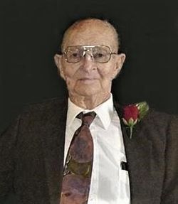
Floyd K. Miller
| Birth | : | 2 Feb 1920 Norborne, Carroll County, Missouri, USA |
| Death | : | 25 Sep 2019 Saint Joseph, Buchanan County, Missouri, USA |
| Burial | : | Bethany Christian Church Cemetery, Graham, Nodaway County, USA |
| Coordinate | : | 40.1585388, -94.9461365 |
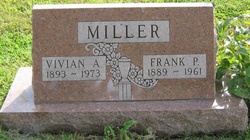
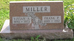
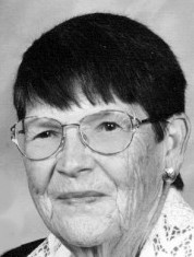
| Description | : | Maryville, Missouri - Floyd K. Miller passed on September 25, 2019 at Living Community of St. Joseph. He was born February 2, 1920 on a farm near Norborne to Frank Park and Vivian Mossbarger Miller. Floyd was a graduate of Trenton High School 1937 and University of Missouri 1941. After college he worked for the USDA in Palmyra where he met Doris V. Hagans. They were married June 11, 1943 while he was serving with the US Army Air Corps. After service during WWII, Mr. Miller worked for USDA in Albany before managing farms in Liberty and Bixby, Ok.... Read More |
frequently asked questions (FAQ):
-
Where is Floyd K. Miller's memorial?
Floyd K. Miller's memorial is located at: Bethany Christian Church Cemetery, Graham, Nodaway County, USA.
-
When did Floyd K. Miller death?
Floyd K. Miller death on 25 Sep 2019 in Saint Joseph, Buchanan County, Missouri, USA
-
Where are the coordinates of the Floyd K. Miller's memorial?
Latitude: 40.1585388
Longitude: -94.9461365
Family Members:
Parent
Spouse
Flowers:
Nearby Cemetories:
1. Bethany Christian Church Cemetery
Graham, Nodaway County, USA
Coordinate: 40.1585388, -94.9461365
2. Centenary Cemetery
Graham, Nodaway County, USA
Coordinate: 40.1293907, -94.9546204
3. Shamberger Cemetery
Graham, Nodaway County, USA
Coordinate: 40.1652985, -94.9925003
4. Litts Cemetery
Whitecloud, Nodaway County, USA
Coordinate: 40.1377983, -94.8756027
5. Baker Cemetery
Barnard, Nodaway County, USA
Coordinate: 40.1660800, -94.8636600
6. Kyle Cemetery
Graham, Nodaway County, USA
Coordinate: 40.1636009, -95.0307999
7. Dysart Cemetery
Andrew County, USA
Coordinate: 40.0934900, -94.9738700
8. Pleasant Grove Cemetery
Pumpkin Center, Nodaway County, USA
Coordinate: 40.2188110, -94.8918610
9. Antioch Christian Church Cemetery
Savannah, Andrew County, USA
Coordinate: 40.0932700, -94.9938600
10. Salem Cemetery
Pumpkin Center, Nodaway County, USA
Coordinate: 40.2076721, -94.8683167
11. Woodcock Cemetery
Bolckow, Andrew County, USA
Coordinate: 40.0815460, -94.9834260
12. Linville Cemetery
Graham, Nodaway County, USA
Coordinate: 40.2160988, -95.0261002
13. Alumbaugh Cemetery
Barnard, Nodaway County, USA
Coordinate: 40.1843987, -94.8383026
14. Swan Chapel Cemetery
Graham, Nodaway County, USA
Coordinate: 40.2449417, -94.9421692
15. Prairie Home Cemetery
Graham, Nodaway County, USA
Coordinate: 40.2036018, -95.0488968
16. Gravel Wall Cemetery
Andrew County, USA
Coordinate: 40.0672210, -94.9260280
17. Barnard Masonic-IOOF Cemetery
Barnard, Nodaway County, USA
Coordinate: 40.1845818, -94.8176727
18. Barnard American Legion Cemetery
Barnard, Nodaway County, USA
Coordinate: 40.1839600, -94.8173828
19. Schooler Cemetery
Maitland, Holt County, USA
Coordinate: 40.1666985, -95.0903015
20. Bolckow Cemetery
Bolckow, Andrew County, USA
Coordinate: 40.1131210, -94.8142929
21. McBrien Cemetery
Rosendale, Andrew County, USA
Coordinate: 40.0698900, -94.8589600
22. Groves Cemetery
Graham, Nodaway County, USA
Coordinate: 40.2369003, -95.0500031
23. White Cloud Cemetery
Arkoe, Nodaway County, USA
Coordinate: 40.2656700, -94.8940500
24. Maitland Cemetery
Maitland, Holt County, USA
Coordinate: 40.2019196, -95.0847015


